“Tolai Hare, Mongolia” is available on a range of products for rabbit and hare lovers….prints, pillows, tote bags, clothing, mugs and more. These lanky hares are found in many of the drier areas of the country, including the Gobi, where I saw one in 2016. They are the only species of rabbit or hare in Mongolia. You can see all the offerings with the tolai hare here.
Note: I’ve been having fun with a new app that offers dozens of different edge designs for photos and am using it for some of my shop images. It’s called Edge Effects for Photos. Very easy to use.
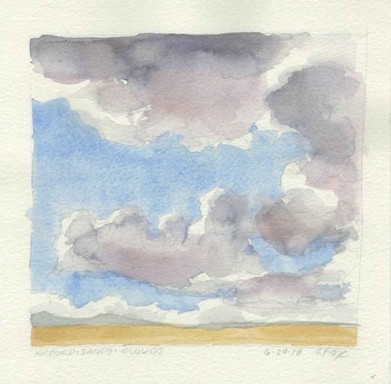
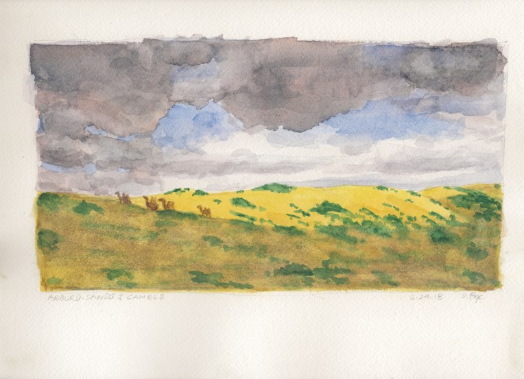
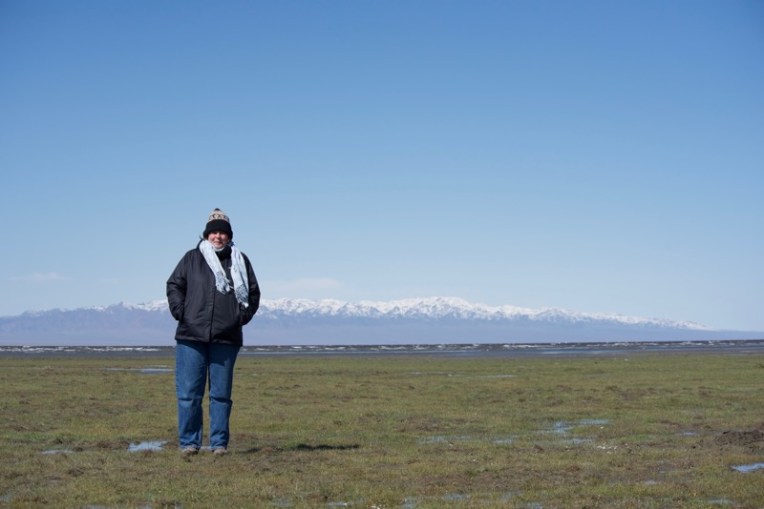
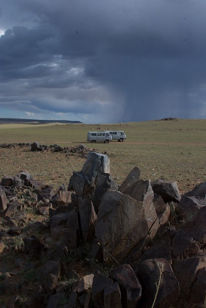
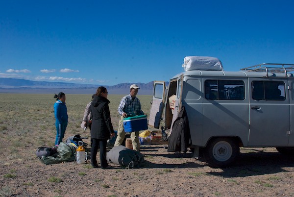
I returned on July 31 from my twelfth trip to Mongolia since 2005. I traveled to a number of places, starting with Arburd Sands ger camp in Bayan-Onjuul Soum, Tov Aimag, about two hours south-west of Ulaanbaatar. The area features a 20km stretch of dunes running east-west, the northernmost extent of the Gobi. I enjoyed capturing the clouds as they drifted by.
Yarka watercolors on Waterford cold press paper
Yarka watercolors on Arches cold press paper
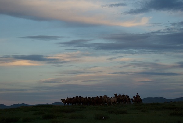
A group of camels was nice enough to move through the scene.
Yarka watercolors on Waterford cold press paper
This was actually the first one I did as a warm-up. A relatively overcast day in a country that gets 250 days of sunshine a year.
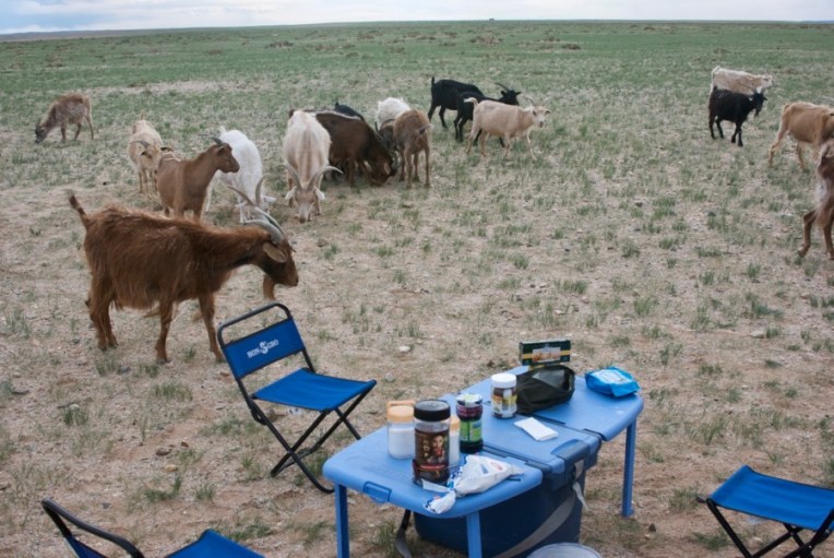
Breakfast, with cashmere goats. Great way to start the day!
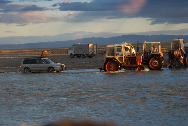
In a country where 100km is a good day’s travel on the earth roads that serve most of it, we had just learned from locals at Baruunbayan-Ulaan, a soum center where we had stopped to get petrol, that the heavy log and plank bridge we heading for in order to cross the Taatsyn Gol had been destroyed, a casualty of five days of rain in the Hangai Mountains followed by serious flooding downstream in the Gobi, where I was on a two-week camping trip in July of 2010, traveling in a Land Cruiser with Khatnaa, my driver/guide and Soyoloo, our cook. The closest intact bridge would require almost a two day detour north and then back south, which didn’t appeal to any of us. What to do.
Khatnaa decided that we would drive on west to the river and see what the situation was. Also at the petrol station were two very full Mitsubishi Delicata van’s worth of Mongol men and their families. A little later a third one showed up.
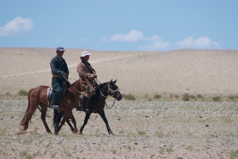
Heading south-east into the Gobi. I love this
In one day that had incident enough to two, here’s my journal entry from July 15, which gives a certain immediacy to what followed (photos after the journal entry):
“What an amazing day. Went south-west with Orog Nuur (Orog Lake) as our goal. Khatnaa knew there was the Taatsyn Gol (Taatsyn River) to cross, so stopped at a petrol station to ask about it. Also there were two van loads of Mongols from Togrog who were heading west to mine for gold. Usual Mongol socializing and information exchange ensued.
A third van showed up and we all headed towards the river, which was flooded due to rains in the Hangai Mountains.
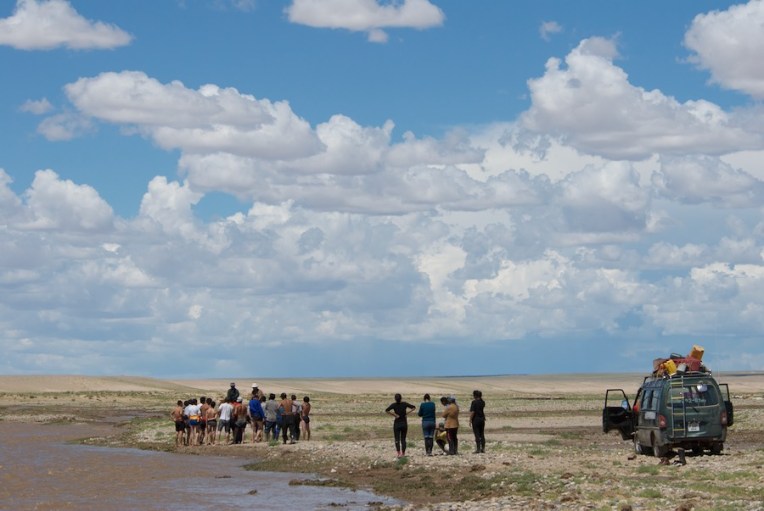
We got across one stream, but were stopped by a broad ribbon of streams and mud. The main channel was moving fast and pulsing with even more water.
Went back up to the bluff overlooking the river and had lunch, watching the three van loads of Mongols look for a way across and mess around in the water.
Went back down to the river. Khatnaa walked a long way to see if he could find a crossing point, but came back and told us that the last stream of water was the worst of all. So we were faced with going north 100 km to the closest bridge. Such is travel in Mongolia.
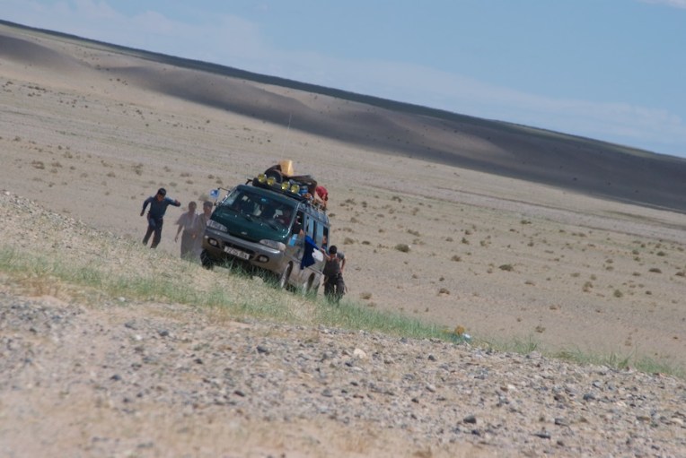
Suddenly, there was action with one of the vans. A bunch of guys had formed a line across one point of the main channel and the van charged into the water, started to stall, but the guys all got behind it and pushed it on through!
Well, if a van could make it, our big Land Cruiser certainly could and did, without even needing a push. We did end up with an extra passenger, a little eej (mother) who wasn’t about to miss her chance to ride in our big car.
We got out on the other side and I photographed the other two vans making the crossing. Then said our good-byes.
We followed one van up a soft sand slope. It promptly got stuck so we rolled back down and went around it and on up the hill.
The entire “adventure” of the river crossing was a perfect example of Mongol practicality, improvisational skills and good humor. No one at any point got angry, showed frustration or swore. When it looked like things had stalled out, the guys took a break and goofed around in the water. Or so it seemed. They were clearly having fun but they were, in retrospect, also searching for a crossing point.
The spot they found was one where the channel wasn’t too wide or deep and where they felt the bottom was solid enough for a vehicle to get across with a minimal chance of getting stuck.
Without winches, cables or even rope, they simply used the same solution they always do – push.”
Here’s a selection of the photos that I took…
Mongols from the vans looking for a place to cross a channel of the flooded Taatsyn Gol (river)Khatnaa walking out to see if he could find a crossing place as described in the journal entryAfter Khatnaa came back from not finding a way across, he drove up to the top of a bank overlooking the river valley where we had a picnic lunch and watched what was going on down belowWe drove back down and passed these two local herders who were riding over to check out what was happeningYou can see them in the distance on the left. Of course, they just rode across, no problem. Which was pretty funny, actually. It was that kind of dayWould-be miners getting advice from the herders. All this taking place under a spectacular summer sky and crystalline lightWe were waiting at our car and suddenly one of the vans started across. I took this photo just as it started to stall out. The guys behind it immediately rushed up to give it a push and out it came on the other sideThen it was our turn. I took this shot at mid-stream. The water was up past the bumperThen the second van crossed with us looking back the way we’d just comeMeanwhile, the herders enjoyed a little unexpected afternoon entertainment…The third van crossing without incident but some pretty good splashesAll vehicles safely across the guys took a few minutes to goof around in the water.Then they headed back to their vans to continue their journeyWe followed behind and came upon one momentarily stuck in sand on the slope up out of the river valley. We smiled and waved as we went by since we still had a fair distance to go to our next destination, Orog Nuur (lake)And not too long after….camels!
In Mongolia, when traveling in the countryside, even when it seems bad it can be very good. And something cool, interesting or out and out wonderful happens every day.
I’ve said for many years that in Mongolia, more than in most places, the journey really is the destination. It’s something most visitors miss with the usual emphasis tour companies have of going from sight to sight on paved roads. Eleven trips in twelve years and I’ve never been bored and have never slept while rolling. It takes time, effort and money for me to go to Mongolia every year and I don’t want to miss a minute of the limited time I have in the countryside. So while this week’s post doesn’t have a lot of incident or excitement, it will give you a chance to see a little of what’s “in between” on the road day to day, this time in the Gobi.
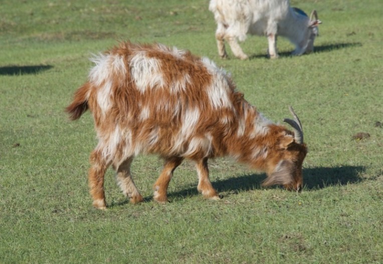
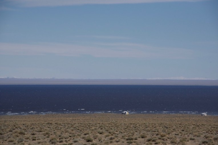
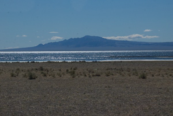
We hadn’t realized it when we set up camp at Boon Tsagaan Nuur, a remote lake in the Gobi, but we were not far from a herder’s ger (see above photo). A short walk towards the lake revealed it settled behind a dune. We found the goats and sheep to be entertaining, but could also see that they had grazed the grass down to the ground in the entire area except for one section that was fenced off, something one sees all too often these days.
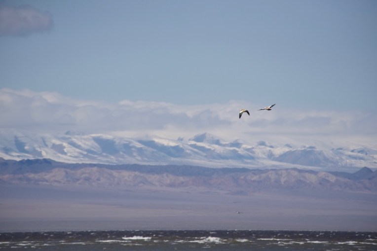
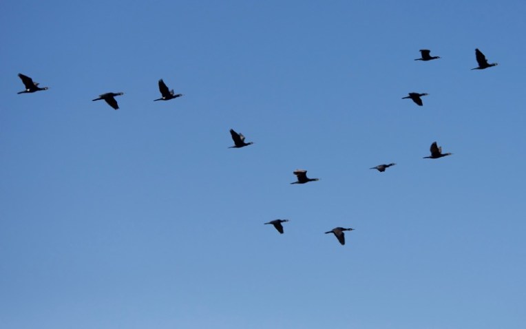
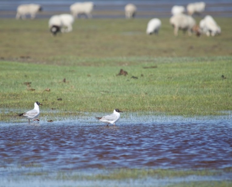
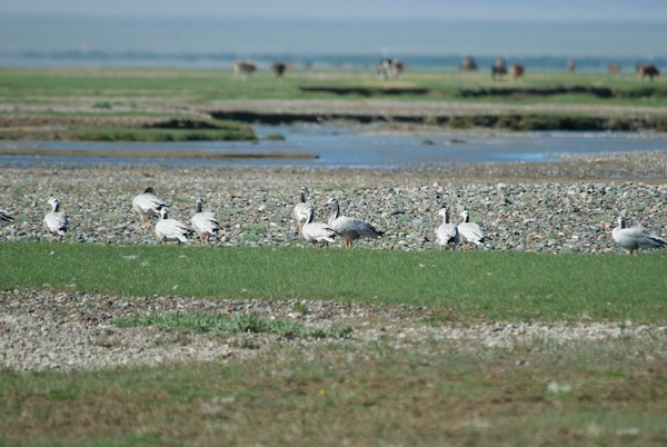
Loved the markings and color of this spotted cashmere goat.After breakfast we picked our way to the lakeshore through wet ground to do some birdwatching. The lake was rough with white caps and backed by a snowy mountain, Dund Argalant Nuruu. It was cold and windy.A pair of ruddy shelducks flew over. That’s the lake at the bottom of the photo.There was also a flock of great cormorants.Black-headed gulls.
There were a number of shorebirds…plovers and a redshanks, but I couldn’t get close enough for decent photos.
Did I say it was cold?
We left the lake driving south around the east shore, a route that I had not been on before, which was great!
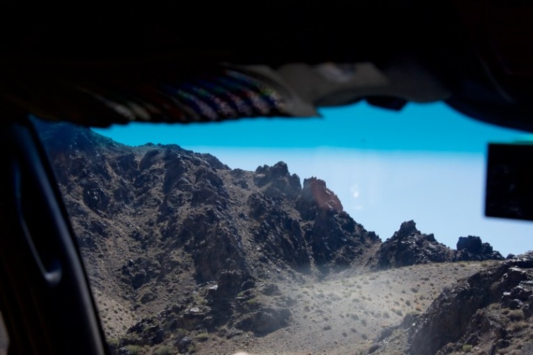
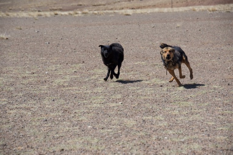
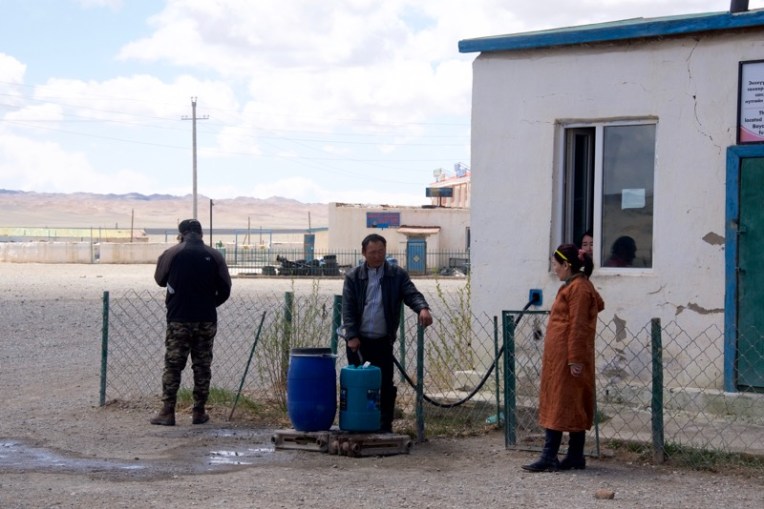
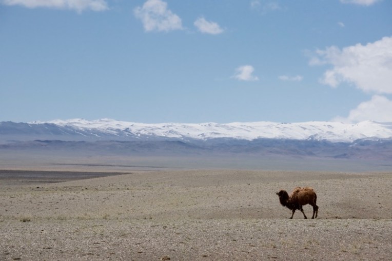
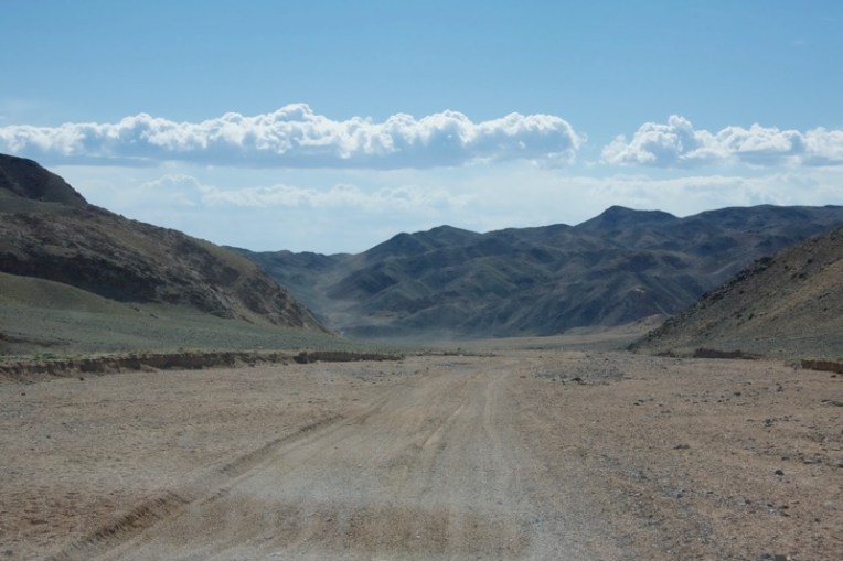
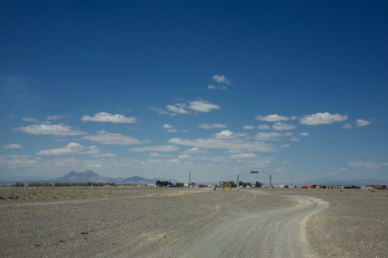
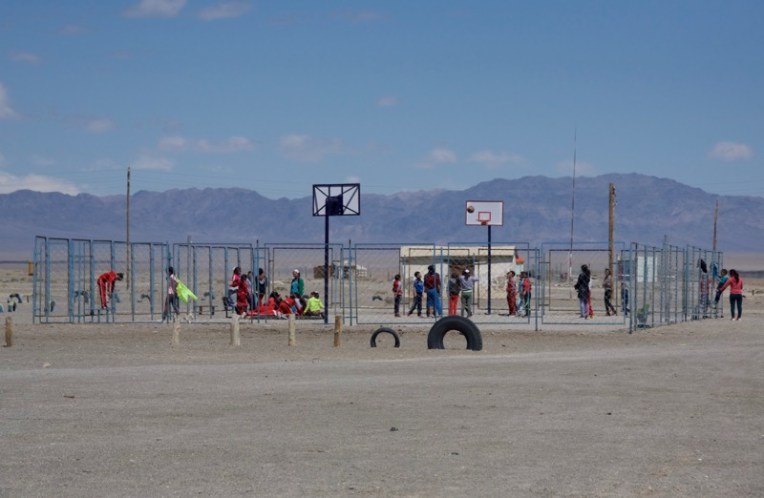
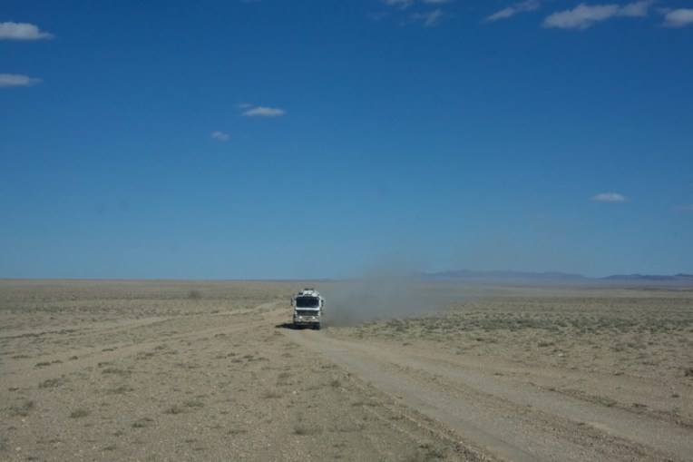
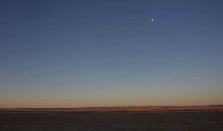
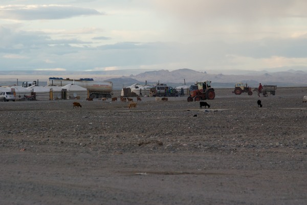
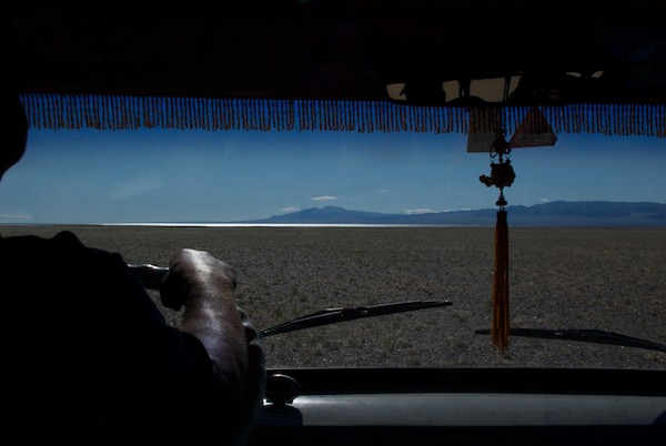
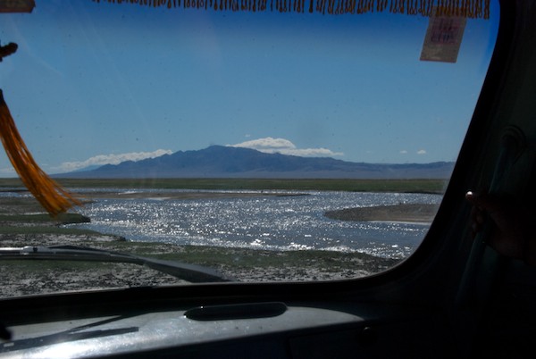
The lake was a deep indigo blue with white caps from the wind. This ger with a solar panel was the last one we saw for awhile.As we headed south it got warmer. There was an minor cognitive disconnect between driving through the warm Gobi and seeing heavy snow on the mountains from the front we’d driven through farther north two days earlier.We started to climb through the first of a number of rugged passes. Grabbed this shot through the windshield of the Land Cruiser.There were some impressive rock formations along the way.And then we entered a stretch with quite a bit of vegetation, including flowering shrubs. I think this is a wild apricot. I’m usually in Mongolia later in the year when the fruits have already formed, so am not sure. But the pink flowers made quite a contrast with the edgy roughness of the rocks.Our Russian fergon support van with our great cook. Soyoloo, waving from the passenger side. Fergons aren’t the most comfortable ride, but they will get you there. No electronics, all mechanical, with the engine between the front seats, which means it can be accessed without getting out of the car, highly desireable when it’s -30F or 90F outside. And they can be fixed by the drivers, who know them inside out and backward, on the road.I always try to get photos of gers in the landscape, maybe THE quintessential Mongolian countryside scene.Also part of the landscape, ger dogs chasing one’s vehicle as a send-off after a visit. The traditional greeting upon approaching a herder’s ger is “nokhoi ga”….”Hold the dog!”. I never, ever, ever get out of the car or van until told to do so by the driver or guide since they can be highly aggressive and are not vaccinated against rabies or anything else.View from one of our lunch stops. Blue sky, fluffy clouds, open space that goes on for hundreds of kilometers.But deserted? Not at all. While Soyoloo and our guide, Batana, got everyone’s lunch boxes out of the cooler, this motorbike rolled up, the family either coming or going from the soum center or maybe visiting family or friends.We spot the first camels! These are domestic bactrian camels. It was great for Kim and Oliver since it was the first time on the trip, but I never tire of seeing camels.Same with the horses, especially with a backdrop like this.We rolled into a small soum center to get water from the local well. This one was quite a set-up with a permanent building and a window through which one paid.More camels. My “ship of the desert” shot. Three days since the snow storm and these higher southern mountains were still blanketed.We had to get south through a range of mountains to our south to reach our next destination, the soum center of Bayantooroi. The driver started to look for a camping spot, but then we noticed possible rain clouds coming up behind us. We needed to get out and down to the plain asap since you can see that the road follows the same path run-off from a rain storm would take.We did make it down to the upland area and out of the mountains. While the rain ended up missing us to the east, it was very, very windy that night. The next day was calm and we found ourselves in an area with saxaul trees.Our lunch stop was at a large out cropping which had a “terrace” that we climbed up to and where we sat to eat. Nice view looking back the way we’d come.The day’s destination, Bayantooroi, where the headquarters of the Great Gobi A Strictly Protected Area is located. We had to go there, quite a bit out of our way, to get a border permit since we were going to be within 50km of the Chinese border. In the background, on the left, is Eej Hairkhan Uul, the sacred mother mountain. On the first WildArt Mongolia Expedition in 2013, we spent two nights camping at the base of the mountain, doing a day hike up onto it. You can read about that wonderful day here.Many westerners have this idea of Mongolia of a somewhat backward, poverty-stricken place and while incomes are low by western standards and there are poor people as is true anywhere, the country is also absolutely up to date in many ways, including an increasing use of alternate energy sources like wind and solar. Bayantooroi is a long way from any major town (I think the aimag center of Altai might be the closest and at least a two day drive, judging from the road atlas I’m consulting) and look at this big solar array that has been installed.Basketball is quite popular in Mongolia. Every soum center seems to have at least one basket set up somewhere. Bayantooroi has a full two-basket court which some local girls and boys were using.Our guide and drivers handled not only getting the border permit, but also arranging for a ranger to take us into the strictly protected area. He lived quite a way out of town, so we had to wait for him to come in to plan the next day’s travel. In the meantime, Batana chatted with another local family getting more information. There’s only so much one can do from Ulaanbaatar. Final contacts and arrangements often have to be made once one is in the field.Everything settled, we now had to backtrack over three hours to where we would turn south into the protected area. The only “traffic” we saw all day.We reached the pre-arranged location and set up camp for the night. The next day the ranger would come to our camp, impossible to miss in its open location on the upland plain, and lead the way to our destination. In the meantime we all enjoyed this gorgeous sunset.
Next week we’ll travel far, far south, deep into the Great Gobi A Strictly Protected Area, one of the most remote locations in Mongolia. No towns, no herder families, no mobile phone service. I could hardly wait!
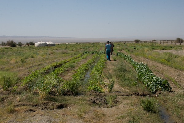
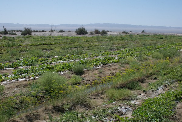
Batmaa, one of our drivers, who grew up in Gobi Altai Aimag, asked if we were interested in visiting a vegetable garden. I had heard on a previous trip that it was well-known that the sweetest vegetables grown in Mongolia came from from the Gobi. This might be my only chance to see something that, to say the least, is not associated with one of the world’s most famous deserts, so the answer was absolutely “Yes!”.
We turned back to the west and drove through an area where there were no gers, no people. Until this line of trees came into view.
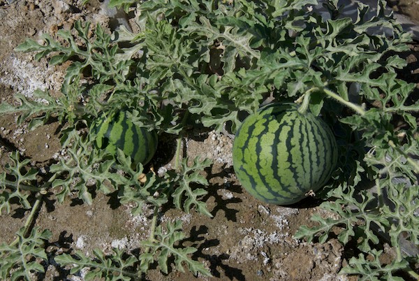
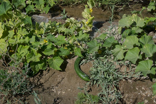
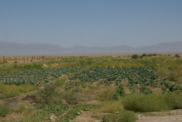
A windbreak. (I was shooting through the windshield of the van, hence the reflections)Then we saw this odd thing…and realized it had water pouring out of it.An amazing sight in the deep Gobi….water. It turns out that there is a lot of water not far below the surface in many areas like this one. This was one of three spots where water was being brought to the surface to form ponds. We all grabbed scarves or handkerchiefs, soaked them and wrung them out on our faces and heads. It was so refreshing!The vegetable garden covered a LOT of ground.As a nice touch, a small flock of demoiselle cranes flew over.Not sure what these are, but I think they’re cabbages.It was hard to get a shot that really showed how big this garden is. It goes all the way to the light-colored areas in the distance and extends to my right and behind me.But this was the big treat…watermelons! We bought some to take with us and they were the best I’ve ever had.There were also many rows of cucumbers. So the owners were successfully growing at least two very water intensive crops in one of the driest places in the world.Our gracious hostess.Between all the rows were these small irrigation ditches. Herbs like this dill were also being grown.A last look back towards the vans with the Gobi Altai Mountains in the distance.The owners live on-site in this ger.
Now it was on to the farthest point we would go in the west…Takhiin Tal.
After a wonderful stay at Arburd Sands and Bayan-Onjuul Soum, it was time for the Expedition to start in earnest. Our first destination was Boon Tsagaan Nuur, a lake deep in the Gobi that is known for the excellence of its birdwatching opportunities, both in the number of birds and variety of species.
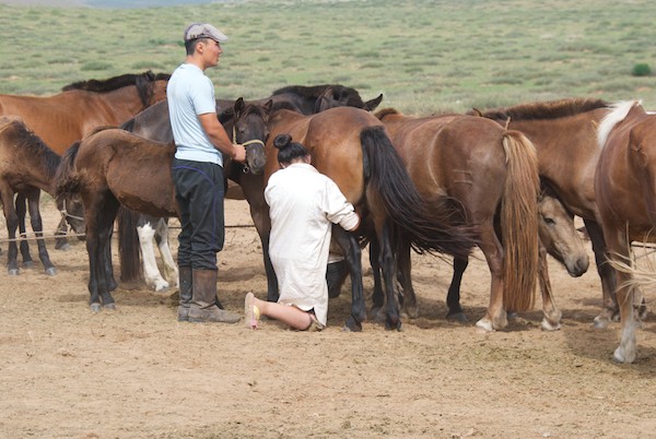
We headed west across country to join up with the main southern east-west road, parts of which are now tarmac. We hadn’t traveled for long when we came upon a herder’s ger just in time to see them milking their mares.
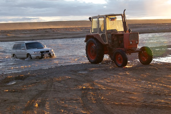
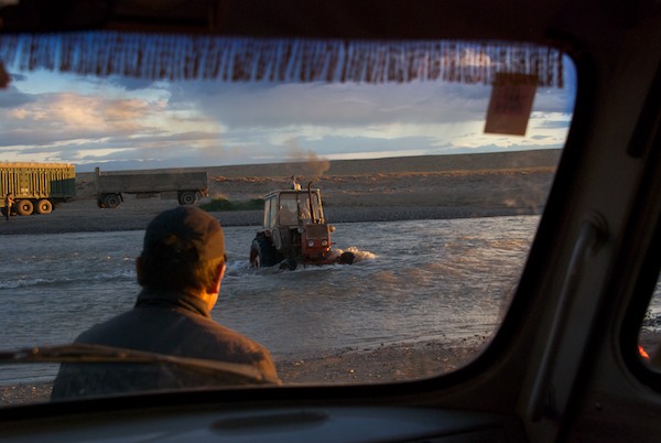
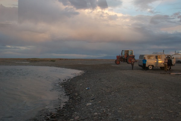
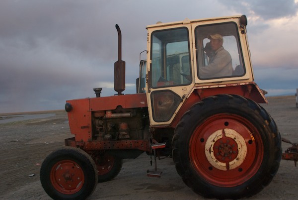
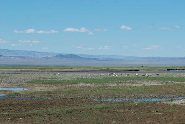
Milking the mares. The foals are tied to a picket line so that their mothers won’t go far and held near the mare so that she will release her milk. Enough is left for the foal to get a good meal. This process is repeated every two hours, 24 hours a day for weeks or months. One result is the famous fermented mare’s milk “airag”, which to me tastes like fizzy yogurt. I like it a lot.Sharon takes a photo of Tugs-Oyun, who is riding in the other van. We all loved her spiffy yellow glasses.Getting water from a local well with the assistance of a young local. An adult had entrusted the keys and the job to him, which he carried off in style.Camping near ArvayheerSharon shows Magvandorj how she photographs flowers close-upEn route to BayanhongorOvoo en route to BayanhongorWhen we arrived at the place to get our water barrel refilled in Bayanhongor, we found that this young boy and his horse-drawn water cart was there ahead of us. A small gift of candy and he was happy to pose for photos. Many of the residential areas of the city are ger districts with no running water. People fetch it themselves, pushing or pulling a wheeled metal frame that holds a water barrel. Or they can have someone with a horse cart deliver it to them.Driving south out of Bayanhongor, which is located at the base of the Hangai Mountains, we traveled through a long stretch of uplands, passing a lot of interesting rock formations, but no gers and relatively few livestock.Reaching the Gobi, we saw the occasional ger. There was rain across a wide swath of the horizon. As you can see, the Gobi is gravel, not sand, although there are isolated dune complexes.We came to the soum center of Baatsagaan, located not far from Boon Tsagaan Nuur. No petrol available and I think at this point the drivers found out what was ahead of us…A lot of rain in the Hangai Mountains had poured down into the Gobi creating temporary rivers and streams. This was between us and the lake. So close, yet so far, since neither of our drivers could find a spot they felt confident taking the vans across. Now what?Batmaa, the driver of the van I was in, grew up in this part of Mongolia and knows it well. He led the way north for quite a distance and then west. We passed really narrow spots like this and I wondered why we didn’t just zip across. But I learned many trips ago that things are often not as they appear to a non-Mongol and that we were going far out of our way for a reason. I had my suspicions though….So benign looking and so tempting….And then we came to this, clearly an established and well-organized operation of some kind.And of course the answer was that Batmaa had brought us to the ford. I would guess the only one for many, many miles around, judging from the number of tractors, gers, and vehicles waiting to cross.We got a preview of what was in store for us.Uh. Oh.Through the deepest part.Piece of cake, right?Now it was our turn. Here’s comes “our” tractor.Last minute directions/instructions. Sharon and I made sure all our gear was up off the floor, just in case.Here we go.Mid-stream.On the other side. Whew.Our hero.On to the south and then east in the setting sun.We drove on and on, hoping to get back to the lake, but finally gave it up and set up camp in the dark with a stiff cold wind blowing. Here we are the next morning. Not too bad for just picking a spot at random. That is part of the Gobi Altai Mountain range to the south of us.Catching up on my journal. Did I say it had been windy?Packing up. The pump sprayer was for both washing our hands and, with an enclosure set up around it, our shower. It worked great and one could get hair and body washed with only a half liter of water, important now that we were going to be traveling through countryside where places to get water were at least a day apart.At last! Boon Tsagaan Nuur!A final stop so that our drivers could consult with local herders. Solar panels and satellite dishes are very common sights now at herder’s gers, along with motorbikes, mobile phones and small flat panel tvs. But this is still a tough environment to live in and only the knowledgeable and smart thrive.We drove along the north side of the lake back to the east end, where the birds would be.The classic landscape of Mongolia….We hadn’t even gotten to the lake yet, having come to a series of interlaced streams we needed to cross, when we spotted bar-headed geese!This species is famous for its ability to migrate from Central Asia to India. Over the Himalayas. At close to 30,000 ft. Which is the height an airliner can fly. Got some great photos from which there will be paintings.One more river to cross. Our van stalled out in the middle, but Batmaa got it started again and we made it across.Our cook, Soyoloo, and guide, Tseegii, walking down to the lake.We had only meant to stop this close to the lake for lunch, but decided to camp overnight. The mosquitos weren’t bad at all, just annoying for a relatively short time.The “I was here” photo. And was I ever glad to be. You’ll find out why in the next installment.
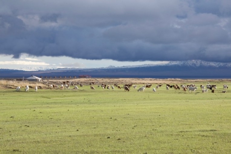
These two Mongol horses were part of a large herd that I saw at Gun-Galuut Nature Reserve in August of 2011. The mosquitos were pretty bad, so they were spending the day standing in a large shallow pond surrounded by a wetland area. Although it is a nature reserve, the local herders are allowed to use the valley as they always have during the times when the ground-nesting cranes aren’t incubating eggs.
Herd of Mongol horses at Gun-Galuut Nature Reserve with the Steppe Nomads eco ger camp in the background. The reserve is only a two-hour drive from Ulaanbaatar
The reference for “Goviin Boroo (Gobi Rain)” was taken in July, 2010 on my amazing two week camping trip. The rains were really good almost everywhere that year and the Gobi, contrary to how most westerners picture it, was green, green, green in many places, including this area near Orog Nuur, a remote Gobi lake where we spent the night.
“Goviin Boroo (Gobi Rain)” 18×24″ oil
I loved the layers of clouds, the streak of sunlight on the grass and the complimentary colors of green and red and knew I’d do a painting of the scene at some point.
You can read about the camping trip by selecting Mongolia 2010 from the drop-down categories menu.
Sunrise, Orog Nuur, the Gobi; the new year and my next trip will take me and the WildArt Mongolia Expedition on new roads, but we might get back to this place again
Thanks to my Mongol friends on Facebook, I’m picking up some Mongolian here and there, like the phrase in the title. I see written Mongolian in both the Latin alphabet and Mongolian cyrillic every day and sometimes I can read all or most of a sentence now, which is fun.
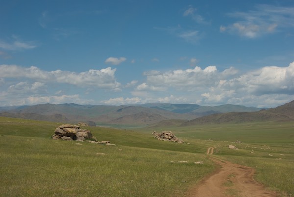
Earth road into the Hangai Mountains; happiness is a Mongolian earth road leading out into the deep countryside, knowing that something wonderful might be just over the next rise or around a bend
There’s plenty coming up for me in 2013. I’ll be entering a number of juried shows, including a few new ones. All my entries will be of Mongolian subjects. In March, I’ll be flying down to Tucson for the opening weekend of the Sea of Cortez exhibition at the Arizona-Sonora Desert Museum. In April I will be going to the 2nd Annual Plein Air Convention and Expo in Monterey, California and shortly thereafter flying back to the east coast for the spring board meeting of the Society of Animal Artists. I’ll also be doing an event in New York to promote the upcoming WildArt Mongolia Expedition, but the exact date hasn’t been set yet. In June there will be a WildArt Mongolia event in the San Francisco Bay Area, final date also to be determined. And, as currently planned, I will leave for my annual trip to Mongolia around the beginning of August. The Expedition is scheduled for late August/early September. I’ll have a couple of weeks at home and then it’s back to the east coast again in early October for the opening weekend of Art and the Animal at the Bennington Center for the Arts and the fall board meeting. I’ll be posting more on all of these events as the dates approach.
Just for a little context….Prairie Creek State Park, Humboldt County, California
I grew up in forests. Redwood forests, to be exact. Camping out meant drippy, foggy mornings and warm sweatshirts with, maybe, sunshine in the afternoon. In August. None of it ever bothered me because I loved being enclosed by those wonderful trees. My mom always loved the desert. Me? Not so much.
Then I went to Mongolia and on my second trip in 2006 spent a few days in the Gobi. And found it quite interesting. Enough to want to go back.
Which I did in July of 2010. And got hooked. Totally. It was hot, sometimes humid, we had to be careful to make sure we had enough water, we fought off mosquitos with dung smoke at a remote lake and I can hardly wait to go there again. I love the Gobi.
Gobi earth road, through sand and saxaul forest near Orog Nuur (remote lake)
So when Dr. David Wagner invited me as one of 30 artists to spend a week traveling to, learning about, sketching, painting and photographing the Sonoran Desert and then creating work for a 2013 show at the Arizona-Sonora Desert Museum in Tucson, Arizona, I accepted immediately, thinking it would be interesting to compare and contrast these two arid environments.
“Earth road” going towards Nacapuli Canyon, Sonoran Desert
I’ve pulled together my research and travel experiences and here’s what I’ve learned, illustrated with images from both places.
GEOGRAPHY:
SONORAN DESERT: Located in both the United States and Mexico
THE GOBI: Located in both Mongolia and China
Which means that both deserts cross an international boundary.
Tetakawi Hill: Mountain and sea, Sonoran DesertMountains and lake: Orog Nuur with Ikh Bogd mountains; demoiselle cranes at lakeside
SIZE:
SONORAN DESERT: 100,000 sq. miles
THE GOBI: 500,000 sq. miles, which makes it the 5th largest desert in the world
Nacapuli Canyon, Sonoran DesertYolyn Am (Vulture Gorge), Gobi Gurvansaikhan National Park, Sept. 2006
ELEVATION:
SONORAN DESERT: sea level to 12,600ft (San Francisco Peaks, Arizona)
THE GOBI: 3,000-5,000 ft. above sea level on a plateau; the highest mountain peak reaches almost 13,000 ft. (Gobi Altai mountains)
Sonoran Desert landscape with chollo and saguaro cactus, Arizona-Sonoran Desert Museum groundsGobi landscape, saxaul trees with Flaming Cliffs in the background
CLIMATE:
SONORAN DESERT: Hot with some colder winter areas at higher elevation. Snowfall rare except in mountains. Temperatures: summer- up to 120F (180F surface temperature has been recorded in Lower Colorado River Valley); winter- average low of 39F. Rainfall: bi-seasonal rain pattern- Dec./Mar., July/mid. Sept.; in some areas, multiple years without rain. Wind: winds blowing onshore bring the summer “monsoon” rains; hurricanes possible.
THE GOBI: “Cold” desert due to location on a plateau. Frost and snow can occur on the dunes. Temperatures: summer- up to 140F; winter- down to -40F; up to 50F temperature swings in 24 hours. Rainfall: one rainy season-July/August; up to 7.6″, some years with no rain. Wind: winds up to 85mph can create dust storms (usually occurring in March/April) large enough to be seen from space.
Estero Solado, a tidal estuary with no inflow, therefore it is always salineThe Flaming Cliffs beyond small Gobi lake, Sept. 2006
MARINE INFLUENCE:
SONORAN DESERT: Coastal areas on the Baja Pennisula and the east coast of mainland Mexico experience marine influence.
THE GOBI: Mongolia is a land-locked country, so the Gobi has no marine influence.
SONORAN DESERT: There are seven ecoregions: Tundra, Coniferous Forest, Temperate Coniferous Forest, Grassland, Chaparrel, Desert, Thornscrub (wet desert), Tropical Forest (source: Arizona-Sonora Desert Museum); sand dune fields of various sizes common.
THE GOBI: There are two or five ecoregions, depending on the source: 1) Eastern Gobi Desert Steppe, Gobi Lakes Valley Desert Steppe (World Wildlife Fund) 2) Eastern Gobi Desert Steppe, Alashan Plateau Semi-desert, Gobi Lakes Valley Desert Steppe, Junngar Basin Semi-desert, Tien Shan Range (“Alternative sources” Wikipedia entry for Gobi Desert); 5% of the Gobi is covered in sand dunes, much of the remainder in gravels of various kinds.
Avocets in the Estero Solado, Sonoran DesertAvocets, Orog Nuur, The Gobi, July 2009
HUMAN ACTIVITY:
Animal herding is common in both places. In the Sonoran Desert, there are cattle and some horses. The cattle graze on their own, the horses get fodder. In the Gobi, there are domestic bactrian camels, goats and some horses. In the more arid areas, camels do the work of horses. All animals graze on their own unless there is a severe winter, then they are fed fodder.
Food growing occurs where there is enough water. In the Sonoran Desert, water comes from springs, groundwater and wells. The growing season is very short- July and maybe into August. In the Gobi, there are lakes in some areas, springs and wells. The growing season may be as long as from April to October, depending on rainfall.
Desert bighorn ram, Arizona-Sonoran Desert Museum, March 2010Argali ram, Ikh Nartiin Chuluu Nature Reserve, April 2005
WILDLIFE:
SONORAN DESERT: 60 mammal species, including desert bighorn, jaguar, Mexican grey wolf, kangaroo rats, saiga antelope; 350 bird species, 15 which are endemic; over 100 reptile and 20 amphibian species. Endangered mammals: jaguar, Sonoran desert pronghorn. Endangered birds: cactus ferruginous pigmy owl, southwestern willow flycatcher
THE GOBI: 40 mammal species, including argali sheep, snow leopards (Altai Mountains) grey wolf, jerboas, Sonoran pronghorn antelope; the only reasonably reliable count for bird species that I could find on the web is 240 (from the Juuchin Tours website) specifically for Gobi Gurvansaikhan National Park. 15 reptile and amphibian species. Endangered mammals: Gobi bear, wild bactrian camel. Endangered birds: lammergeier, houbara bustard
Sonoran desert tree that stores water in its trunkSaxaul tree, which has wood so dense from slow growth that a branch, thrown in the water, will sink
FLORA:
SONORAN DESERT: 2000 species of plants; known for: saguaro cactus
THE GOBI: 410 species of plants; know for: saxaul trees
For my Mongol friends, a desert that meets the sea
So there you have it. What I found to be a useful and interesting comparison of two of the great deserts of the world.
I want to thank Dr. Wagner for inviting me along on this wonderful trip and all my fellow artist traveling companions. Did we have fun or what? You’re the best!


")


")
