The 2015 WildArt Mongolia Expedition, Part 8: Dorgon Nuur (Again), Jargalant Hairkhan Uul And Back To Hovd


Cropped-in photo
Cropped-in photo

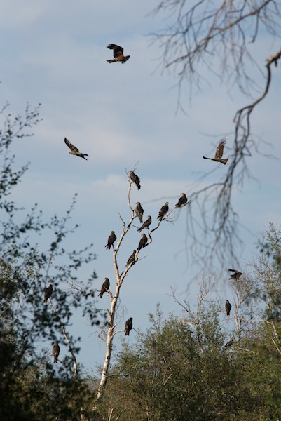
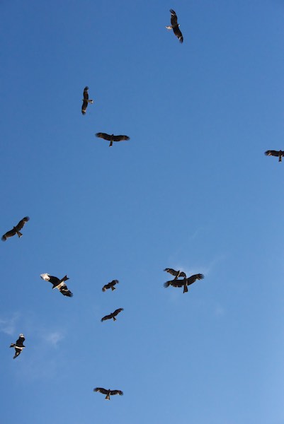
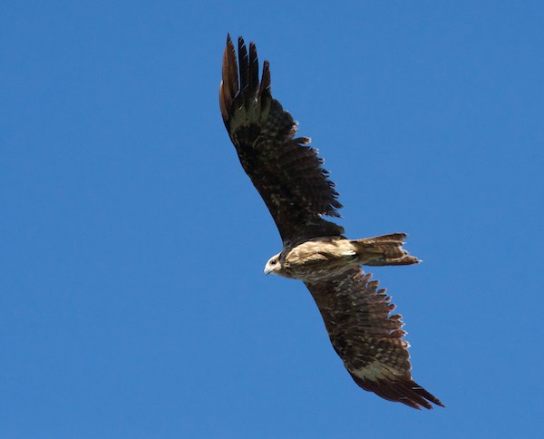
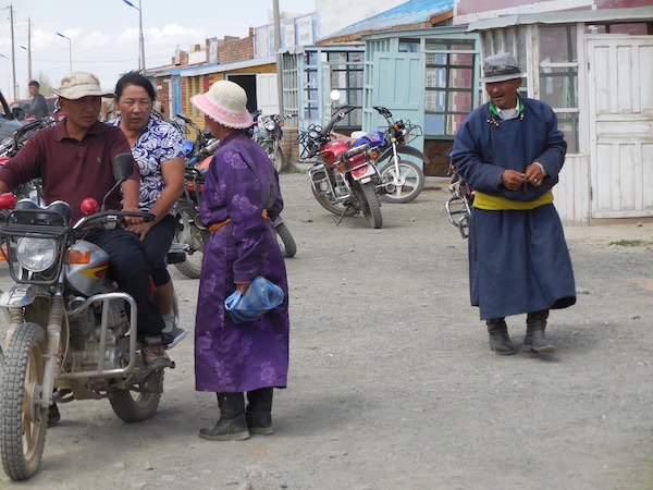
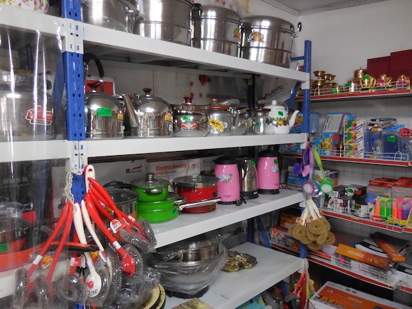
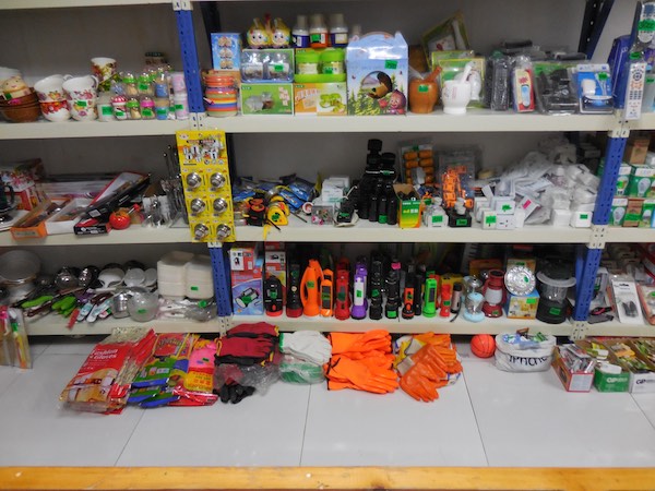
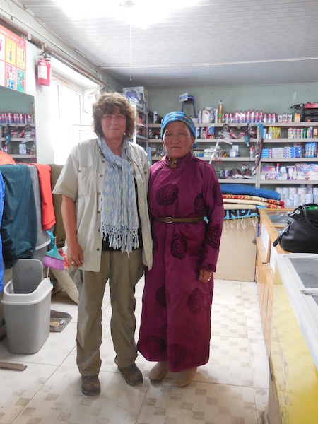
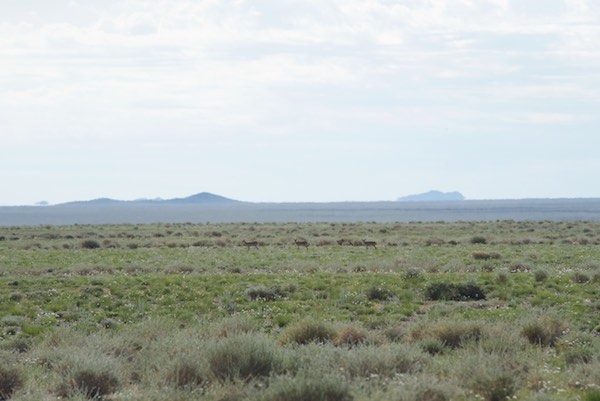
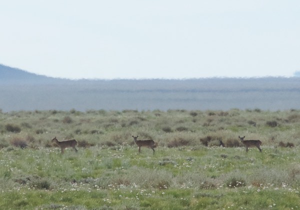
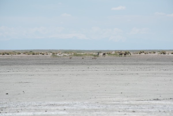
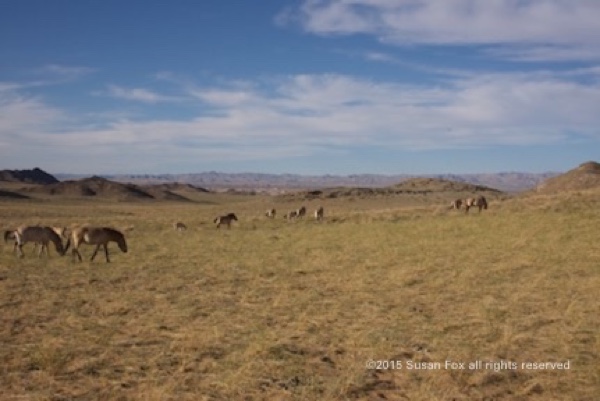
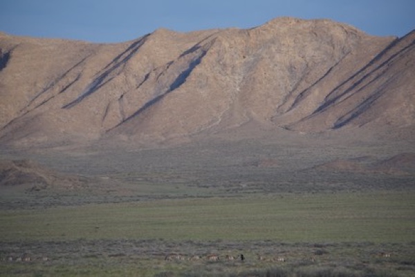
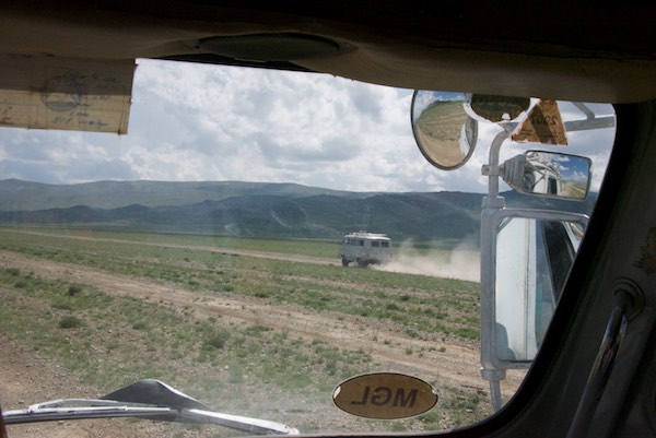
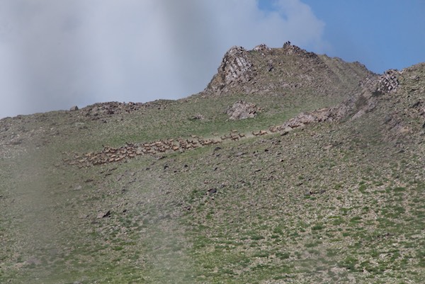
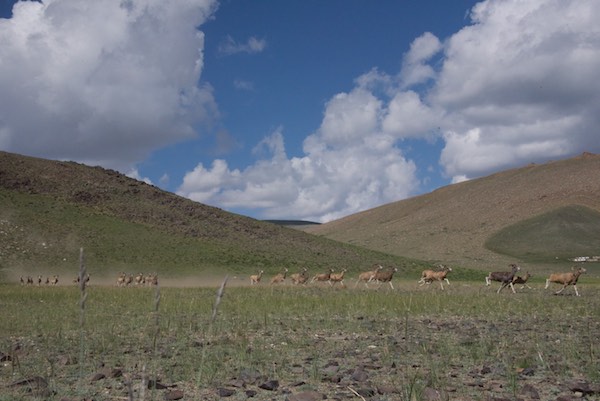
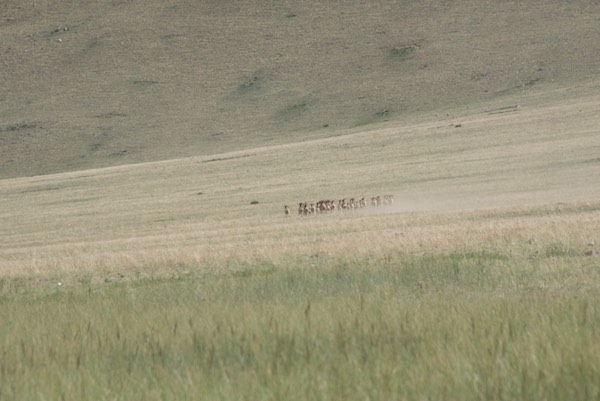
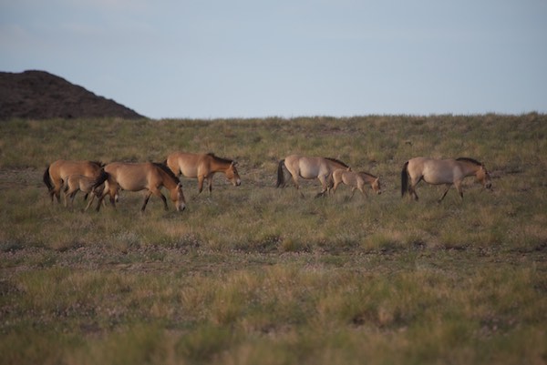
We finished our shopping in Chandmani, had lunch and headed east back to Dorgon Nuur. On the way, the “saiga show” started again, with at least three groups crossing our path as they headed north. As always they were too far away for good photos but some of this group of twelve are reasonably ok. Here’s the uncropped version.

More saiga...
More saiga…

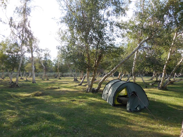
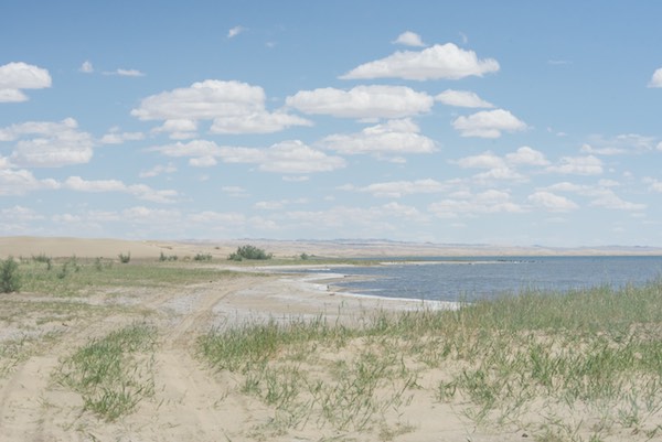
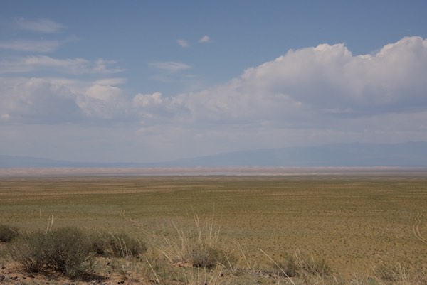
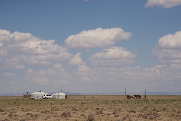
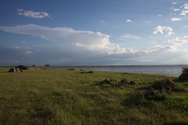
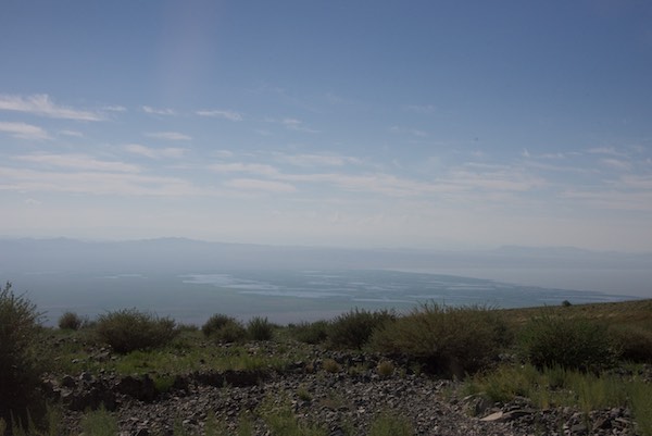
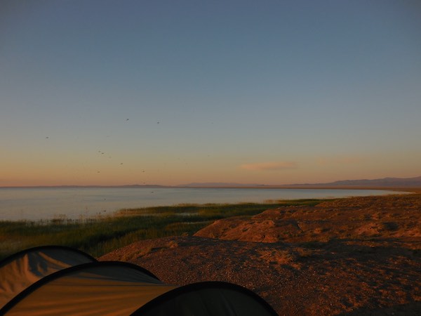
The driver drove along the lake edge for a bit and finally stopped on a bluff.

Campsite overlooking lake with whooper swans
View to the south
View to the south
I found a nice spot for my tent
I found a nice spot for my tent. My guide is resting a bit before setting up the kitchen tent

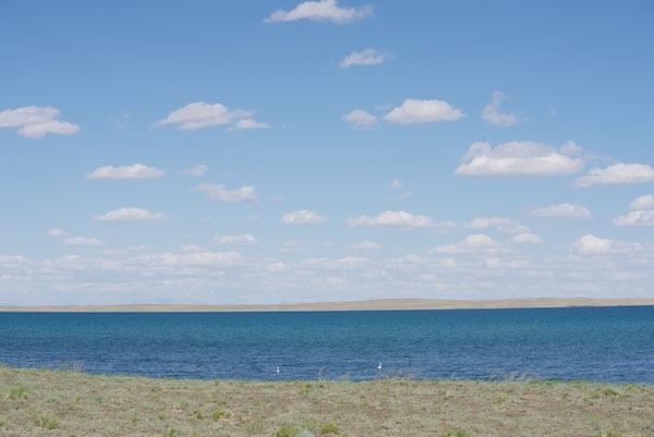
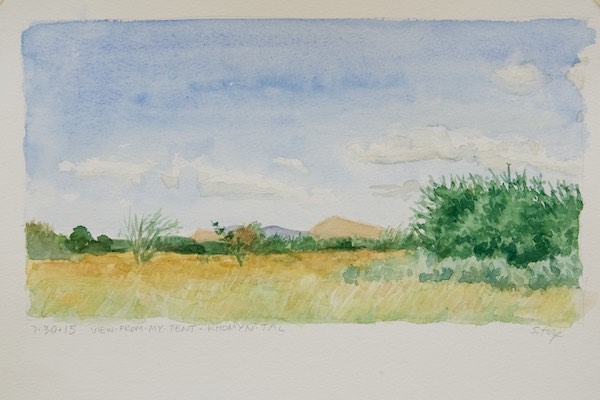
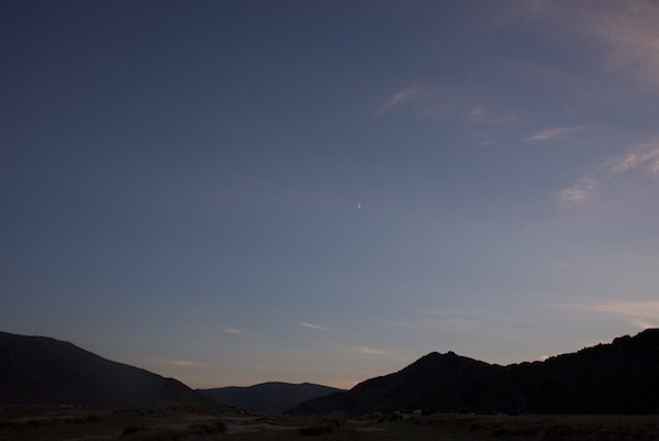
Once set up I got out my watercolors and sketchbooks and started to work. It was breezy, but not cold. Also no mosquitos. The late light started to get really interesting.

Reedbeds
Reedbeds
Early evening light
Early evening light
View from my tent looking north

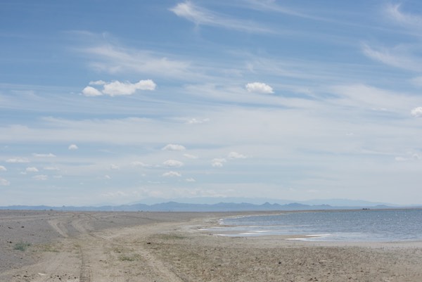
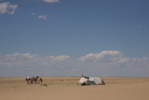
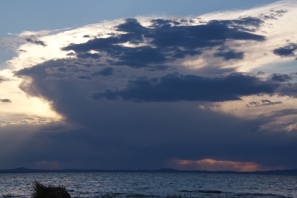
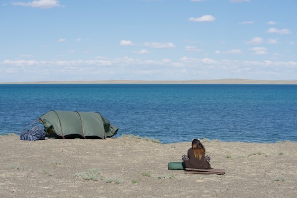
As the sun set, the wind died down and…the mosquitos arrived. Since we were the only living things of interest in the area. apparently every single one within a hundred miles showed up. I didn’t leave my tent unless it was absolutely necessary and turned in early. At some point, probably near dawn, I was awakened by a very odd sound. I couldn’t tell if it was natural or man-made and had never heard anything remotely like it before. But I wasn’t about to poke my head out in the dark, so I rolled over and went back to sleep, probably for an hour or so. When I woke up again it was just barely getting light and that sound was still going on. It was really mystifying. I finally had to look. I zipped open the vestibule just enough to see out and there, at standing head height, just in front of and above the tent was a ball of mosquitos close to the size of a soccer ball. And that was the source of the weird sound. I ducked back into the tent and quickly zipped the vestibule closed. No way was I going out that end. I seriously needed to pee and I wanted coffee so I slathered on the repellent and crawled out of the other end of the tent into a cloud of them that was only “better” ‘compared the packed mass a few feet away . Everything was covered with them…the tents, the Land Cruiser, the cooler. I did what I needed to do and retreated back my sanctuary.

Just another spectacular sunset
Sunrise. I’m amazed that it can be seen through the cloud of mosquitos in front of the lens.

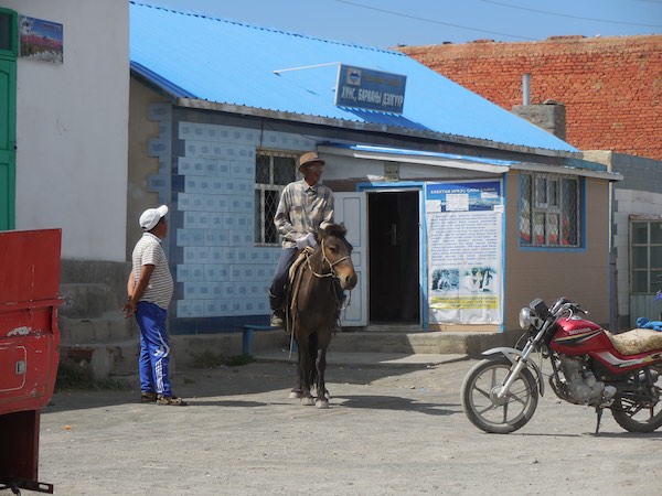
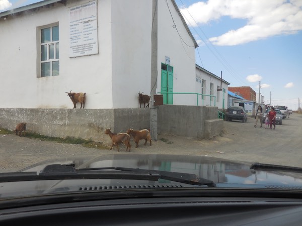
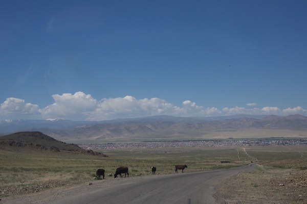
My guide and driver got up a little later and, I think, were equally appalled by the situation. So in a rerun of our last stay on the shores of Dorgon Nuur, we ate, packed up and left. We made a short stop in Chandmani and then drove south around the end of Jargalant Hairkhan Uul.

Chandmani
Chandmani with Jargalant Hairkhan Uul in the background.
On the way out of town we passed this monument
On the way out of town we passed this monument with an argali and ibex

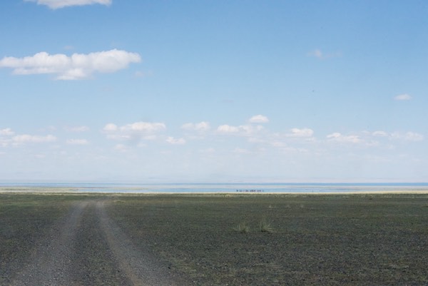
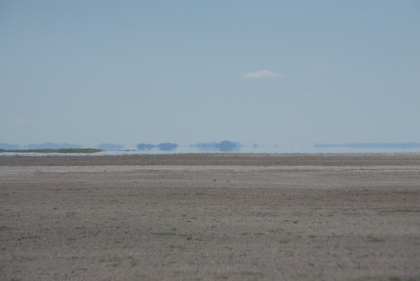
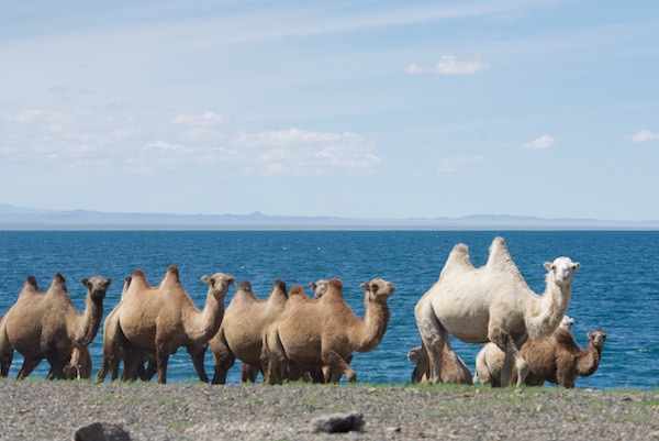
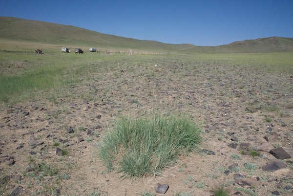
It took a couple of hours to get to the end of the mountain. It was very arid and overgrazed land. The highlight was a “camel jam”.

Bactrian camels
Bactrian camels

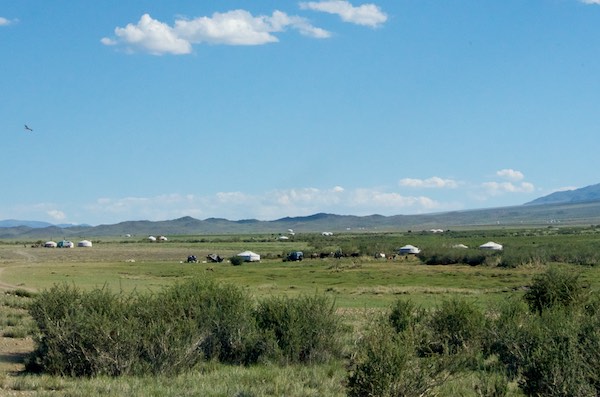
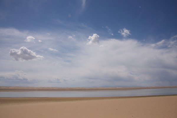
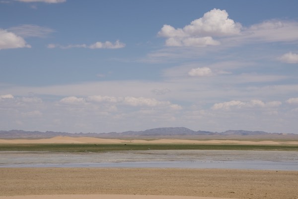
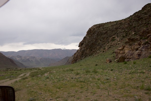
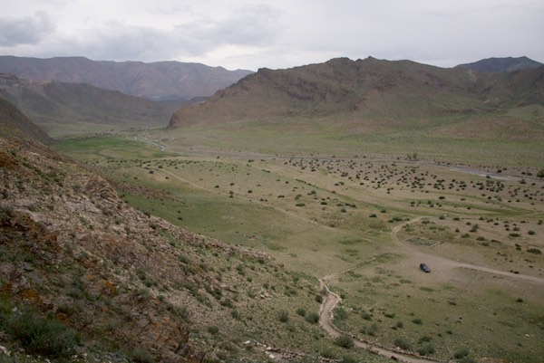
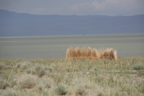
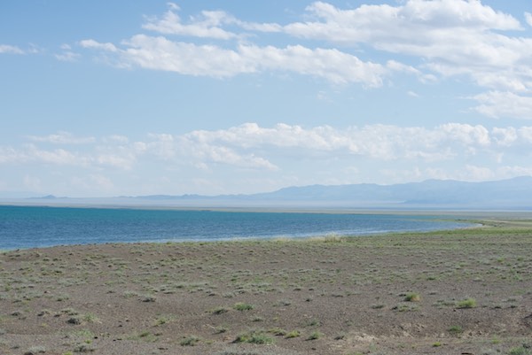
We dropped down to the plain and could see the reedbeds of Khar Us Nuur in the distance. Finally we turned northwest and paralleled the mountain. The two sides are very different. The mountain creates its own weather. Rain falls on the southwest face. A rain shadow keeps much, if any, rain from falling on the northeast side. No one lives or grazes their animals on the mountain, even though Chandmani and quite a few herder families live at the base. The entire mountain is contained in Khar Us Nuur National Park’s boundary, but there are herders on the side we were now driving along.

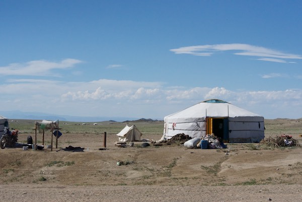
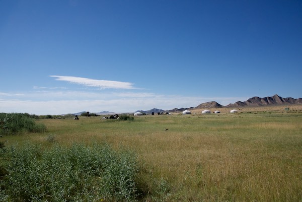
There were sights of interest along our route, including this communications tower. What got my attention was the contrast between this modern high tech installation and the ger at its base.

Tower and ger
Tower and ger

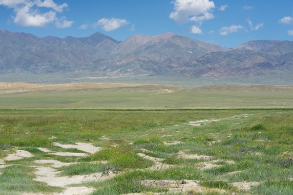
We drove for awhile along a small river and then through a lush green area with a variety of wildflowers.

Green grass and wildflowers
Jargalant Hairkhan Uul

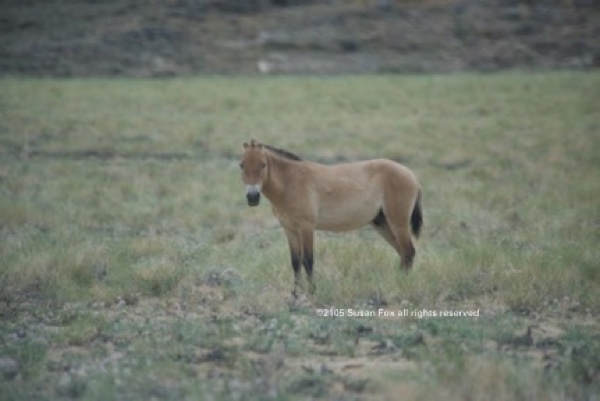
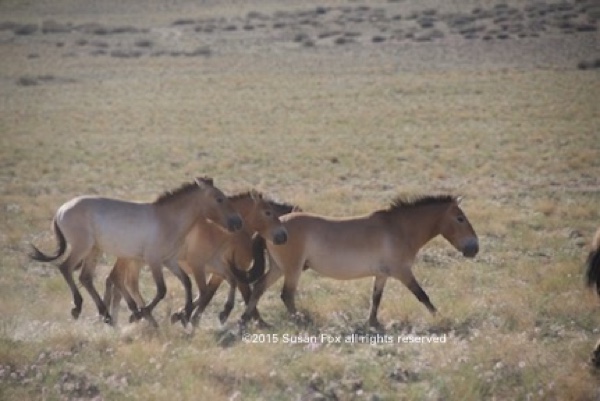
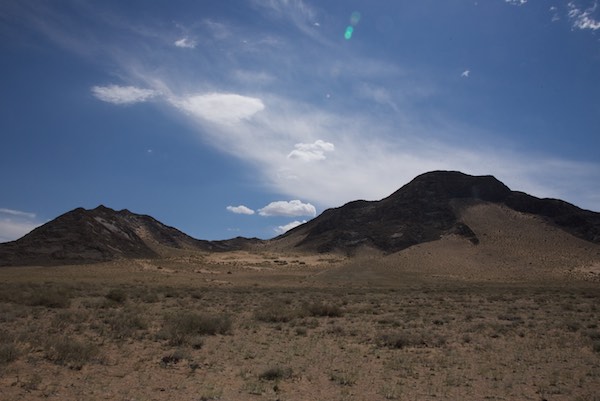
I’d been wanting to go to the mountain, which is really a freestanding range with many peaks, since I saw it from a distance in 2006. Between the previous trip a week or so earlier, which you can read about here, and this one, I will have almost completely circumnavigated it. This side was so much more interesting. I was awed by the colors and patterns of some of the slopes we drove past.

Jargalant Hairkhan Uul

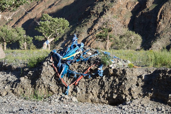
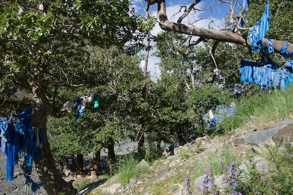
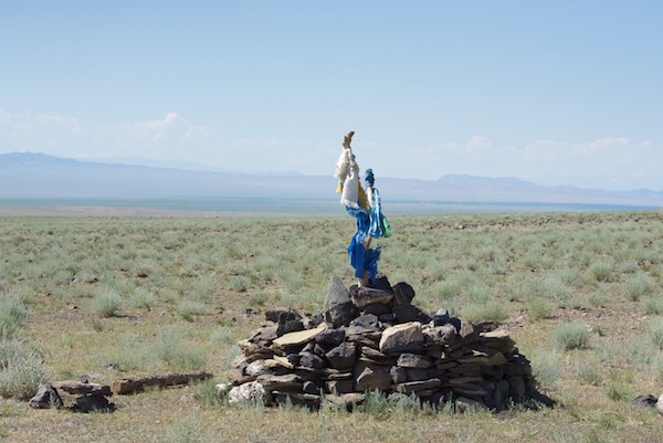
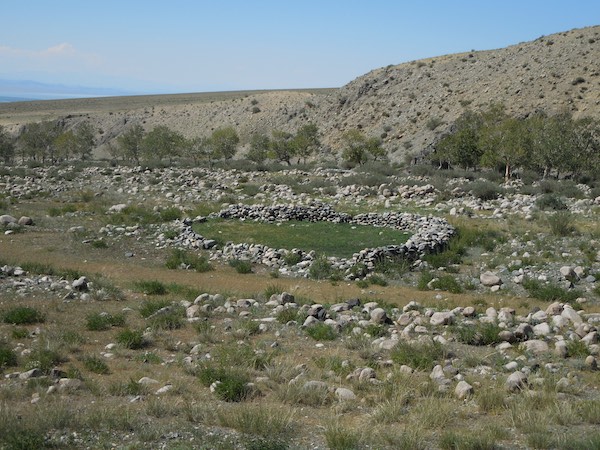
As we headed onto the upland slopes to the valley where we would camp for two nights, we passed this ovoo.

Ovoo
Ovoo

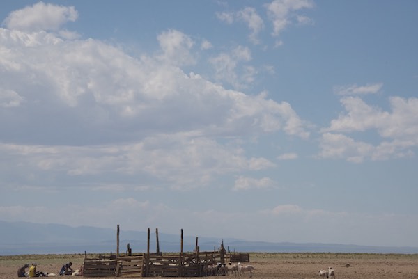
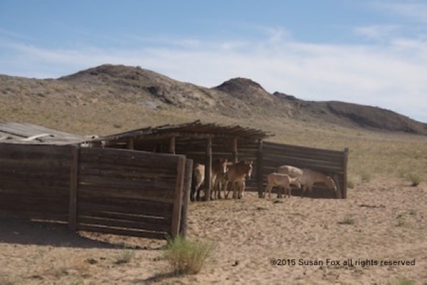
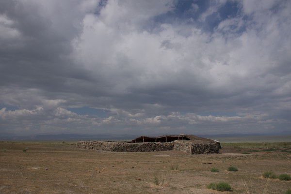
The ground became rockier the farther up we went and I grabbed a shot of this local herder’s winter livestock shelter.

Winter shelter
Winter shelter

We entered the valley and I could tell that I was going to like this place a lot.

Valley entrance
Valley entrance

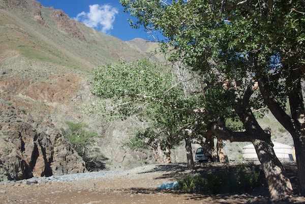
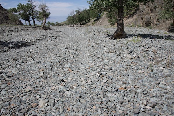
We were finally driving on the barest hint of a “road” over rocks that covered the whole valley floor, some pretty big. There were groves of aspen trees, more than I’d seen anyplace else.

Aspen trees
Aspen trees

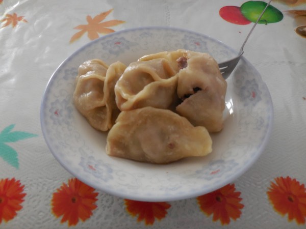
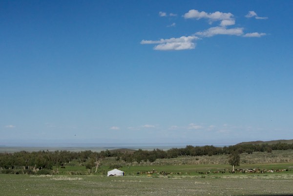
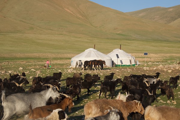
We finally came to the end of the road and stopped at a ger. We were fed boortz soup and aaruul and our driver got the latest news from them, which included being told that a snow leopard had killed a another herders’s goat two days earlier not too far from where we were. So now I was in the middle of snow leopard territory, also home to ibex and argali!

The herder's dogs. They were very aggressive. I took this photo from the car.
The herder’s dogs. They were very aggressive. I took this photo from the car.

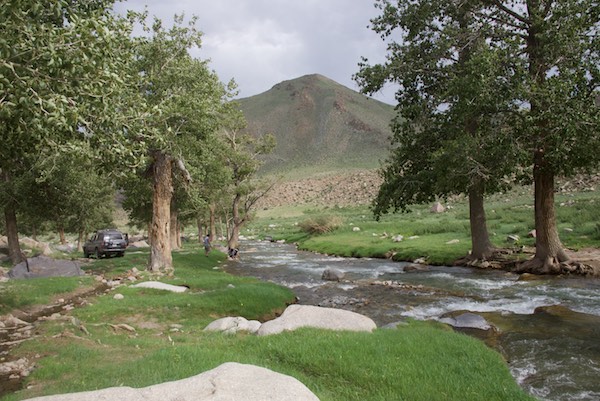
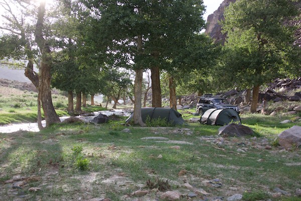
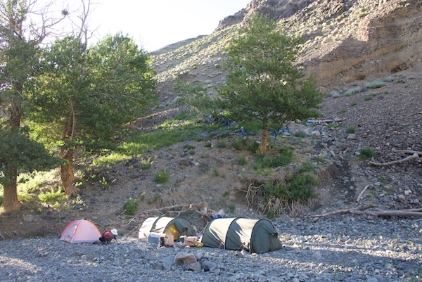
We drove back down the valley and set up camp at this spot, right next to a stunning, fast-flowing stream. Idyllic doesn’t begin to describe it.

Our campsite
Our campsite

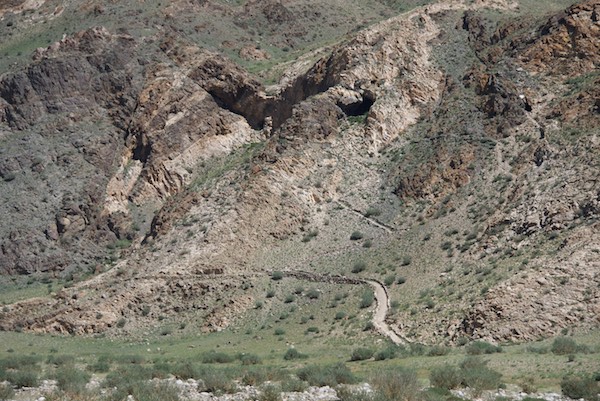
The next afternoon my guide took me on a hike up the valley into a part that was separated from the main one. We clambered over rocks, moving steadily higher in elevation until the trail narrowed and continued as a track that led deep into the mountain.

At the end point of our hike with snow leopard habitat behind me

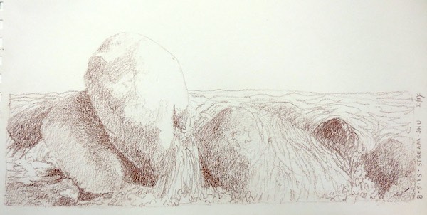
We hiked back down to camp, where I spent the rest of the day drawing the rocks and flowing water of the stream.

Rocks and stream- Derwent drawing pencil on paper

The next day I worked until lunch, doing a double study of two of the aspen trees.

Aspen trees, Jargalant Hairkhan Uul, Khar Us Nuur National Park
Aspen trees, Jargalant Hairkhan Uul, Khar Us Nuur National Park- pencil and watercolor on paper

While I was drawing, two camels showed up! They crossed the stream not far from where I was sitting. For a minute or two I wasn’t sure how close they’d get, but it turned out all they wanted was to get past our camp so they could move on down the valley.

Bactrian camels
Bactrian camels

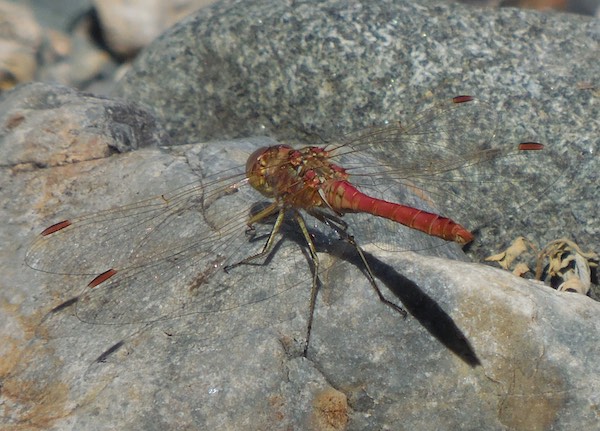
There weren’t a lot of insects and even the mosquitos weren’t too bad, especially compared to the lake. I did manage to get a good photo of this flashy dragonfly.

Dragonfly
Dragonfly

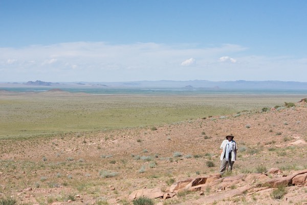
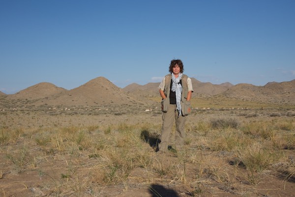
My guide took some pics of me working.

On location
On location

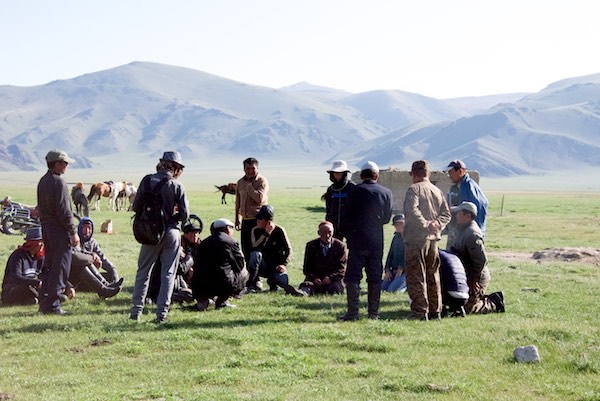
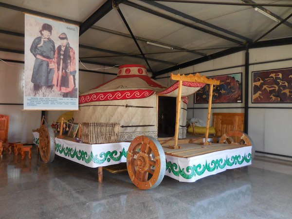
Finally, it was time to leave. This was the last stop on this year’s WildArt Mongolia Expedition and it was one of the best. I thought the trip was over when we got back to Hovd, but my guide and driver weren’t done yet. The next day was my flight back to Ulaanbaatar, but it wasn’t until late afternoon. So they picked me up in the morning and took me on a tour that included the local cultural center, which has gers, artifacts, objects and clothing from all the ethnic Mongol groups who live in Hovd, plus the Kazakhs.

The cultural center
The cultural center

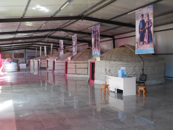
It really is a must see.

Imperial ger
The kind of ger and wheeled platform that a wealthy aristocratic Mongol might have had.

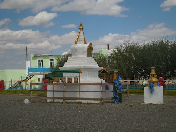
The final stop in town was a monastery that had just started to be re-built five years earlier. The original was one of the hundreds destroyed by the communist government in the late 1930s. I was told that the whole community came together to raise the money.

Temple in new monastery complex in Hovd

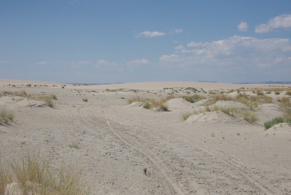
They took me back to the hotel to rest for a couple of hours and then it was off to the airport. The flight was delayed, so we looked at some of the photos and video I’d shot. Finally, it was time to do in to the boarding area, onto the plane and back to Ulaanbaatar. I was in town for a couple of days, then went “on vacation” to Delger Camp for four relaxing days, just hanging out, doing watercolors and hiking down to the dunes and back. A few more days in UB and I was homeward bound, my tenth journey to Mongolia at an end.


The 2015 WildArt Mongolia Expedition, Part 7: A Lovely Camping Place And…We Go Shopping!

Our beautiful campsite

I loved our hidden campsite in the birch grove. I did as many sketches and watercolors as I could since I have no idea if I’ll ever be at that place again. Here’s a two-page set of drawings from my journal.

Birch trees at campsite near Chandmani

And here’s one of the watercolors I did.

Birch trees at campsite near Chandmani

We weren’t, however, alone. The grove seems to be headquarters for a large number of black-eared kites, a very common bird that one doesn’t pay much attention to after awhile while traveling around. Well, you sure couldn’t ignore this crowd, which carried on enthusiastic “conversations” until nightfall.

The "kite tree"
The “kite tree”
Just a fraction of the number that were in the air at this point
Getting checked out
Getting checked out

They also nest here.

Black kite nest
Black-eared kite nest

It was such a lovely spot.

Birch tree grove
Birch tree grove

And it wasn’t easy to leave.

Stream
Stream

But we needed to get food and supplies for the last leg of the Expedition, so we packed up by late morning and drove the short distance into Chandmani, the soum center. There is also a Chandmani in Gobi Altai Aimag, which we drove through on the first Expedition in 2013, so now I’ve been to both of them. The guide had to get some money, which gave me a little time to wander around and find quite a few things of interest.

Stupa
A Stupa

Heroes from socialist times, along with WWII, are honored with statues in various towns. This one says “Khodolmoriin Baatar R. Chadrabal”.

Memorial statue
Memorial statue

I thought this next one was awesome. So perfectly an expression of its time and a good work of art. The plaque says, I think, “Bimaulsin Baatar/Bayaibalin Tegshee”.

Memorial statue
Memorial statue

And, providing a contrast nearby, was this very cute playground.

Playground
Playground

On the ground near the red hero statue was a wonderful sculpture of oversized anklebones (shagai). The real ones are used for an apparently endless number of games, many of them involving alcohol consumption. Each of the four sides represents a specific domestic animal: horse, sheep, goat or camel.

Shagai
Shagai

I was not surprised, this being Mongolia, that there would be a statue of a horse.

Horse statue
Horse statue

I was, however, quite surprised to see a statue of an argali.

Argali statue
Argali statue

It seemed a sleepy town, like most soum centers I’ve been to, not many people out and about.

Chandmani scene with horses and Jargalant Hairhan Uul in the background

The town’s setting, with the northeast side of Jargalant Hairkhan Uul as a backdrop, was very nice. We went into the town center and, wow, it was hopping! The local naadam festival had just ended and people had come into town to do their shopping.

The main shopping street in Chandmani
Local people who have come to town

This was one of the few soum centers I’ve been in (not a huge number) that really had a main shopping street. Our first stop was this shop. I was dazzled by the riot of color and the variety of goods. I’m posting a lot of photos of it for two reasons. One is that I just want to share the experience, which is not one that visitors often get. I had the best time poking around and taking photos with my phone camera. The second is that I am so tired of uninformed, to put it diplomatically, Americans seeing the herder’s gers and how country people live, and going on and on about “those poor people” living in poverty as if it was some kind of degraded life that they need to be rescued from by the noble westerners. It’s true that most herders don’t have a lot of cash money. They also don’t accumulate a lot of stuff because everything they have is going to have to be packed up and moved at least a couple of times a year. But they have what they need and if they want something they have access to shops like these.

Behind the counter
Behind the counter
Candy is dandy
Candy is dandy and every shop I’ve ever been in has an excellent selection
Vegetables
Vegetables and sundry other things like Russian nesting dolls and heavy electrical cords.
Children's shoes
Children’s shoes
Children's clothing
Children’s clothing

As you have probably guessed by now, the Mongols are not a people who are afraid of color. Westerners have commented on that for as long as any have made the journey to the Land of Blue Skies.

Fabric temptations, but I managed to resist
Cookies and biscuits
the stationary and school supply department
the stationary and school supply department, plus some Buddhist offering cups and such on the top shelf
Nails
Nails
The toy department
The toy department
Paint, tape, locks...hardware stuff
Paint, tape, locks…hardware stuff
Pots and pans
Pots and pans
Nuts and bolts and washers
Mobile phones
Mobile phones
Flashlights and other things one might need around the ger
The auto/motorbike parts department
Beverages, including fruit juices and beer
Beverages, including fruit juices and beer; breads are on the left; oh, look, more candy on the right at the bottom

We were almost ready to leave when a woman came in wearing a del the same color as one I have. Our eyes met and I got up the courage to have my guide ask if she’d have her picture taken with me. I got a smile and a nod. Mongols almost never smile for photos, having been taught to keep a serious face since childhood. I’ve learned to keep a neutral friendly expression for these photo opps.

Love this photo; one of my favorites from the trip

We left the first shop and went to have lunch, which turned out two of my favorites! Buuz and khuushuur. I have yet to get tired of either.

Buuz, which are steamed mutton dumplings
Khuushuur, which are fried mutton turnovers

We needed to go to one more shop to get meat.

The restaurant
The second shop

There was a huge poster attached to the wall. It was information about snow leopards. It says that there are 37 living on Jargalant Hairkhan Uul. The photo shows camera trap images of two leopards who have lost a paw in a trap, so other information on the poster is about not setting traps.

Snow leopard information poster

But we go into the shop and I see this. I was not able to find out the whole story behind either the poster or the traps. When I do I’ll be writing a post about it.

Traps
Traps

It turned out that there was no meat on site. The proprietor made a phone call and about 20 minutes later a local herder came in with a small bag of fresh mutton. In the meantime I took some more photos, including this stack of ger felts.

Felt ger coverings
Felt ger coverings

We went back to the car and got in. In the meantime, some of the local goats started to put on a show.

Goats finding a raised vantage point on a building

As we were leaving I spotted this horse tied to a fence and had to get some photos.

Good-looking grey horse with very nice saddle

Now we really did need to get going. Our destination? Back east to Dorgon Nuur to camp in a different location than before. Will there be mosquitos? Find out next week.

On the road again for an hour or two


The 2015 WildArt Mongolia Expedition, Part 6: Dorgon Nuur, Saiga Antelope and Sacred Mountains

The road south
The road south

It was time for the Expedition to try to see critically endangered saiga antelope (Saiga tartarica mongolica). I had been told that they could be found in an area in Khar Us Nuur National Park between Khar Us Nuur and Dorgon Nuur and also to the south. That’s the way we headed in the morning at about 9am trailed by a cloud of mosquitos that we thankfully and quickly left behind. The sightings began at 9:40 am (I kept notes of time, number of saiga, plus a GPS reading of the first sighting).

Three saiga antelope
Three saiga antelope; they really blend into the landscape
Closeup of saiga
Closeup of saiga

Almost all the sightings that followed were initially made by the driver who, typically, had incredible the visual acuity I’ve kind of been spoiled by over the years. I’m always scanning with my eyes and binoculars for whatever we’re looking for but rarely spot an animal before the driver. (The exception is argali at Ikh Nart because I’ve spent so much time there and know exactly what to look for.) And were there ever sightings! Between 10:45am and 12:49pm, we saw a total of 35 saiga in groups of 2-5, except for a single calf, every five to ten minutes and I got some kind of “I saw them” shot of almost all of them. Part way through my guide remarked that she’d brought a group of tourists to the same area not long before and they’d seen exactly….five.

We came to this place where there was a spring that saiga came to drink at. The driver said that we wouldn’t likely see any farther south, so we turned back and the sightings, as described above, continued as we retraced our route.

Watering place
Watering place

On one stretch the car flushed lots of Pallas’ sand grouse. It was a challenge to photograph them from the moving car, but I got some good shots.

Pallas' sand grouse
Pallas’ sand grouse

We came within sight of Dorgon Nuur again and…more saiga! The dunes are the same ones we had to work our way past the day before.

Saiga antelope with Dorgon Nuur in the background

It had gotten hot and mirages appeared in the distance.

Mirage
Mirage

Finally, around 1pm, we stopped for lunch at an observation tower that was in the middle of the plain between the lakes. We parked near the base of it. The only shade was on one side of the car. The driver, who was also the cook, had made, believe it or not, sushi for lunch. No fish, just rice, a little vegetable and an interesting sauce, but it really hit the spot.

Observation tower
Observation tower

I did some sketching while we rested and watched a herd of camels wandering past.

Bactrian camels
Bactrian camels

I had been looking at my map and noticed that there were some small lakes at the north end of the park. I asked the driver if it was possible, with the time we had for the day, to go there. And that’s the direction we headed after lunch.
In a lot, if not most, of Mongolia there aren’t any trees, so the raptors just stand on the ground, like this upland buzzard, when they aren’t flying.

Upland buzzard
Upland buzzard

As we drove red rock formations came into view. Past them in the distance are some of the reedbeds of Khar Us Nuur.

Red rocks
Red rocks

We came to a raised area to the left of the rock formations and, wow, what a view!

Posing with the view

I could see that we were still a long way from those small lakes, if they were even there, but my guide more than made up for that by telling me that from where we were standing there were three sacred mountains to be seen. That was completely unexpected. She pointed them out to me from left to right. The first, to the west was…Hokh Serkhiin Nuruu, which was where I had been for the argali capture just  a couple of weeks ago!

Hokh Serkhiin Nuruu
Hokh Serkhiin Nuruu (3776m)

To the right and north was Altan Hokhii, one of the four State Sacred Mountains of Mongolia. The president of Mongolia had visited it for a ceremony not long before. It still had quite a bit of snow on the top even though it was August. The green in the middle ground are reedbeds.

Altan Hokhii (3351m)

And finally, almost straight north was Tsambagarav (4165m) the tallest of the three. It and the surrounding area form one of Mongolia’s national parks. It also still had snow on its peak.

Tsambagarav
Tsambagarav

This is one of the things I love about traveling in Mongolia. One can have a plan or idea of what one wants to see or do, but something else equally good or better often happens instead. Having reached the northmost point of this drive for this trip, we turned south. We now had Jargalant Hairkhan Uul on our right and another line of hills to our left, forming a very wide, shallow valley that started out arid and absent any gers or livestock, but gradually became greener and populated.

Heading back south
Heading back south

We started to pass gers quite regularly, some right next to the road.

Herder's ger
Herder’s ger

There were more and more goats and sheep and we found ourselves momentarily in a “sheep jam”.

A sheep jam
A sheep jam

The landscape became quite green, trees appeared and then I saw a good-sized wandering stream.

Green valley with Jargalant Hairkhan Uul as a backdrop

It was quite beautiful and very appealing with a storybook quality. All I could think was what a great place this would be to spend the summer. And apparently that’s what a lot of the local people do. They live in or near, Chandmani, the soum center, most of the year, but in the summer set up gers in this valley and stay in them on the weekends and for vacation. At the end of the season they pack them up and store them away.

Gers
Gers

We came to the end of the valley, which had a lot of trees, and were at a high enough elevation that we could see Dorgon Nuur in the distance.

Ger, trees and
Ger, trees and lake

It was getting late in the afternoon and I knew we’d be stopping soon to camp for the night. I gazed longingly at the trees, which lined the streams. But I leave the choice of campsite to the driver unless specifically asked. So on we went, past the trees, up a slope, around and over a rise, the road becoming more of a rutted track. There were signs of previous campers and, unfortunately, quite a bit of trash strewn about. Yuk. But then we dropped down the hill and pulled up at this:

The birch glade
The birch glade

Oh, my.  The driver asked, through the guide, if this would be ok. All I could do was grin and nod “yes”. To get to it we had to carry our gear across this.

"Our" stream
“Our” stream

I know. Bummer. But I soldiered on and picked this spot for my tent. Then I took my shoes and socks off and went wading in the stream and just sat on the bank with my feet in it, listening to the water and the black kites wheeling around overhead (more on them next time).

One of the Best Camping Spots Ever

And then it was magic light time.

Magic light among the birches

I wandered about the area, did a little sketching and wished we could stay here for a week instead of just one night. More on this special place and some of the art I created here next week.


The 2015 WildArt Mongolia Expedition, Part 5: Dorgon Nuur

Khar Nuur
Khar Nuur

After our relaxing break on the shores of Khar Nuur, we headed south along the east side of the lake to the beginning of the channel that joined it to Dorgon Nuur. What is interesting about all this is that Khar Nuur is a freshwater lake and Dorgon Nuur is 4% saline. One map I have shows the area of salinity in pink instead of blue. It starts at the far northern point of the channel, but I have been able to find no documentation or explanation for it, other than a suggestion that maybe there are salt deposits in that area.

Like everywhere else in Mongolia, the herder’s horses run loose in the countryside when not be used. Visitors consistently write or post about seeing “wild horses”, assuming that they are the equivalent of American mustangs, which are feral domestic horses. Mongol horses are very independent-minded, aren’t approachable by strangers and can give their owners a good run for their money trying to catch them. But the takhi/Przewalski’s horse is the only surviving true wild horse.

Local Mongol horses.
Local Mongol horses

There were lots of birds…cranes, herons, cormorants, gulls, terns, plovers, to name what I saw just passing by.

Traveling along the channel
Traveling along the connecting channel we saw a pair of demoiselle cranes

When we started out the ground was covered with species of low and high grasses. As we went south, the vegetation became more sparse and obviously adapted to less rainfall. The mountain in the background with its top in the clouds is Jargalant Hairkhan Uul, again an upcoming destination.

Vegetation change
Vegetation change

The vegetation finally petered out and we were running on hard gravel. I didn’t know how well these mirages would photograph and was pleased with what I got.

Mirage
Mirage

The “road”, which at this point was the treadmarks of previous vehicles, led away from the water for awhile on what was becoming sandier ground, but still hard.

Hard ground
Sandy ground with Jargalant Hairkhan Uul in the background. The channel is mid-photo on the left.

A second group of horses eyed us as we drove by.

More horses
More horses

We passed this group, drove on a bit and then just as I saw the four horses in the distance (next photo below), the driver stopped and said “Saiga!”. And there they were…four of them, two females with calves running right past the horses, who just stood there watching them go by. I kept shooting until they disappeared into the dunes in the background. We drove on a bit and suddenly I thought to tell the driver to stop. I got out my GPS and took a reading of our location. I was expecting to look for saiga on the plain on the other side of the lake and also to the south, not here. Then I asked the driver, who grew up in the area, if he had ever seen them on the east side up along where the channel was and this far north and he said no. So on my to do list very soon now that I’m caught up on a bunch of work I’ve had to do, some of which had deadlines, is to consult with the saiga researchers I know about and see if I’ve recorded something new. Whatever I find out, I’ll post about it.

Four saiga antelope
Four saiga antelope

We finally reached the shores of Dorgon Nuur and I got this shot of wild greylag geese taking off.

Dorgon Nuur
Dorgon Nuur

We were driving south on the east side of the lake, which is quite large. It is almost 15 miles long and 12 miles wide. The photo below shows the view to the south where the lakeshore curves around to the west.

Dorgon Nuur
Dorgon Nuur

We had nice easy driving for a time on this grass “earth” road.

Grassy road
Grassy road

Then we came to the stretch that I’d been warned about, at which the shore became sand. My tour company person had told me that the southern part of the lake was known as the “Riviera of Mongolia” because it’s where the sand meets the water.

Sandy road
Sandy road

He had also told me that when the lake level was high the only way to go forward was to drive into the water and that it would be up to the driver to decide whether or not to go. If not, it meant a really long detour to get around this section. And, in fact, here we were, with the “road” having disappeared completely into the water. We stopped and the driver got out and went to reconnoiter the situation around the bend of the dune. Would we go on? Or have to go back?

Driver
Driver checking out the situation

And here’s why we couldn’t just cut inland a bit and go around…high dunes of loose sand. One could see that horses moved through and over them just fine. So passage around this part of the lake only became a problem when cars, vans and trucks came along.

Dune next to where we were stopped

The driver came back, made a “going for it” gesture and off we went. I took the photo below through the windshield. The tires on my side seemed to stay a little on the wet sand. No way did the driver want the wheels in the loose stuff higher up. Getting stuck doing this would have meant a long, long delay. No roadside assistance in Mongolia unless someone stopped. And we hadn’t seen another vehicle all day. This was clearly a “road less traveled” and then some.

Around the dune
Around the dune

We made it around the dune and picked up the road again, which was on sand, but not too soft.

Around the corner
Around the corner

We came upon a pair of whooper swans and stopped so I could get some photos of them.

Whooper swans
Whooper swans

And then we came to another, even longer, stretch of dunes that came right down to the water. Once again the driver got out to see what was ahead. Took a look, came back to the car, got in and off we went.

Another recon
Another recon

This time I set my Nikon D750 for video. I’d been having some problems with the lens, so this is a little out of focus, but it gives the feeling of what road travel is like in a way that still photos can’t.

Now we could see that there was a grassy edge the rest of the way.

Clear sailing ahead
Clear sailing ahead

We finally arrived at the curved south end of the lake. No more sand. This was rock and gravel. And a beach!

At the south end of the lake

With camels!

Bactrian camels
Bactrian camels

The beach is a weekend destination for local people who live in Chandmani, the soum center (county seat) an hour or two away.

Local people
Local people camping out and swimming in the lake

We headed farther off down the beach (Love using the word “beach” in a post about Mongolia and am enjoying it while I can!) and picked a spot to set up the tents. It was quite windy, but not cold.

Our campsite
Our campsite

The surrounding scenery was great. And then, to end an adventurous (for me, anyway) day, we were treated to one of the most spectacular sunsets I’ve ever seen.

Sunset, Dorgon Nuur
Sunset, Dorgon Nuur

The next morning brought calm weather and hordes (the only word in Mongolian that has made it into English, along with a version of “hooray”) of mosquitos. We packed up as quickly as possible and headed on west and then south to look for critically endangered saiga antelope. And that will be the subject of the next Expedition post.


The WildArt Mongolia Expedition, Part 4: Khomyn Tal to Khar Nuur; On the Road Again

What's over that hill?
What’s over that hill?

This post won’t show any great sights. Some of that is coming up. But it does give an idea of what travel between destinations is like, what’s out there along the road is interesting in its own way and almost always things that most visitors either don’t see or pass by. I love just rolling along on the earth roads through the enroute days, grabbing shots from the car as we go, doing a quick sketch or two when we stop for lunch. I never find it boring, no matter what the landscape is. Something nifty, cool or interesting shows up every day. It’s a kind of vacation for me….nothing really to do, the driver knows where we’re headed, knows to stop for wildlife and I can just relax into simply being in Mongolia, where the journey really will be the destination if you let it.

We had left Khomyn Tal and headed southwest towards a small lake the driver knew about and then would go on to Khar Us Nuur National Park. We were in an area I’d never been to before, so when we started up this gentle rise (above photo and also previous post), I had no idea what I’d see. And here’s the view, looking across a steppe area to the lake, a line of dunes and the mountains in the park beyond. It was a beautiful day and not too hot. “Bag” means “small” in Mongolian and “nuur” means “lake”, so Baga Nuur=Small Lake, which it was.

Baga Nuur
Baga Nuur

On our way there we passed a some people getting out of the sun in a jury-rigged shelter, something I hadn’t seen before.

Local herders
Local herders

The lake was big enough that I couldn’t get any shots of all of it, even when we parked on the top of a dune to get an overview. There were a lot of shorebirds in a few spots.

Baga Nuur
Baga Nuur
Baga Nuur
Baga Nuur

We continued north towards Khar Nuur (Black Lake), one of the two large lakes on the east side of the park. There were gers and livestock scattered around. This photo kind of sums up Mongolia today…horses on a picket line ready to ride and and a car. I have no patience at all with westerners who moan and go on about how the traditional way of life of the quaint and picturesque herders has been “spoiled” by modern things like, oh, mobile phones, solar panels, satellite dishes, etc., any and all of which they may have themselves.

Local herders
Local herders

We came upon this enclosure with the family engaged in shearing their sheep. The driver spoke with one of the men, who was shirtless and had the deepest tan I’ve ever seen, clearly someone who’d spent their life outdoors. I try to be discrete when photographing people, so stayed in the car and got just a few shots.

Sheep-shearing
Sheep-shearing

As we approached the lake we encountered this stretch of soft sand and dunes that had to be crossed. That’s the “road” in the photo. I had been told about this and remembered it from going to Khomyn Tal in 2006. Last year, when my tour company person and I were planning the Expedition route it had meant that the trip would have to use Russian fergon vans. It turned out that the Land Cruiser drivers out west can handle it, but sitting next to my driver I could see the specialized observation and skill set that was needed. It’s this kind of experience, repeated in different parts of the country with different drivers over the years, that has taught me what I know to be true about road travel in Mongolia.

Onward through the sand

We finally came to the spot where the southern end of the lake joins a south-flowing channel that connects with another lake, Dorgon Nuur.

Khar Nuur
Khar Nuur

Through my guide I had told the driver about my 2006 trip and mentioned camping on the shore at the site of a large log bridge that was partly collapsed. And there it was…

The broken bridge
The broken bridge

I did not walk out on it, but the driver and guide did. There was another car with some people on the other side. Being from the area, the driver knew them, so they had a visit while I took photos.  I have no idea why the bridge has never been repaired or replaced. Not having it means that people have to to quite a long way around to get to the area between the east and western lakes where Chandmani, the soum center is located. Here’s what the same bridge looked like at sunrise in 2006. I think you can see why I’ve wanted to go back again and have more time to explore than just two days. That’s Jargalant Hairkhan Uul in the background and there will be a LOT more about that mountain in future posts.

Log bridge in 2006
Log bridge in 2006

We drove back north to the Khar Nuur shore proper. The driver stopped and asked if we should camp here. Yes, yes, yes!

Will this do?
Will this do?

Here’s our campsite. My tent’s in the foreground on the left. It wasn’t too hot and there weren’t too many mosquitos. I could walk barefoot in the grass. We all bathed and waded in the lake, washed our hair and did laundry. It was a refreshing break from the heat and “mozzies” at Khomyn Tal.

Khar Nuur campsite
Khar Nuur campsite

There was a very nice sunset to watch and one could see that it was raining to the west. Summer is the rainy season in Mongolia and since the quality of the grass it produces affects how well the livestock will do in surviving the winter, I’m always happy to see rain and never think poorly of it even when it goes on for, oh, say, 16+ hours (that was later on after the Expedition).

Sunset
Sunset

Mongols don’t generally eat breakfast (the guides do if they’re with a group and sometimes the drivers), but I needed something in the morning. This trip was different because before we left Hovd, instead of a cook having purchased all the food before leaving UB or a town shop en route, the driver, guide and I did the grocery shopping together in the big Nomin Supermarket, which was really fun. The guide and I even chose a couple of bottles of wine and we made sure there were plenty of snacks, yogurt and canned fruit. The driver, who was also the cook, made sure there were plenty of dinner supplies like dried meat (boortz) and noodles for “soup”. The cost for all the food for three people for two weeks was about $100. We’d done the same when Turuu was with us, so I now had a pretty good idea of what everyone liked and what was needed. I was quite happy to find this box of German muesli, which is basically what I eat on weekdays at home. “Cyy” is milk. There were also lots of different kinds of fruit juices available and we had what was needed for morning coffee, so I was set.

Cereal and milk
Cereal and milk

The next “episode” will be another day on the road, but one of the more adventurous days of the entire Expedition. Stay tuned….


The WildArt Mongolia Expedition, Part 3: Khomyn Tal

Entrance to the Khomyn Tal takhi release project

Before I left Ulaanbaatar on the Expedition arrangements had been made for me to go to Khomyn Tal for three specific days…in on one day and out on another. I left Hovd with the driver/cook and guide on July 27 for the long run east. It took around nine and half hours and we arrived at dusk. By the time we got to the research camp it was dark. The staff members present let us use a ger for the night, which was much appreciated. The next morning we set up our tents not far away.

Our campsite by the Zavkhan Gol (river)

On hand were two of the Mongolian ranger/researchers and one French volunteer, who spoke good English. He explained the routine to me. I wasn’t sure what to expect and had not assumed any particular assistance since I knew from my very short trip there in 2006 there is always much to do. So I thought that we might be driving around the reserve area on our own looking for the horses every day. But a much better plan was suggested, which was that I would go out in both the morning and evening with whoever was assigned for that time slot to either locate the horses and check on them or to follow a pre-determined two of the three family groups for an hour each doing behavioral observations. This was perfect! In return we used the Land Cruiser for three of the drives, donating our petrol and wear and tear. The camp vehicles were a Russian fergon van and a small white jeep, so we could offer more comfortable “accomodation”.

The reintroduction project at Khomyn Tal in Zavkhan Aimag, (which is in western Mongolia) after many years of planning and breeding of takhi who would be acclimated and able to survive in Mongolia through the use of semi-reserves in the French Alps, officially began in 2004 with the shipment of 22 horses. It is the brainchild and inspiration of Dr. Claudia Feh who is still in charge of the project but who, unfortunately, I was unable to meet with. I did go to Khomyn Tal on my second trip to Mongolia in 2006, met her then, and have wanted to go back ever since. So this year I finally made it.

I will be doing an extensive, more science-oriented post reporting on my interview with Florian and what I learned about the project, but for now I just want to share what I saw…these wonderful wild horses and the place they live:

My first look at them
My first look at them; the sheds provide shelter from both heat and cold

One difference between the project at Khomym Tal and the other two reintroduction sites, Takhiin Tal and Hustai National Park, both of which I’ve also been to, is that the horses are quite acclimated to the presence of humans who they know or, in my case, a human who is with someone they know. Dr. Feh told me in 2006 that she didn’t believe there was a reason why they should fear people and being able to approach them closely allowed a visual examination that did not require tranquilizing them with the attendant risks that that entails. This approach clearly has not changed, as you’ll see.

Takhi mare and foal
Takhi mare and foal

So I went out with one of the rangers and sat next to him as he did his behavioral observations, recording certain specific things by voice. And got an eyeful of equine wonderfulness.

Takhi stallion
Takhi stallion
Looking back down the valley towards the river, which is lined with sand dunes on the east side

The project is located in a remote river valley, with an upland and some mountains. There are local herder families and much effort has been made over the years to create and maintain a cordial relationship.

Takhi family group on hillside

After around an hour, one after the other, the three family groups left the sheds. One grazed past us up onto this hillside.

Family group heading down the valley
Two family groups heading down the valley

The other two went in the same direction but on the valley floor. The social organization of the Khomyn Tal takhi, of which there are now 53, seems to differ from that of the other two locations. There are three family groups, each with a dominant stallion and a lead mare. But they merge into one herd on and off through the day and the stallions get along, although I was told that two of them don’t like each other. There is also a “bachelor” group of five, which has two young mares in it, for reasons currently unknown, and one young stallion born with very short ears who lives on his own.

The young stallion
The young stallion with short ears

One of the great things about going out with the rangers is that it was during the part of the day, morning and evening, when the light was terrific.

Great light and takhi
Takhi in morning light

When doing behavioral observations rangers like Florian must follow the horses wherever they go and whatever the weather. The weather part could be pretty uncomfortable in the winter and spring, but the scenery, well…

Florian following a family group
Florian, in black jacket, following a family group

There is other wildlife around, like Mongolian gazelles. I had to crop in quite a bit so you can see them at all. Zooming in on my iMac, I’ve got what I need for one or two nice paintings.

Mongolian gazelles
Mongolian gazelles

I got to see and record quite a variety of behaviors, including these two young stallions. I found it interesting that the foal just stood close to them until the serious bumping and then a kick happened. But he still didn’t move very far.

Young stallions having a bit of a tiff

I didn’t go with Florian the first time he followed the horses because I wasn’t sure how far it would be and was afraid that I might inadvertently affect his observations as a stranger. But the second time we were at the sheds and when the horses started to move off, he said to come on along. Oh my goodness.  Ok. So off I walked on a parallel path with two family groups, around thirty horses who paid no attention to me. We all just walked along together on a lovely summer morning.

Takhi mare and foal
The mare is known as “the old mare”. Incredibly, she is one of the original horses shipped to Khomyn Tal in 2005.
Some of the younger horses were feeling frisky

I took the next photo for a personal memory of what it was like to, literally, walk in the hoofprints of the world’s only surviving true wild horse.

Hoofprints
In their hoof steps
Takhi stallion
Takhi stallion; I followed along behind and next to him. I believe he is also one of the original group of 22.

There was finally an opportunity to have my picture taken holding Explorers Club Flag 179 with takhi in the background. It would have been nice to have been closer, but the ranger’s observation routine took precedence.

With Flag 179
With Flag 179

In some ways it was a difficult stay. The mosquitos were really bad where we were near the river and it got very hot for a couple of the days, so exploring much on foot was limited. I did do some sketching and managed one watercolor, the view from my tent. You can see the sketches I did of the horses here.

View from my tent- watercolor on cold press paper
View from my tent- watercolor on Saunders Waterford cold press paper

The time to depart arrived, but not before we were invited to lunch by one of the rangers who had his family with him. His wife made us a tasty boortz soup (homemade noodles with bits of dried mutton or goat meat in it). Then we were on our way. I didn’t see any of the horses, so just enjoyed a last look at the scenery.

Black rock mountains

But this was just the first stop, albeit a most special one, on the second phase of the 2015 WildArt Mongolia Expedition.

What's over that hill?
What’s over that hill?


The 2015 WildArt Mongolia Expedition, Part 2: Maikhan Nature Reserve & Jargalant Hairkhan Uul

Khar Us Nuur reedbeds with Jargalant Hairkhan Uul in the background

The first leg of the Expedition ended in Hovd at midnight. But a hotel room was waiting for us and the hot shower was great. The next day Turuu, the Mongol student/artist who was participating in the first two weeks of the Expedition, and I, met with the guide and driver/cook who would take us on the next leg to Maikhan Nature Reserve and Jargalant Hairkhan Uul, a freestanding mountain which is part of the eastern tail end of the Altai Mountains. I had seen the mountain from a distance in 2006 and had done a painting of it at sunrise. I’d been curious about it and wanting to explore it ever since. Now I would get my wish, in ways I could never have envisioned. But first up was the nature reserve, about which I knew nothing except its location on a map.

We left Hovd the next morning heading south along the shore of Khar Us Nuur, stopping for photos along the way. The lake’s edge has the largest expanses of reedbeds left in Asia which are home to many species of birds and endangered wild boar.

Khar Us Nuur reedbeds

There are very few access points to the lake. The one mentioned in the guidebooks is off the main road and has an observation tower, which is where we had lunch. What a view.

2a. KUN lunch stop
Lunch in the observation tower with a view of Jargalant Hairkhan Uul

We continued on until the turn from tarmac to earth road, going southwest toward the reserve. Good thing we had a driver who knew the area because there were no signs to indicate which road to take.

The road into the reserve

Our guide had told us there was a cave we could visit. That was something I’d never encountered before in Mongolia so definitely wanted to see it.

5. cave
The cave entrance is the black area to the right of the “v” shaped shadow
6. view from cave
The view from the cave entrance, looking up the valley in the direction we would be going
7. cave interior
The cave interior. Even with my wide-angle lens I couldn’t get more than a section. This shows the left side where the cave drops off to some unknown depth. I was told that there were petroglyphs and/or paintings on the wall down below, but without any equipment, not even a flashlight, and no way of really finding out what was down there, there was no way I was going to risk it
8. view from entrance
Here’s the cave entrance, looking out

After driving up a beautiful valley with a stream running through it and many aspen trees, we came to this place at the end of the road, our campsite for the night. Wow.

9. MNR stream
The driver asked if this place would be ok to camp at. What would anyone say but “Yes!”?
10. MNR tents
I pitched my tent so that I would have a view of the stream when I crawled out of it in the morning.

Turuu and I painted and sketched in the evening and the next morning and then it was time to move on. Back down the valley we traveled with our next destination in view….Jargalant Hairkhan Uul.

11. road to JHU
Back out the earth road through the reserve

I had only seen the mountain, as I mentioned above, from a fair distance. I really had no idea of its scale until we started to get close. But I did know that we were heading into snow leopard habitat, where the World Wildlife Fund Mongolia has been doing research for some years. In a later post, I’ll be sharing what I learned about snow leopards in this part of Mongolia.

12. JHU approach
The central section of the mountain, with what looked to me to be the highest point on the right
13. valley entrance
The entrance to the valley where we would spend the next two nights.
14. KUN reedbeds from valley
We drove awhile on the upland slope before we got to the mountain proper. Before we went into the valley we stopped and I got some photos looking back the way we’d come. This shows Khar Us Nuur’s open water on the right and the reedbeds we saw on the way to the nature reserve in the middle and left
15. JHU aspens
Once we got to the valley proper we found ourselves working our way up a very rocky dry riverbed dotted with aspen trees, some of them clearly very old
16. JHU end of the road
At the end of the road was one ger. We visited with the family for bit, learning that a snow leopard had killed another herder’s goat two days earler not far away from where we were, and then headed back down the valley to find a campsite for the next two nights
16.a JHU campsite
It was hot so we looked for a place that had shade in the afternoon. As it happened the best spot was here, right at the base of a sacred spring
17. JHU white poppies
On the valley floor and slopes wild flowers were blooming, including these delicate white poppies
18, JHU moonrise
All the early clouds had gone away and it was a beautiful wam summer evening. First the moon came up
19, JHU sunset with khadag tree
The the sun started to set and the mountain peaks and slopes of the valley glowed in the intense orange light
20. JHU sunset down valley
Looking west and somewhat south out the valley entrance the colors were more subtle

It was great having the whole next day to be in this place and have time to amble about and take pictures.

21. JHU valley road
The angle of the light let me get a photo of the “road” that goes into and up the valley
22. JHU painted inscription
Inscription painted on one of the rocks
23. JHU Turuu
It was a hot day. I managed to get in some painting time in the morning by finding a place in the shade. Turuu read and dozed. How he managed to stay on this tree limb for some hours was impressive.
24. ovoo
This ovoo was directly across from the spring

The second afternoon and evening it clouded up, so no evening light. I noted in my journal that at about 9:24pm bladder pressure reached the point where I had to go out and deal with it. It had already gotten quite windy and there had been a little rain on and off. I was back in my tent at (I checked) 9:27pm when a heavy downpour hit like someone had flipped a switch. Good timing.

25. JHU sacred spring
Turuu and our guide filling water bottles from the spring.
26. JHU khadag
Trees next to the spring festooned with khadag, the offering scarves
27. JHU with Flag
Since my WildArt Mongolia Expedition was also an Explorers Club Flag Expedition duriing which I was required to display the Flag, I had Turuu’s and my picture taken with it in front of the ovoo

As we headed back down the mountain after lunch, our guide said that the driver knew of another road that accessed the lakeshore, so of course we had to see that.

28. KUN reed enclosure
Khar Us Nuur in the background with something on the shore I’d not seen before…an animal enclosure made from dried reeds
29. KUN winter enclosure
This is a very nicely built winter shelter for livestock. The presence of these shelters tells one where a herder will spend the winter.
30. KUN unloading ger
We passed a family unloading their belongings, including their ger, from this truck. Imagine being able to drive to a lake-front location like this and set up anywhere you want to
31. KUN at the beach
The driver had mentioned something about a “beach” and near the end of the road, there it was…a real sandy beach

The beach was the last stop and then it was time to head back to Hovd.

32. Enroute sand road to Hovd road
Sandy earth road on the way back to the tarmac
33. truck with horses
We saw a number of trucks with horses over the previous days, a sure sign that there was a naadam happening in the area and there was going to be one the next day in Chandmani. Unfortunately, our schedule didn’t allow time to go to it
34. Ovoo
Comiing up over a last pass before dropping down to Hovd there was this quite elaborate ovoo
35. Hovd
Hovd in the distance

Back in town, Turuu had to catch a flight back to Ulaanbaatar to register for university. I was sorry he couldn’t stay for the rest of the trip, but very glad he was along for most of it.

The next destination for the Expedition was also a place that I had been to for a very short time in 2006, Khomyn Tal, one of the three places where takhi/Przewalski’s horses have been reintroduced. The journey there and the three days I spent with the horses will be the subject of my next post.

The 2015 WildArt Mongolia Expedition, Part 1: Altai Argali in Bayan-Olgii

Olgii, the Aimag center of Bayan-Olgii

The 2015 WildArt Mongolia Expedition, which had the honor of carrying Explorers Club Flag 179, began when I got up at 3:45 am on July 16 for the drive to the airport. We picked up the Mongol student/artist, Turuu, who was going with me for the first two weeks of the trip, and arrived at Chinggis Khan International Airport at almost the same time as our hosts for this first part of the Expedition, argali researchers Dr. Barry Rosenbaum and Dr. Amgalanbaatar Sukh. Barry had generously allowed me invite myself and Turuu to join him and his team for this year’s argali capture attempts. It was about a 2 1/2 hour flight to Olgii and, having a window seat, I was able to get some aerial photos as we flew in.

We were met by two drivers with Russian fergon vans. One was from Ikh Nartiin Chuluu Nature Reserve, of which Dr. Amgalanbaatar (Amgaa) is the Director. They had driven out from central Mongolia with the capture equipment, including a very large pile of nets. We had lunch in town and had time to explore the town while Barry and Amgaa took care of some final arrangements.

Russian Fergon vans, the vehicle of choice, and necessity, when heading out into the deep countryside

Bayan-Olgii Aimag has a Kazakh majority and is best known as the home of the eagle hunters. But our mission was Altai argali. I had never seen the sheep that live out in the far west and was interested to see what, if any, differences there were between them and the Gobi argali I have become very familiar with. They are both members of the same species, Ovis ammon.

Our destination was the Hokh Serkhiin Nuruu Strictly Protected Area, about a three hour drive south of Olgii.

Heading south on the earth road
We passed some really great scenery
Stunning scenery in the Altai Mountains

We arrived at our destination, a Kazakh “homestead” in a wide valley with a stream running through it.

Our campsite for the next three days
Our campsite area for the next three days. Our dining and gathering ger is on the left.

The first order of business was to prepare the last bits needed to set up the nets.

Stakes to be used with the capture net supports

Then it was time to head out to the capture site. I had the pleasure and privilege of being designated “the photographer” since I had good camera equipment with me, so I was able to move around as needed and document the whole process.

Loading the support poles

Barry had briefed everyone (he had a number of volunteers with him) on what to expect….how the nets would be set up and why, how the sheep would not be “driven” but slowly and carefully moved along in the desired direction by local Kazakh horsemen and the many ways the argali had found in previous years to evade the nets.

Unloading the nets
Unloading the nets

The nets were set up in two rows about two hundred yards long at the low point of the level area between hills.

Setting up the nets and the sun goes down
Setting up the nets as the sun goes down

This took some time. It took “teams” of three or four people working together. One on either side of the net to raise the supporting posts, one at the end to hold the rope taut and someone to hammer in the stakes.

Adding an end support rope
Adding a support rope

Then, after all that work, setting up four hundred yards of netting, the order came from Barry to drop them to the ground! Which made sense once one thought about it, not taking a chance on an animal getting caught and trapped during the night. Of course, this took mere minutes compared to the set-up.

Setting up the nets
Setting up the nets

Back at camp the next morning there was a meeting between the researchers and the local Kazakh horsemen who had been hired to find and bring in the sheep.

Getting organized
Getting organized

Then we went back out to the capture site. I took this photo to try to give some idea of how long the net line was.

Back out at the nets
Putting the nets back up

A couple of local herders with very sharp eyes and binoculars had been scanning the surrounding hills for argali and did so again the next morning while the nets were raised again. They did this every day and sheep were located almost every time.

Looking for argali
Looking for argali

A single ram was spotted, silhouetted against the sky. There were two ewes grazing on a hillside far up. Also this herd of ewes and lambs. Taken with my 80-400mm lens, so they were a long way off.

Argali ewes and lambs

Once the nets were in place, everyone took a pre-determined position.

My spot
My spot, on the ground behind a clump of grass that was at one end of the nets and between the rows

The first morning the horsemen found and started to drive a group of seven argali rams, but they did what the rams do, which is split up and dash in different directions. I started to understand why captures are challenging with smart animals who have survived because they know so many ways to escape.

The second morning the spotters went out and came up empty. I went back in the afternoon with Barry and the Ikh Nart crew and joined in helping to set up the nets.

Word had come back an hour or so earlier that the horsemen, who had ridden a long ways into the mountains in their search, had finally found the big herd that was believed to be in the area. Barry initially decided to delay because it was sunny and hot. Argali can become hypothermic and die within twenty minutes of capture in those conditions. But then it started to cloud up and Amgaa got things moving. Barry went back to camp in one of the vans to get the volunteers.

One could feel a frisson of excitement and anticipation. Everyone in the valley around the nets was on the ground and had to stay absolutely still. The previous attempts had the volunteers, strung out at 40 yard intervals on either side of the end points of the nets and up onto the slope where the argali were supposed to show up, laying flat and face down for over two hours. Their job was to get up when signaled via walkie-talkies to block the sheep from that escape direction.

Waiting behind my clump of grass, camera aimed at where I was told the sheep would appear

This time it was a little over an hour after everyone was in place and…

Argali
Argali!

The huge herd just poured down off the hill. Anand, one of the rangers from Ikh Nart, who was acting as a spotter and not far from me yelled” Susan, get down!” So I ducked even lower behind my grass clump.

Argali!
But wait…

Then things started to happen very fast. The sheep on the slope started to pull up.

And off they go..
And off they go

Anand called my name again and pointed past me. I turned and saw this…

Thirty argali ewes and lambs

They must have split off as the main herd was running up and over the mountain. They came out from between it and the next hill at a dead run. All I could do was sit and shoot as many photos as I could as they went by, maybe thirty yards away.

On their way
On their way…

It was definitely a letdown for everyone, even though the researches (and I) know that nothing is guaranteed with wild animals. But I got some fantastic images of those argali who ran past me, one of whom was wearing a radio collar, so she was one who had been captured by Barry last year.

The next morning we went out for one last try. Word had come in that two groups of argali had been located. At 10:15am I was in “my spot”, this time knowing that I was so close that I would use the Nikon D750 body with the 28-300 lens, not the 80-400. My instructions had been to stay put until the sheep hit the nets, then I was free to move around wherever I wanted to. But by 12:40 all the horsemen and motorbike riders were back, having found no argali. So it was back to camp and the end of capture attempts for this year for the researchers, sorry to say.

No matter, I wouldn’t have missed it for the world, heat and epic numbers of mosquitos notwithstanding. For three days I got to be part of an important research effort since Barry’s work in Bayan-Olgii is the only other place in the world besides Ikh Nartiin Chuluu where research is being carried out on this species. I was able to see Altai argali who, while the same species, do differ in color and markings from the Gobi argali.

There was the usual group photo session. I asked if I could pose with the Kazakh horsemen. Someone said something to them and they walked off, so I figured the answer was “no”. But, silly me, they had just gone to get their horses and line up for this great shot.

Kazakh horsemen, Susan and Flag 179

I also wanted one of me and Barry and the Ikh Nart crew, which first got a little silly.

24. ikh nart group 1And then we got the “real” one.

From left to right: Moogii, Baagii, Dr. Amgalanbaatar Sukh, Susan Fox, Dr. Barry Rosenbaum, Chuka, Anand

It took awhile to get everything set for departure, so what the heck…

Waiting for the ride to Hovd

Turuu and I were able to hitch a ride with the Ikh Nart folks for the four hour run to Hovd, where we would join up with a guide and driver/cook for the next stage of the Expedition.

It was a stunning drive. Lots of grab shots from the van.

Earth road going south
For reasons known only to itself, this Siberian marmot ran alongside and then in front of the van for quite a distance, to much laughter from everyone
For reasons known only to itself, this Siberian marmot ran alongside and then in front of the van for quite a distance, to much joking and laughter from everyone
Crossing at a ford
Crossing at a ford
More scenery
More scenery
Herder's ger
Herder’s ger
We stopped at this small commplex of standing stones for a break and photo op
We stopped at this small complex of standing stones for a break and photo op
Finally night fell and we finished the drive in the dark, arriving in Hovd at midnight

Turuu and I stayed at a local hotel for a couple of nights, meeting up with our guide and driver/cook over lunch and planning the next week’s route, which included Maikhan Nature Reserve and Jargalant Hairkhan Uul. And they will be the subject of next week’s post.

Sketches of Takhi/Przewalski’s horses from Khomyn Tal

Susan at Khomyn Tal w- takhiAt Khomyn Tal with takhi in the background

I arrived back home a week ago and have been resting and catching up after seven wonderful (as always) weeks in Mongolia. I’ll be blogging the whole trip in multiple parts as I have past trips, but wanted to start out by sharing the sketches I did of takhi at Khomyn Tal. The horses there are used to people and are easy to get pretty close to without causing them stress or distress. I went out morning and evening for three days with the “rangers”, local Mongol men and one volunteer from France, while they either located the all the horses, 53 as of this writing, or spent an hour each with two of the three family groups (rotating between them on a set schedule) doing behavioral observations. This arrangement was perfect for my purposes since it got me close to the horses during the times of day with the best light.

KT takhi

KT takhi shed

The horses are provided with large “sheds” which provide shade and shelter. That’s where I did these sketches, sitting on the ground about ten yards away, since they were mostly resting, not moving much. I’ve sketched them at zoos also, but it was deeply satisfying to sit and draw these extraordinary creatures in their natural habitat.

7. KT takhi

9. KT takhi

10. KT takhi

8. KT takhi

11.KT takhi