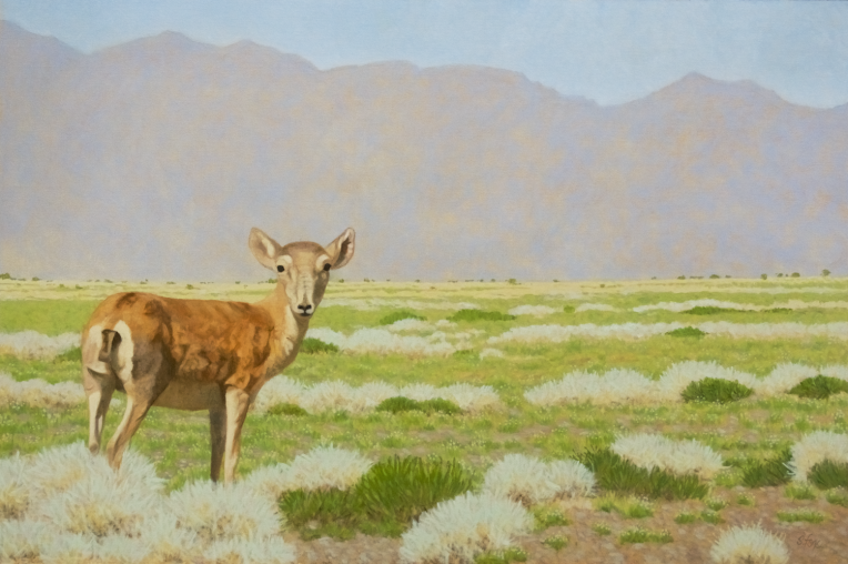
December 3 was quite a day. First I got an email from Focus on Nature XV informing me that “Watchful (Saiga Antelope)” has been accepted into their exhibition. A couple of hours later I got an email from the California Art Club letting me know that “Elephant Seals, Piedras Blancas” was going to join fellow members’ work in “Magnificent Migrations: A Journey Through Central California”.
The first one is a big deal for me since scientific accuracy in appearance and behavior is required. Here’s the criteria:
“The Focus on Nature jury selects original works of natural and cultural history subjects (in whole or in part), excluding human anatomy and portraiture, that demonstrates:
a high degree of technical skill
scientific accuracy, including taxonomic definition
aesthetic qualities, including composition
a unique scientific and/or artistic viewpoint, techniques, medium, or format (organic depiction, schematics, diagrams, etc.) including traditional, mixed and multimedia, or computer-generated images
a broad representation of artists”
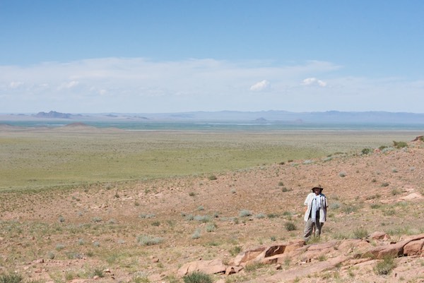
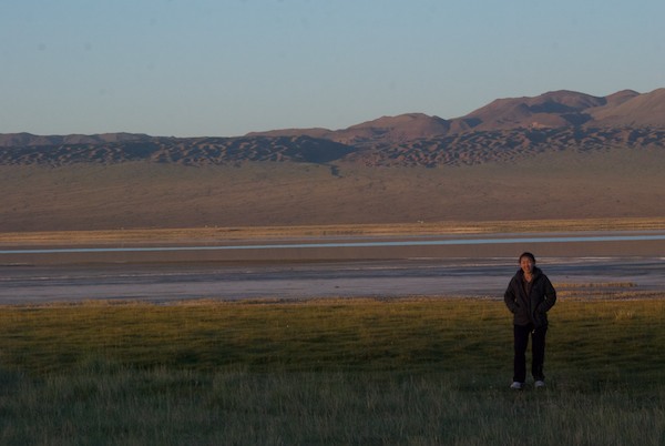
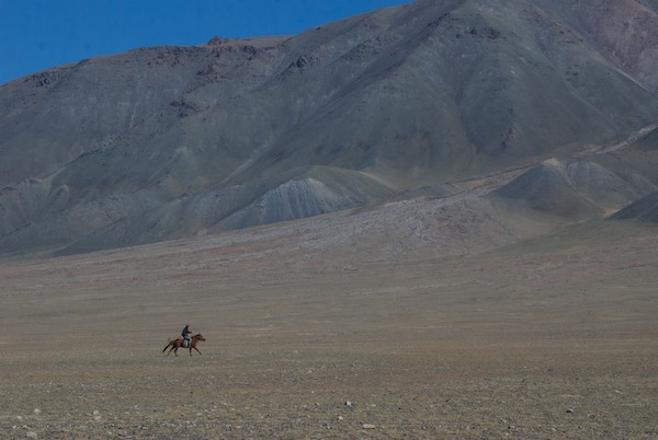
So my saiga piece was in competition with artists who have degrees in scientific illustration. I have a BFA Illustration. I saw my subject, a young saiga antelope, in Mongolia when I was at Khar Us Nuur National Park in 2015. Generally, saiga run away the instant they spot a car or human, but this fellow stayed close enough for me to get some good reference photos. The mountain in the background is Jargalant Hairkhan Uul, which is sacred, as are all mountains in Mongolia.
The exhibition will be at the Roberson Museum and Science Center from July 21, 2019- January 12, 2020. You can find out more here.
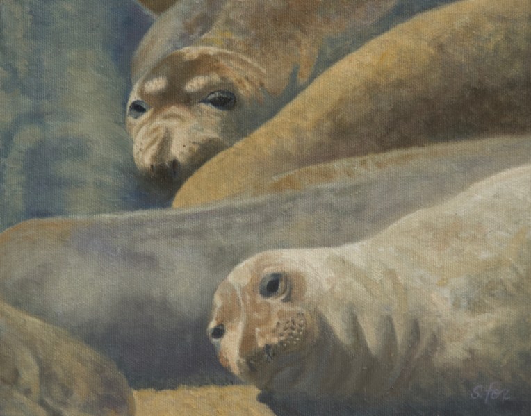
“Elephant Seals, Piedras Blancas” oil 8×10″
My second accepted painting “Elephant Seals, Piedras Blancas” will be in the California Art Club/Pacific Grove Museum of Natural History exhibition “Magnificent Migrations: A Journey Through Central California” from January 18-April 14, 2019.
What makes this acceptance special is that it was open to all members and that means I was competing with nationally-known. long established artists. I just rejoined the Club this year which one does at the entry level of Associate Artist member. There is a review once a year in November for which one can submit work in hopes of getting a “promotion” to Artist Member and then beyond that are the Signature and Master Artists. That’s one of my goals for next year.
I saw these elephant seals on a trip to southern California many years ago. We were heading home up the coast on Highway 1. There was a big parking lot right on the ocean with a long stretch of beach on the south side, where I took this photo (which is closely cropped from the original) and a rocky area with tide pools on the north side. That day there were hundreds of elephant seals all over the place on both sides. And it was noisy! Young bulls were jousting with each other on land and in the surf, the pups trying to stay out of their way. My painting is from a long “pile” of seals who were laying about along the waterline. When I was going through my reference to find animal subjects from Central California, these two were an easy choice. I liked their expressions, colors and marking variations, plus the variety of colors on the ones around them.
You can find out more about the Pacific Grove Museum of Natural History here.
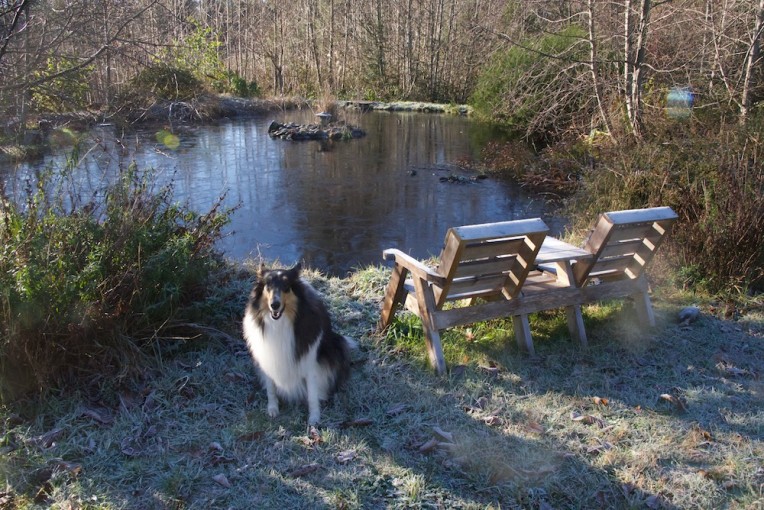
Thank you to everyone who reads my blog for your support and kind words. I wish you all the best in 2016! That’s Hailey, our tricolor rough collie girl, posing in front of our pond which froze over last night here in sunny California.
Lots coming up this year, including the next WildArt Mongolia Expedition in May/June, a major group exhibition, “Wildlife Art: Field to Studio” , featuring myself and six of my animal art friends and colleagues, at the Flinn Gallery in Greenwich, Connecticut, March/May; attending the Explorers Club Annual Dinner in New York, with maybe a short trip to Florida for some warm weather fieldwork in March; and plans to attend the Susan K. Black Foundation art conference and workshop this September in Wyoming.
Here’s one of the new paintings that will be in the Flinn Gallery exhibition. The subject is a young saiga antelope who I saw on this past year’s WildArt Mongolia Expedition when we were at Khar Us Nuur National Park in western Mongolia. That’s Jargalant Hairkhan Uul in the background, where I got to camp in two different locations. I’ll be posting work-in-progress for a number of the paintings I’m doing for the show over the next couple of months.
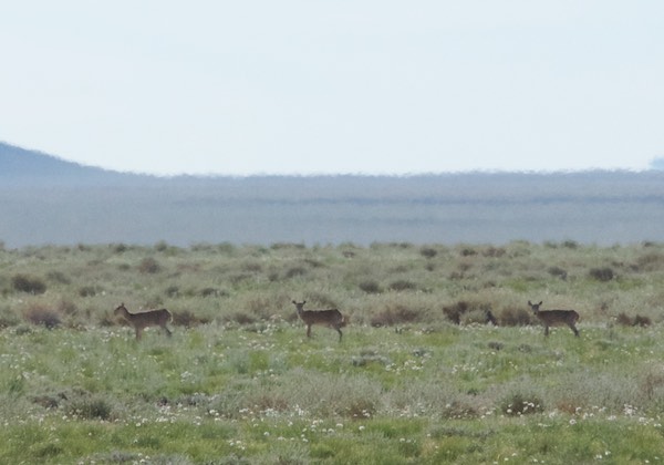
We finished our shopping in Chandmani, had lunch and headed east back to Dorgon Nuur. On the way, the “saiga show” started again, with at least three groups crossing our path as they headed north. As always they were too far away for good photos but some of this group of twelve are reasonably ok. Here’s the uncropped version.
More saiga…
The driver drove along the lake edge for a bit and finally stopped on a bluff.
Campsite overlooking lake with whooper swansView to the southI found a nice spot for my tent. My guide is resting a bit before setting up the kitchen tent
Once set up I got out my watercolors and sketchbooks and started to work. It was breezy, but not cold. Also no mosquitos. The late light started to get really interesting.
ReedbedsEarly evening lightView from my tent looking north
As the sun set, the wind died down and…the mosquitos arrived. Since we were the only living things of interest in the area. apparently every single one within a hundred miles showed up. I didn’t leave my tent unless it was absolutely necessary and turned in early. At some point, probably near dawn, I was awakened by a very odd sound. I couldn’t tell if it was natural or man-made and had never heard anything remotely like it before. But I wasn’t about to poke my head out in the dark, so I rolled over and went back to sleep, probably for an hour or so. When I woke up again it was just barely getting light and that sound was still going on. It was really mystifying. I finally had to look. I zipped open the vestibule just enough to see out and there, at standing head height, just in front of and above the tent was a ball of mosquitos close to the size of a soccer ball. And that was the source of the weird sound. I ducked back into the tent and quickly zipped the vestibule closed. No way was I going out that end. I seriously needed to pee and I wanted coffee so I slathered on the repellent and crawled out of the other end of the tent into a cloud of them that was only “better” ‘compared the packed mass a few feet away . Everything was covered with them…the tents, the Land Cruiser, the cooler. I did what I needed to do and retreated back my sanctuary.
Sunrise. I’m amazed that it can be seen through the cloud of mosquitos in front of the lens.
My guide and driver got up a little later and, I think, were equally appalled by the situation. So in a rerun of our last stay on the shores of Dorgon Nuur, we ate, packed up and left. We made a short stop in Chandmani and then drove south around the end of Jargalant Hairkhan Uul.
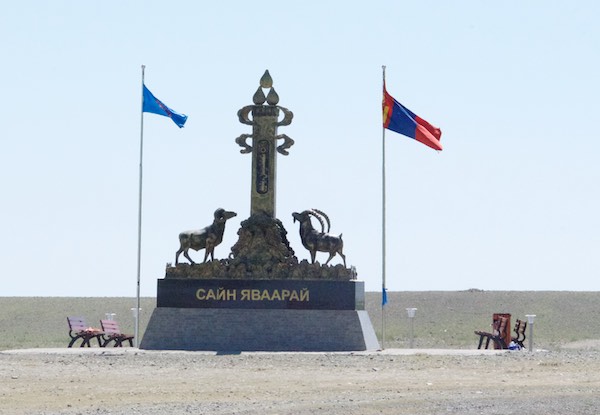
Chandmani with Jargalant Hairkhan Uul in the background.On the way out of town we passed this monument with an argali and ibex
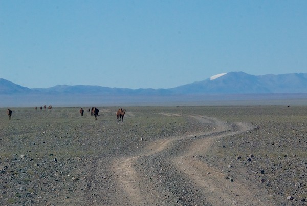
It took a couple of hours to get to the end of the mountain. It was very arid and overgrazed land. The highlight was a “camel jam”.
Bactrian camels
We dropped down to the plain and could see the reedbeds of Khar Us Nuur in the distance. Finally we turned northwest and paralleled the mountain. The two sides are very different. The mountain creates its own weather. Rain falls on the southwest face. A rain shadow keeps much, if any, rain from falling on the northeast side. No one lives or grazes their animals on the mountain, even though Chandmani and quite a few herder families live at the base. The entire mountain is contained in Khar Us Nuur National Park’s boundary, but there are herders on the side we were now driving along.
There were sights of interest along our route, including this communications tower. What got my attention was the contrast between this modern high tech installation and the ger at its base.
Tower and ger
We drove for awhile along a small river and then through a lush green area with a variety of wildflowers.
Green grass and wildflowersJargalant Hairkhan Uul
I’d been wanting to go to the mountain, which is really a freestanding range with many peaks, since I saw it from a distance in 2006. Between the previous trip a week or so earlier, which you can read about here, and this one, I will have almost completely circumnavigated it. This side was so much more interesting. I was awed by the colors and patterns of some of the slopes we drove past.
Jargalant Hairkhan UulJargalant Hairkhan Uul
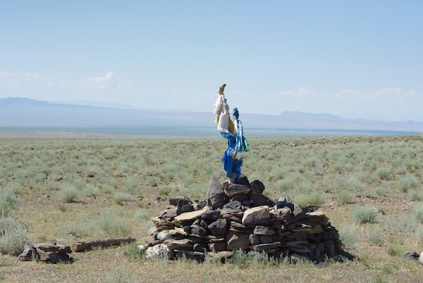
As we headed onto the upland slopes to the valley where we would camp for two nights, we passed this ovoo.
Ovoo
The ground became rockier the farther up we went and I grabbed a shot of this local herder’s winter livestock shelter.
Winter shelter
We entered the valley and I could tell that I was going to like this place a lot.
Valley entrance
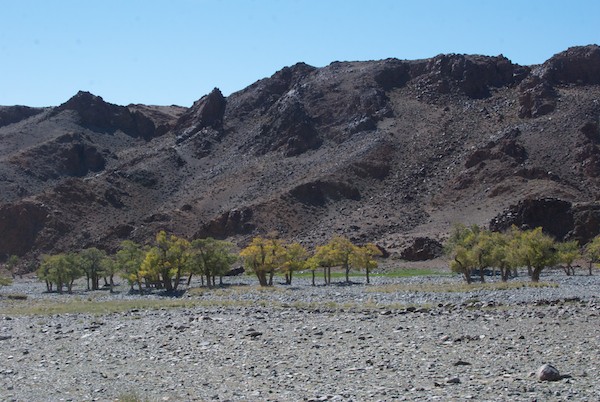
We were finally driving on the barest hint of a “road” over rocks that covered the whole valley floor, some pretty big. There were groves of aspen trees, more than I’d seen anyplace else.
Aspen trees
We finally came to the end of the road and stopped at a ger. We were fed boortz soup and aaruul and our driver got the latest news from them, which included being told that a snow leopard had killed a another herders’s goat two days earlier not too far from where we were. So now I was in the middle of snow leopard territory, also home to ibex and argali!
The herder’s dogs. They were very aggressive. I took this photo from the car.
We drove back down the valley and set up camp at this spot, right next to a stunning, fast-flowing stream. Idyllic doesn’t begin to describe it.
Our campsite
The next afternoon my guide took me on a hike up the valley into a part that was separated from the main one. We clambered over rocks, moving steadily higher in elevation until the trail narrowed and continued as a track that led deep into the mountain.
At the end point of our hike with snow leopard habitat behind me
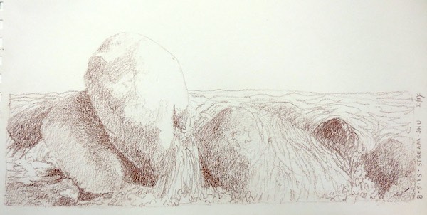
We hiked back down to camp, where I spent the rest of the day drawing the rocks and flowing water of the stream.
Rocks and stream- Derwent drawing pencil on paper
The next day I worked until lunch, doing a double study of two of the aspen trees.
Aspen trees, Jargalant Hairkhan Uul, Khar Us Nuur National Park- pencil and watercolor on paper
While I was drawing, two camels showed up! They crossed the stream not far from where I was sitting. For a minute or two I wasn’t sure how close they’d get, but it turned out all they wanted was to get past our camp so they could move on down the valley.
Bactrian camels
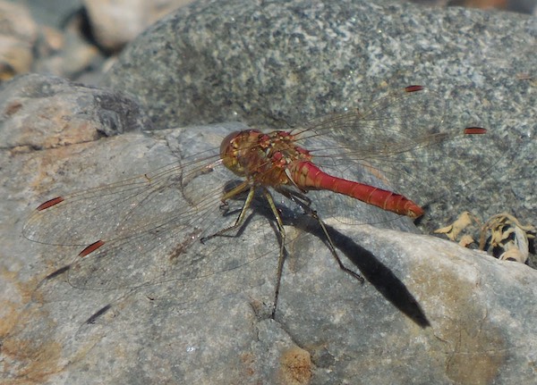
There weren’t a lot of insects and even the mosquitos weren’t too bad, especially compared to the lake. I did manage to get a good photo of this flashy dragonfly.
Dragonfly
My guide took some pics of me working.
On location
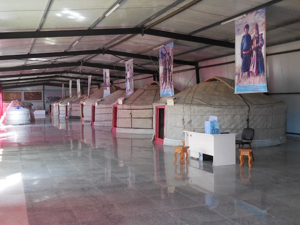
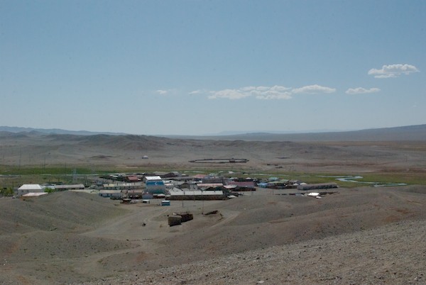
Finally, it was time to leave. This was the last stop on this year’s WildArt Mongolia Expedition and it was one of the best. I thought the trip was over when we got back to Hovd, but my guide and driver weren’t done yet. The next day was my flight back to Ulaanbaatar, but it wasn’t until late afternoon. So they picked me up in the morning and took me on a tour that included the local cultural center, which has gers, artifacts, objects and clothing from all the ethnic Mongol groups who live in Hovd, plus the Kazakhs.
The cultural center
It really is a must see.
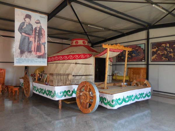
The kind of ger and wheeled platform that a wealthy aristocratic Mongol might have had.
The final stop in town was a monastery that had just started to be re-built five years earlier. The original was one of the hundreds destroyed by the communist government in the late 1930s. I was told that the whole community came together to raise the money.
Temple in new monastery complex in Hovd
They took me back to the hotel to rest for a couple of hours and then it was off to the airport. The flight was delayed, so we looked at some of the photos and video I’d shot. Finally, it was time to do in to the boarding area, onto the plane and back to Ulaanbaatar. I was in town for a couple of days, then went “on vacation” to Delger Camp for four relaxing days, just hanging out, doing watercolors and hiking down to the dunes and back. A few more days in UB and I was homeward bound, my tenth journey to Mongolia at an end.
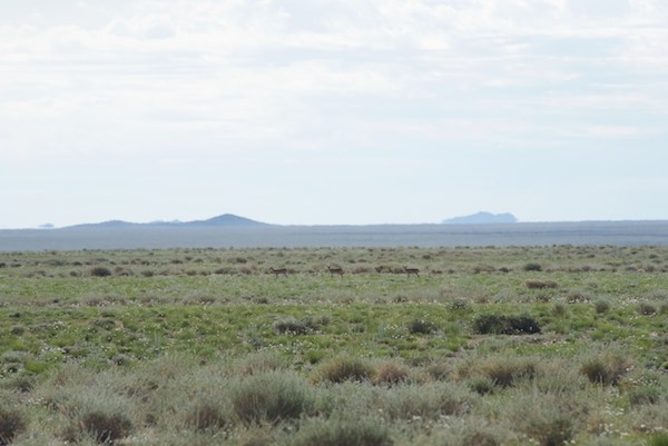
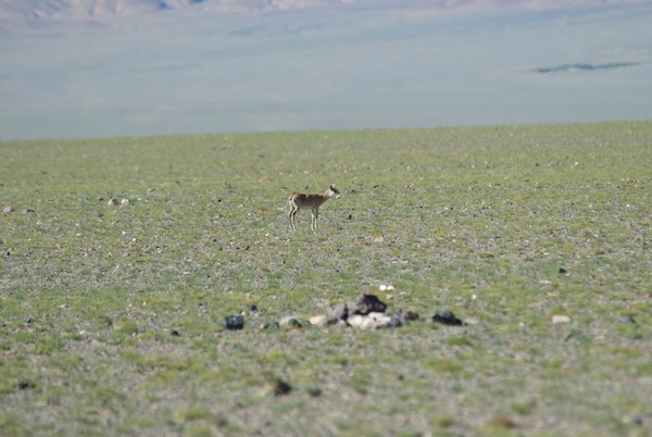
It was time for the Expedition to try to see critically endangered saiga antelope (Saiga tartarica mongolica). I had been told that they could be found in an area in Khar Us Nuur National Park between Khar Us Nuur and Dorgon Nuur and also to the south. That’s the way we headed in the morning at about 9am trailed by a cloud of mosquitos that we thankfully and quickly left behind. The sightings began at 9:40 am (I kept notes of time, number of saiga, plus a GPS reading of the first sighting).
Three saiga antelope; they really blend into the landscapeCloseup of saiga
Almost all the sightings that followed were initially made by the driver who, typically, had incredible the visual acuity I’ve kind of been spoiled by over the years. I’m always scanning with my eyes and binoculars for whatever we’re looking for but rarely spot an animal before the driver. (The exception is argali at Ikh Nart because I’ve spent so much time there and know exactly what to look for.) And were there ever sightings! Between 10:45am and 12:49pm, we saw a total of 35 saiga in groups of 2-5, except for a single calf, every five to ten minutes and I got some kind of “I saw them” shot of almost all of them. Part way through my guide remarked that she’d brought a group of tourists to the same area not long before and they’d seen exactly….five.
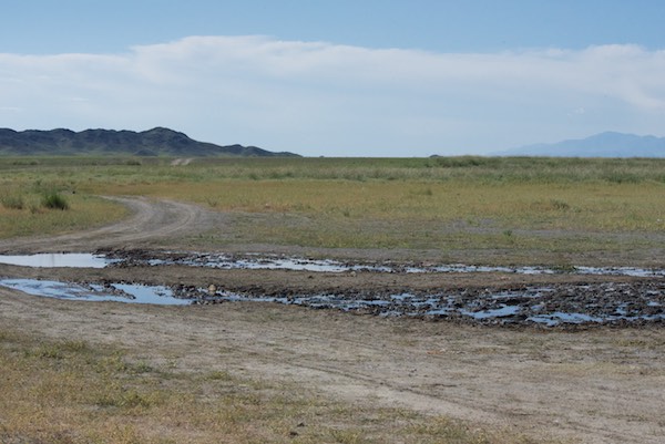
We came to this place where there was a spring that saiga came to drink at. The driver said that we wouldn’t likely see any farther south, so we turned back and the sightings, as described above, continued as we retraced our route.
Watering place
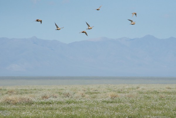
On one stretch the car flushed lots of Pallas’ sand grouse. It was a challenge to photograph them from the moving car, but I got some good shots.
Pallas’ sand grouse
We came within sight of Dorgon Nuur again and…more saiga! The dunes are the same ones we had to work our way past the day before.
Saiga antelope with Dorgon Nuur in the background
It had gotten hot and mirages appeared in the distance.
Mirage
Finally, around 1pm, we stopped for lunch at an observation tower that was in the middle of the plain between the lakes. We parked near the base of it. The only shade was on one side of the car. The driver, who was also the cook, had made, believe it or not, sushi for lunch. No fish, just rice, a little vegetable and an interesting sauce, but it really hit the spot.
Observation tower
I did some sketching while we rested and watched a herd of camels wandering past.
Bactrian camels
I had been looking at my map and noticed that there were some small lakes at the north end of the park. I asked the driver if it was possible, with the time we had for the day, to go there. And that’s the direction we headed after lunch.
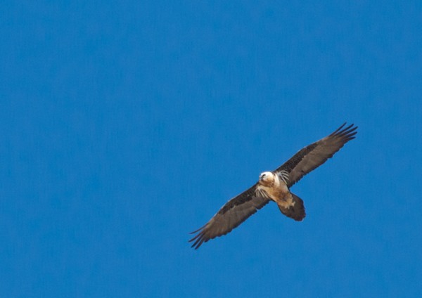
In a lot, if not most, of Mongolia there aren’t any trees, so the raptors just stand on the ground, like this upland buzzard, when they aren’t flying.
Upland buzzard
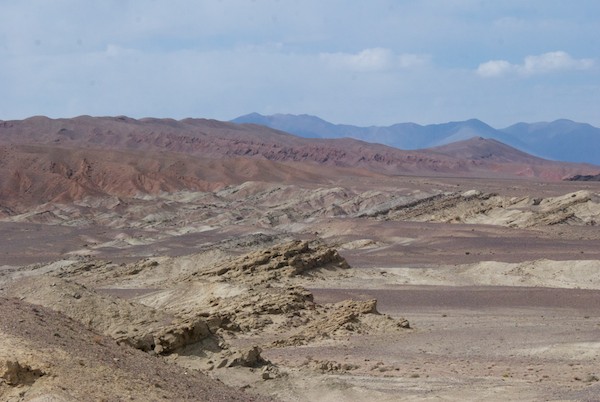
As we drove red rock formations came into view. Past them in the distance are some of the reedbeds of Khar Us Nuur.
Red rocks
We came to a raised area to the left of the rock formations and, wow, what a view!
Posing with the view
I could see that we were still a long way from those small lakes, if they were even there, but my guide more than made up for that by telling me that from where we were standing there were three sacred mountains to be seen. That was completely unexpected. She pointed them out to me from left to right. The first, to the west was…Hokh Serkhiin Nuruu, which was where I had been for the argali capture just a couple of weeks ago!
Hokh Serkhiin Nuruu (3776m)
To the right and north was Altan Hokhii, one of the four State Sacred Mountains of Mongolia. The president of Mongolia had visited it for a ceremony not long before. It still had quite a bit of snow on the top even though it was August. The green in the middle ground are reedbeds.
Altan Hokhii (3351m)
And finally, almost straight north was Tsambagarav (4165m) the tallest of the three. It and the surrounding area form one of Mongolia’s national parks. It also still had snow on its peak.
Tsambagarav
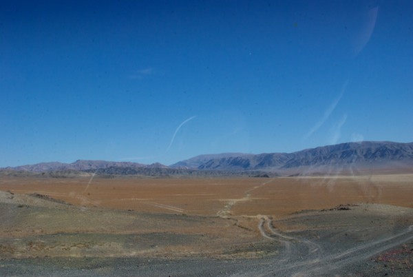
This is one of the things I love about traveling in Mongolia. One can have a plan or idea of what one wants to see or do, but something else equally good or better often happens instead. Having reached the northmost point of this drive for this trip, we turned south. We now had Jargalant Hairkhan Uul on our right and another line of hills to our left, forming a very wide, shallow valley that started out arid and absent any gers or livestock, but gradually became greener and populated.
Heading back south
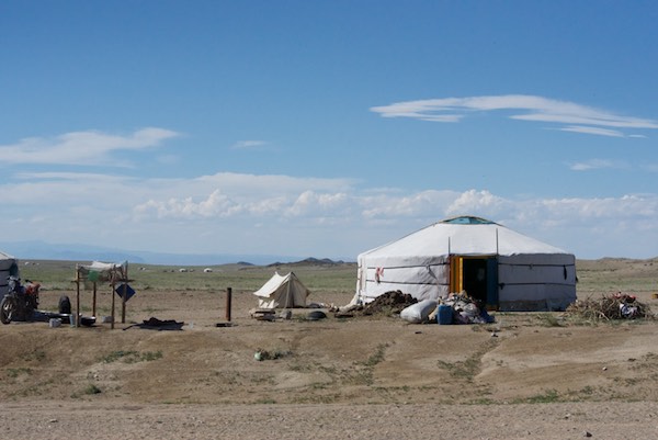
We started to pass gers quite regularly, some right next to the road.
Herder’s ger
There were more and more goats and sheep and we found ourselves momentarily in a “sheep jam”.
A sheep jam
The landscape became quite green, trees appeared and then I saw a good-sized wandering stream.
Green valley with Jargalant Hairkhan Uul as a backdrop
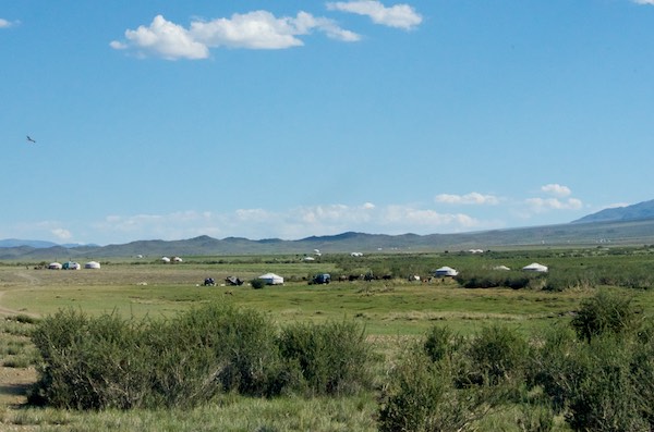
It was quite beautiful and very appealing with a storybook quality. All I could think was what a great place this would be to spend the summer. And apparently that’s what a lot of the local people do. They live in or near, Chandmani, the soum center, most of the year, but in the summer set up gers in this valley and stay in them on the weekends and for vacation. At the end of the season they pack them up and store them away.
Gers
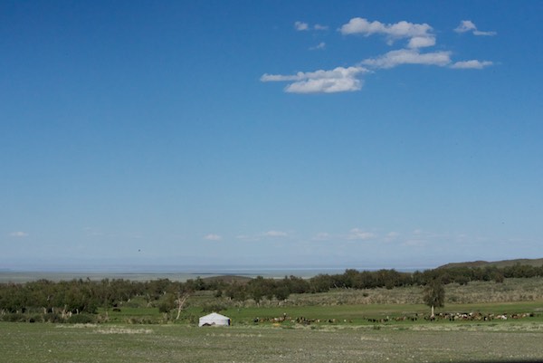
We came to the end of the valley, which had a lot of trees, and were at a high enough elevation that we could see Dorgon Nuur in the distance.
Ger, trees and lake
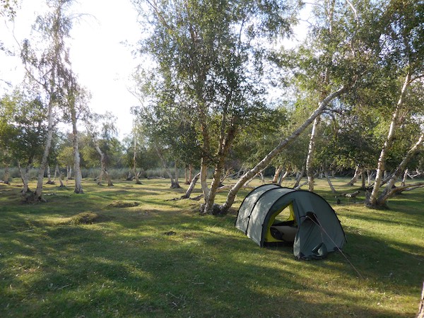
It was getting late in the afternoon and I knew we’d be stopping soon to camp for the night. I gazed longingly at the trees, which lined the streams. But I leave the choice of campsite to the driver unless specifically asked. So on we went, past the trees, up a slope, around and over a rise, the road becoming more of a rutted track. There were signs of previous campers and, unfortunately, quite a bit of trash strewn about. Yuk. But then we dropped down the hill and pulled up at this:
The birch glade
Oh, my. The driver asked, through the guide, if this would be ok. All I could do was grin and nod “yes”. To get to it we had to carry our gear across this.
“Our” stream
I know. Bummer. But I soldiered on and picked this spot for my tent. Then I took my shoes and socks off and went wading in the stream and just sat on the bank with my feet in it, listening to the water and the black kites wheeling around overhead (more on them next time).
One of the Best Camping Spots Ever
And then it was magic light time.
Magic light among the birches
I wandered about the area, did a little sketching and wished we could stay here for a week instead of just one night. More on this special place and some of the art I created here next week.
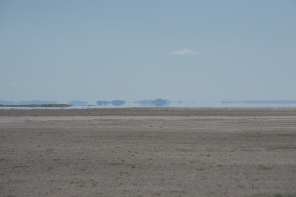
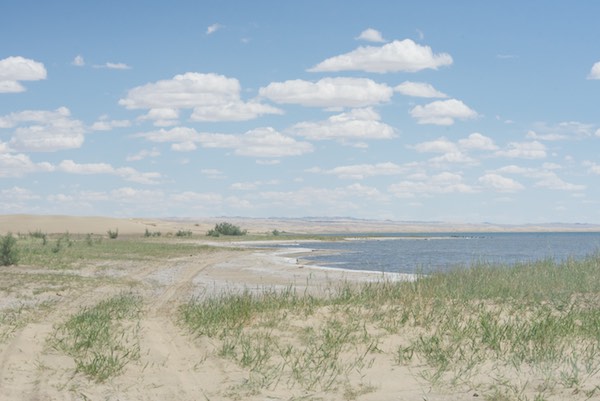
After our relaxing break on the shores of Khar Nuur, we headed south along the east side of the lake to the beginning of the channel that joined it to Dorgon Nuur. What is interesting about all this is that Khar Nuur is a freshwater lake and Dorgon Nuur is 4% saline. One map I have shows the area of salinity in pink instead of blue. It starts at the far northern point of the channel, but I have been able to find no documentation or explanation for it, other than a suggestion that maybe there are salt deposits in that area.
Like everywhere else in Mongolia, the herder’s horses run loose in the countryside when not be used. Visitors consistently write or post about seeing “wild horses”, assuming that they are the equivalent of American mustangs, which are feral domestic horses. Mongol horses are very independent-minded, aren’t approachable by strangers and can give their owners a good run for their money trying to catch them. But the takhi/Przewalski’s horse is the only surviving true wild horse.
Local Mongol horses
There were lots of birds…cranes, herons, cormorants, gulls, terns, plovers, to name what I saw just passing by.
Traveling along the connecting channel we saw a pair of demoiselle cranes
When we started out the ground was covered with species of low and high grasses. As we went south, the vegetation became more sparse and obviously adapted to less rainfall. The mountain in the background with its top in the clouds is Jargalant Hairkhan Uul, again an upcoming destination.
Vegetation change
The vegetation finally petered out and we were running on hard gravel. I didn’t know how well these mirages would photograph and was pleased with what I got.
Mirage
The “road”, which at this point was the treadmarks of previous vehicles, led away from the water for awhile on what was becoming sandier ground, but still hard.
Sandy ground with Jargalant Hairkhan Uul in the background. The channel is mid-photo on the left.
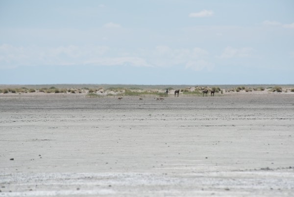
A second group of horses eyed us as we drove by.
More horses
We passed this group, drove on a bit and then just as I saw the four horses in the distance (next photo below), the driver stopped and said “Saiga!”. And there they were…four of them, two females with calves running right past the horses, who just stood there watching them go by. I kept shooting until they disappeared into the dunes in the background. We drove on a bit and suddenly I thought to tell the driver to stop. I got out my GPS and took a reading of our location. I was expecting to look for saiga on the plain on the other side of the lake and also to the south, not here. Then I asked the driver, who grew up in the area, if he had ever seen them on the east side up along where the channel was and this far north and he said no. So on my to do list very soon now that I’m caught up on a bunch of work I’ve had to do, some of which had deadlines, is to consult with the saiga researchers I know about and see if I’ve recorded something new. Whatever I find out, I’ll post about it.
Four saiga antelope
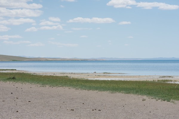
We finally reached the shores of Dorgon Nuur and I got this shot of wild greylag geese taking off.
Dorgon Nuur
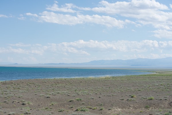
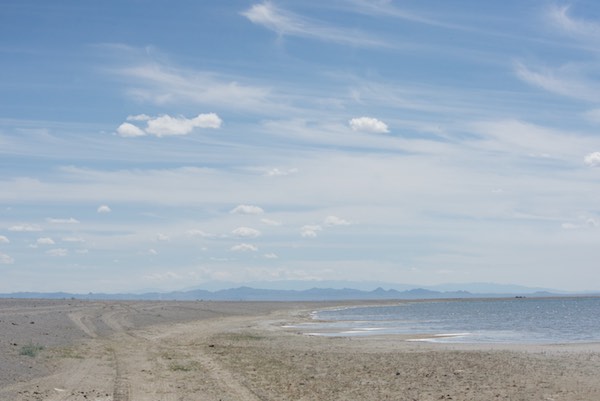
We were driving south on the east side of the lake, which is quite large. It is almost 15 miles long and 12 miles wide. The photo below shows the view to the south where the lakeshore curves around to the west.
Dorgon Nuur
We had nice easy driving for a time on this grass “earth” road.
Grassy road
Then we came to the stretch that I’d been warned about, at which the shore became sand. My tour company person had told me that the southern part of the lake was known as the “Riviera of Mongolia” because it’s where the sand meets the water.
Sandy road
He had also told me that when the lake level was high the only way to go forward was to drive into the water and that it would be up to the driver to decide whether or not to go. If not, it meant a really long detour to get around this section. And, in fact, here we were, with the “road” having disappeared completely into the water. We stopped and the driver got out and went to reconnoiter the situation around the bend of the dune. Would we go on? Or have to go back?
Driver checking out the situation
And here’s why we couldn’t just cut inland a bit and go around…high dunes of loose sand. One could see that horses moved through and over them just fine. So passage around this part of the lake only became a problem when cars, vans and trucks came along.
Dune next to where we were stopped
The driver came back, made a “going for it” gesture and off we went. I took the photo below through the windshield. The tires on my side seemed to stay a little on the wet sand. No way did the driver want the wheels in the loose stuff higher up. Getting stuck doing this would have meant a long, long delay. No roadside assistance in Mongolia unless someone stopped. And we hadn’t seen another vehicle all day. This was clearly a “road less traveled” and then some.
Around the dune
We made it around the dune and picked up the road again, which was on sand, but not too soft.
Around the corner
We came upon a pair of whooper swans and stopped so I could get some photos of them.
Whooper swans
And then we came to another, even longer, stretch of dunes that came right down to the water. Once again the driver got out to see what was ahead. Took a look, came back to the car, got in and off we went.
Another recon
This time I set my Nikon D750 for video. I’d been having some problems with the lens, so this is a little out of focus, but it gives the feeling of what road travel is like in a way that still photos can’t.
Now we could see that there was a grassy edge the rest of the way.
Clear sailing ahead
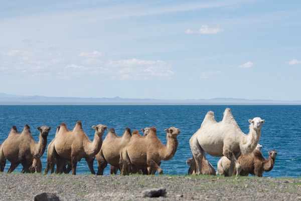
We finally arrived at the curved south end of the lake. No more sand. This was rock and gravel. And a beach!
At the south end of the lake
With camels!
Bactrian camels
The beach is a weekend destination for local people who live in Chandmani, the soum center (county seat) an hour or two away.
Local people camping out and swimming in the lake
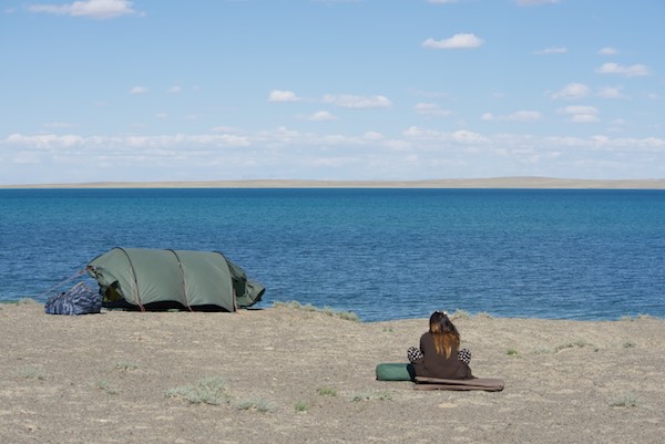
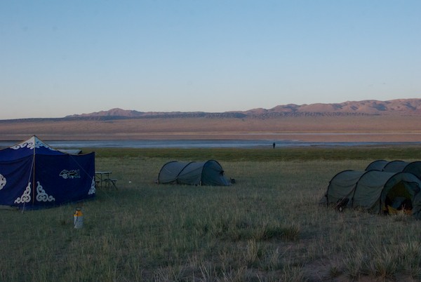
We headed farther off down the beach (Love using the word “beach” in a post about Mongolia and am enjoying it while I can!) and picked a spot to set up the tents. It was quite windy, but not cold.
Our campsite
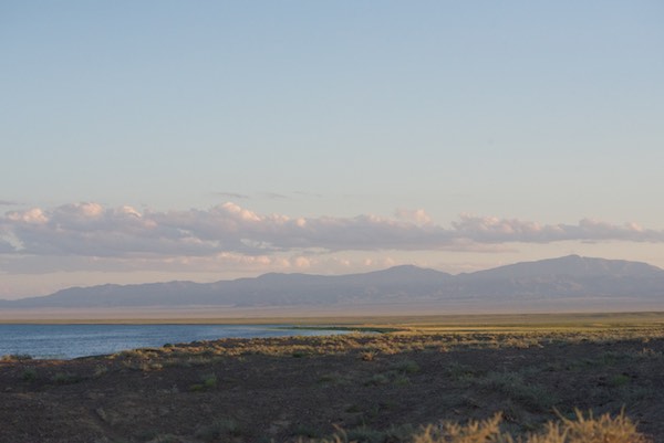
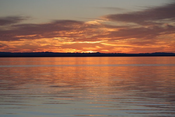
The surrounding scenery was great. And then, to end an adventurous (for me, anyway) day, we were treated to one of the most spectacular sunsets I’ve ever seen.
Sunset, Dorgon Nuur
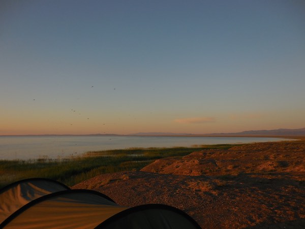
The next morning brought calm weather and hordes (the only word in Mongolian that has made it into English, along with a version of “hooray”) of mosquitos. We packed up as quickly as possible and headed on west and then south to look for critically endangered saiga antelope. And that will be the subject of the next Expedition post.
Sunrise at Ihes Nuur with our excellent cook, Soyoloo.
We had a lovely evening by the lake, Ihes Nuur. Mosquitos weren’t a problem since it was now September. The next morning the light was wonderful. Off in the distance we could hear drumming. One of the Mongols remarked that they thought it was a shaman who was at one of the gers we could see from where we were camped.
The goal this morning was to find Batsaikhan, the coordinator of the Saiga Ranger Network. But first we had time to walk around the lakeshore and sketch, paint and take photos.
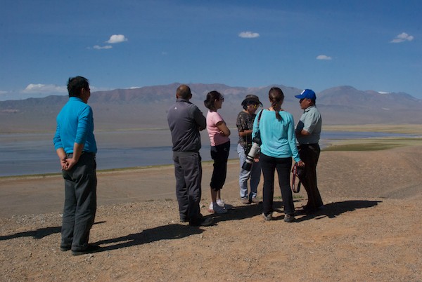
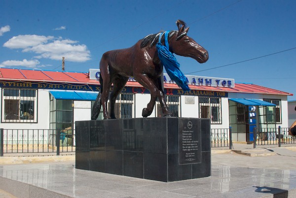
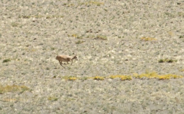
A herd of yaks grazed near our camp.Magvandorj paints on location.Tugsoyun sketching.Soyoloo and Tseegii packing up the kitchen and food.On our way into town, we passed a hillside with a lot of black kites.Myself and Batsaikhan Baljiinnayam, the Saiga Ranger Network coordinator. He gave us an excellent briefing on the history and current status of saiga antelope conservation and offered to take us out to look for them.To get an overview of the area, Batsaikhan took us up to this high point which had a large ovoo.The soum center of Darvi.Batsaikhan briefs the group on the local area and saiga conservation.Back into town for a short stop where I got a photo of a local woman fetching water. Almost no one in the soum centers has running water in their home, so they must fetch water using metal or plastic barrels carried by these small carts. Needless to say, water conservation is a way of life.Statue of a famous race horse, named Darvi. The town and soum are named after him. The Darvi and Sharga areas of Mongolia are well-known throughout Mongolia for their horses.Batsaikan led us on a “game drive” and we again saw a lot of saiga. They were always a long way off, which is why this cropped-in close-up of a male saiga is a little blurry.Saiga live here….Getting information for the next leg of our journey from one of the rangers. We would now begin the long trip back to the east and Ulaanbaatar.Picnic lunch with a view.A group of four saiga.Impressive landscape.The largest number we saw at one time was this group of five. They didn’t seem to notice the presence of the herders and their livestock at all.Time to say goodbye and get a group shot. From left to right: Susan Fox, Tugsoyun Sodnom, Oidoviin Magvandorj, Batsaikhan Baljinnayam, Sharon Schafer, Soyoloo, I. Odna, local ranger, driver, Sendag, driver Batmaa. Photo by guide Tseegii.On the road again…We came to a sand dune area and got out to poke around and take a break. Here’s our faithful Russian vans.Camp all set up in Sharga Soum.
On the (earth) road again. Taken through the windshield of the van.
We were sorry to have to leave Takhiin Tal so soon, but ahead of us, with luck, would be sightings of the world’s most endangered antelope, the saiga. At one time there were millions. Poaching reduced their numbers in Mongolia to a low of 760 at one point. Biologists had calculated that below 600 the species would no longer viable. A turnaround came when the World Wildlife Federation helped set up the Saiga Ranger Network, based in Darvi Soum. That was our next stop, where we hoped to be able find and speak with the Network coordinator Batsaikhan Baljiinnyam. But we had quite a drive ahead of us…
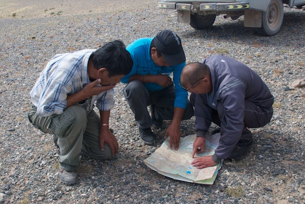
Local herderGer in a protected spot. One of the Mongols told us that gers serve as a compass in the countryside. Since they always face south, once you spot one you know which way is which.Oncoming traffic for the day. One motorbike.Unexpected trees.Gers in a really lovely spot that I’d love to go back to and have time to paint.The road and the stream became one for quite a distance.The soum center of Bugat. Typical size and setting.Leaving Bugat I suddenly saw a lammergeier/bearded vulture right by the road!He took off and I got some nice aerial shots.Where better to stop for lunch than near a herd of camels?We went up into another rugged pass. I wasn’t sure exactly where we were, but knew that the driver of our van was heading towards the Sharga area, as I had requested, since that was where we had a chance to see the antelope.We came out of the pass onto this upland area and within a few minutes, oh my gosh, there was a male saiga antelope!We started to see them almost everywhere it seemed, including this female.We spotted a number of vultures circling and it turned out to be two species, a smaller griffon vulture and the much larger eurasian black/cinereous vulture.That is a patch of snow on that mountain. In early September. Camels and earth roads, a combination I never, ever get tired of.By the time we got to the soum center of Darvi, we calculated that we had seen at least twenty saiga, far, far more than my wildest dreams. And did they put on a show. I’ve seen a lot of wild hoofed animals, but never a species that runs like these do.We drove into Darvi to get petrol and water. Notice the solar panel on the left.The second van didn’t show up where expected at the petrol station, so we went looking for them and found that they’d been stopped by a flat tire. Hundreds of miles on earth roads through the deep Gobi and we get a flat in town. Sendag, the driver of that van, took care of it that evening, to my surprise. He found someone at 8:00 at night who repaired the tire for about $8.We had seen the lake Ikhes Nuur when we drove into town and decided to see if it would be a good place to camp. It was.Gers with a view of the lake.Our camp.
Thus ended quite a day. Our mission on the morrow was to find Batsaikhan and learn about saiga conservation.
Mongolia country map with destination areaExpedition destinations by species
I leave for Mongolia a week from tomorrow!
I posted about one of the three WildArt Mongolia Expedition destinations here. Today I’m going to cover the other two- the Altai Mountains and Sharga. The difficulty is that I have never been to any of them, so I don’t have any images to share. For Takhiin Tal, I used a photo from Khomiin Tal, the newest takhi release site, which is to the north. So I’ll post a couple of my own images that show similar terrain, based on what I’ve seen for both on Google Images.
The Mongolian Altai Mountains in Mongolia are the extension of a range that extends east from Kazakhstan. I saw the Gobi Altai Mountains during my 2010 two-week camping trip when we went to Orog Nuur, a remote lake. Farther west they are much higher and more rugged. The Expedition is going in September to be there between the summer heat of the Gobi and snow beginning in the mountains. We will go to the Altai Mountains first, in early September, but snow is still a possibility, so I’ll have a down bag and thermals, just in case.
Gobi Altai mountains at sunrise, Orog Nuur, July 2010
The reason we’re going is to see snow leopard habitat. These elusive cats are essentially impossible to spot. Researchers who have trapped and collared them have walked away and looked back to where they know they left the cat and have been utterly unable to see it. But we’ll keep an eye out anyway.
Sharga was an area of Mongolia that I had not heard of until I added saiga antelope to the list of the Expedition’s featured species. They are critically endangered. Less than twenty years ago there were over a million. The population crashed to under 50,000 in ten years, the most extreme drop ever seen in a large mammal species. Poaching and lax law enforcement after the fall of the communist government in the 1990s were the cause. Intense conservation efforts are under way to save them and build up the population, something we plan to learn more about.
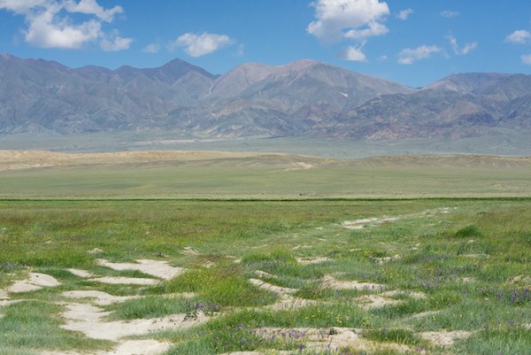
Steppe grasslands, July 2011, traveling north from Ikh Nartiin Chuluu to Gun-Galuut
Sharga has some of the last stretches of the vast steppe grasslands that once extended from almost the Pacific west into Hungary. It is an area also known for producing what are considered by many to be the best horses, called Sharga Azarga, in a country that seriously knows horses.
Arrangements are being made for a local reserve ranger to accompany us to help spot the saiga since they apparently now run at the slightest sight of humans and understandably so.
One of the missions of the WildArt Mongolia Expedition is, by traveling to these remote, beautiful places, to use the art that we will create to draw attention to them and the wildlife that lives there.