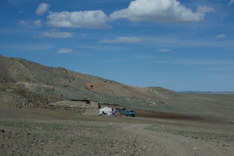
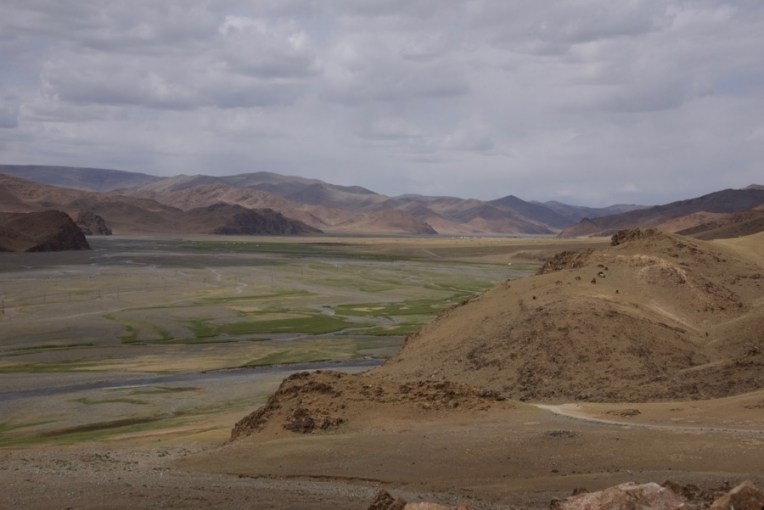
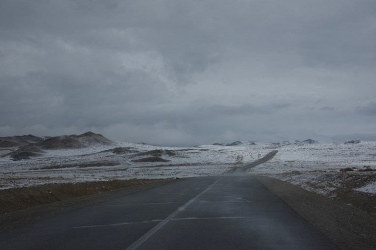
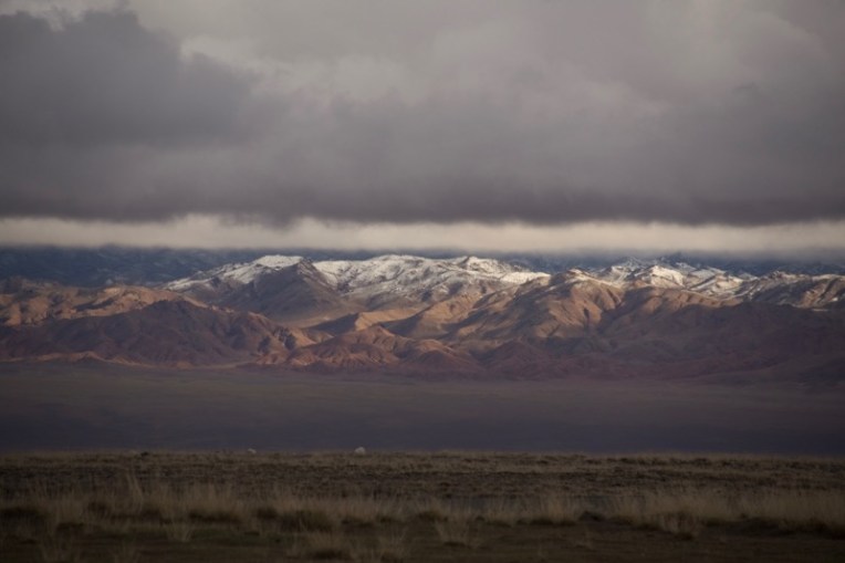
Departure from Great Gobi A, looking north on a hazy day
Our time in Great Gobi A at an end, we packed up and headed back north the way we’d come. The fuel level in the Land Cruiser was low so the first order of business was to get to a soum center, Bayan-Ondor, to fill up. We also had lunch there. Soyoloo, our cook, went into a cafe and arranged for us to use a table and to get a thermos of milk tea. This worked out very nicely.
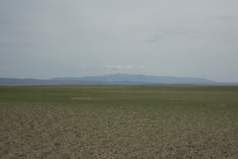
Once again I’ve included a fair number of photos to show our route in case it might be of interest to someone else doing research about going there.
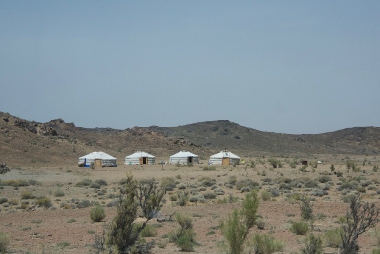
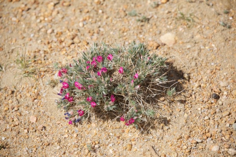
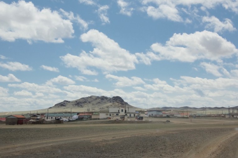
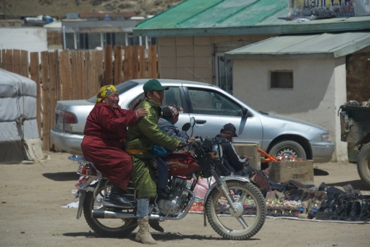
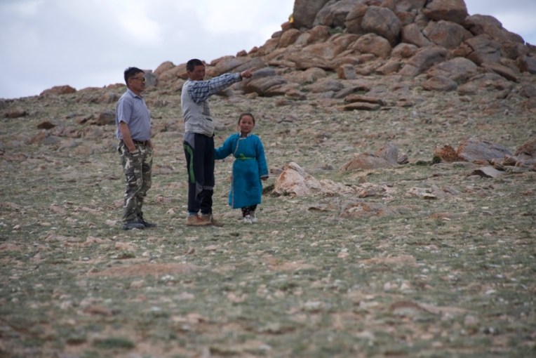
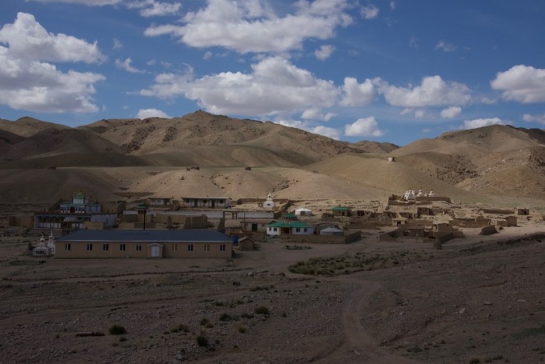
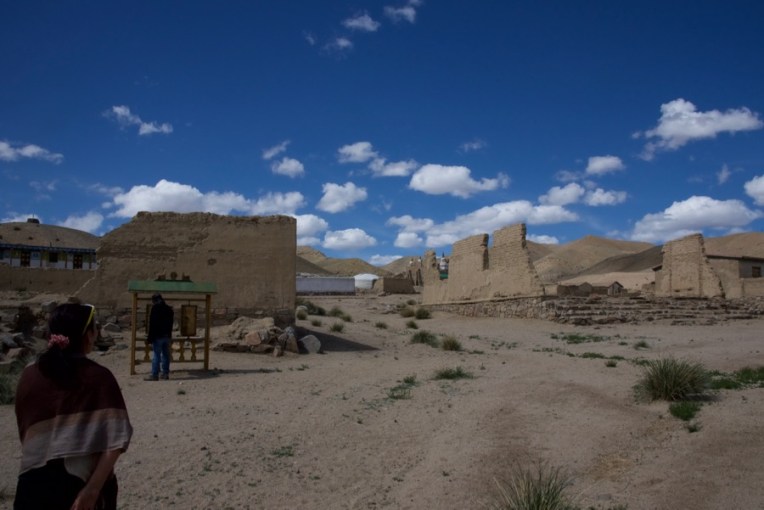
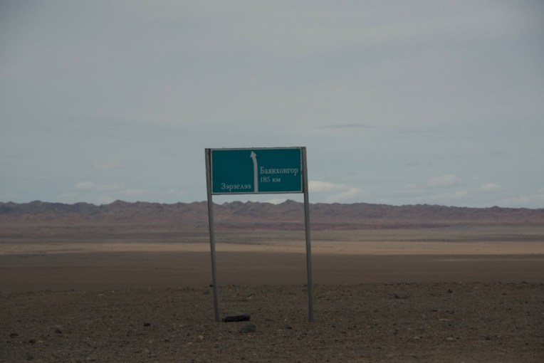
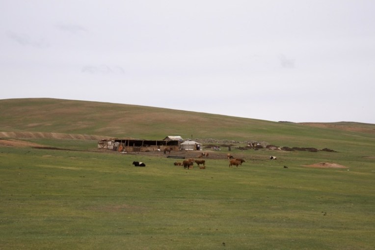
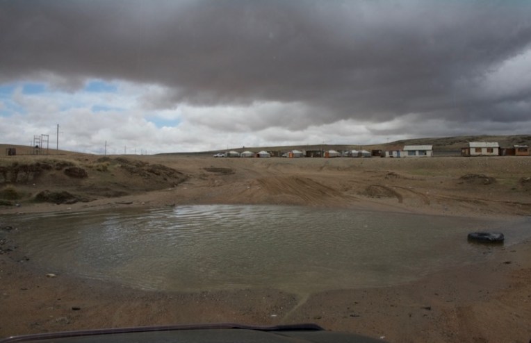
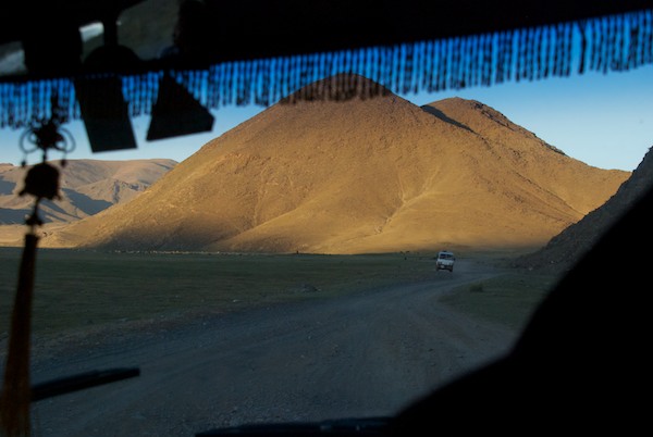
Heading northThe areas of haze created interesting atmospheric perspectiveThe boundary sign we passed going into Great Gobi A. I hope to see it again sometime on another trip there.Not far north of the SPA boundary, we started to see livestock. There was a fairly large herd of goats in the distance. You can see that we are now in an area of more red soil than gravel.We came upon this line of gers with no one around, as far as we could tell, since we didn’t stop. No dogs or any of the things outside that one sees at herder’s gersHowever, there was this cleared area which had been divided into a grid and bags of something laying within each squareA little farther on and back into a shrubby area we suddenly spotted two gazelles! I was barely able to get a few grab shots from the car and then they were gone.We stopped for some reason that I can’t recall now and someone saw this arachnid. She was over an inch long. No idea of the species.We drove through the afternoon back through the basin and range topographyOn another short stop I photographed a couple of wildflowers. From the shape of the flowers I think this one is a member of the pea familyWe finally had the mountain in view which had been totally covered in snow when we saw it on our way southBayan-Ondor, where we got gas for the vehicles and had lunch The man probably was bringing his or his wife’s mother into town to shop and maybe visit with friendsThen we were on our way to our next stop, Amarbuyant Monastery, which had been destroyed in the late 1930s as had been so many, but was supposed to be undergoing restoration. The Dalai Lama had been there and this stupa was built in his honor.But we were on a very “local road” and Erdenbat had never been this way, so when we saw a herder and a little girl sitting up on rock keeping an eye on their livestock we stopped to ask directions. We were quite charmed by the two of them as a father out with his daughter, who he clearly had great affection for. She was very self-possessed, not an uncommon thing to see in Mongolian country kidsThe herder decided that the best thing was to show us the way, so off we went with him in the leadWe finally reached a point where we could apparently go the rest of the way on our own, so we gave them each a gift as a thank you and went on our way through some pretty rugged terrainWe came upon a well and stopped for Kim and Oliver to see how they work. This one is typical in that a very large commercial tire has been split lengthwise to form the trough, a great reuse of something that would otherwise be thrown awayWe came up over a rise and there before us was Amurbuyant Khiid…what was left of it. It had been a major commercial caravan route and a hive of activity. That all ended in 1937 when the Mongolian communist government destroyed it and hundreds of other monasteries in the country to break the political and social power of the lamasWall sections like these are pretty much all that is leftThere were a very few artifacts to see like this incense burner, which would have been outside of one of the templesThere has been some rebuilding and there are monks and students in residence again. But it felt like rather a sad, isolated place. We asked for and were given a tour of the two temples, but not with much enthusiasm or welcome
I started to feel uneasy not long after we started to visit the second temple. Wasn’t sure why. There was a stillness I found unsettling and not just that it was quiet. We were shown a couple of large panels in the main temple that listed all the people who had donated to the restoration, along with the amounts they had given. It added up to millions and millions of tugrik. The surviving old temple was in poor condition and visible repairs were cheaply done, although the interior wood framing and supports looked sturdy and good. The new temple, in the shape of a ger, also had a feeling of being built quickly and cheaply. The ceiling was made square panels a little like the acoustic tiles one sees in America. Some were askew and some seemed worse for wear. In both cases, it felt like no one had noticed and no one cared. The tower for, I assumed, calling the monks to prayer, looked to be in pretty bad shape. A new long, low building, had been constructed (visible in the front of the photo of the complex above). There was also a good array of solar panels to provide power. Our young student tour guides walked us past the newish long living quarters building on our way out, answering some last questions, and a very unfriendly male voice ordered them back inside. The closest school was 60km away and the boys only attended one week a month. The rest of their time was at the monastery taking classes in Buddhist practice. And so we left. We had been given permission to camp somewhere in the vicinity and we drove around looking for a spot. I became more and more uncomfortable and stressed, to the point that I finally had to say that I needed to leave now, right now. Something felt bad and wrong there and I needed to get away from it. It was so very odd and I was clearly the only one who felt it, or at least no one else said anything. Have never had anything like this happen on any of my travels to any place before. But leave we did and found a spot on an open plain to the north with a great view. As sometimes happens a local herder and his wife showed up on their motorbike to check us out and have a visit. We went to their ger the next day.
Our “neighbors”, a kilometer or two from where we were camped
As we pulled up the woman came out. She was holding her hand which was wrapped in a plastic bag. We could see instantly that it was terribly swollen, a bite of some kind. I gave her a half-dozen or so ibuprophen for the pain, emphasing that she should take no more than three at a time. Her husband was going to take her to the soum center hospital, probably more of a clinic. It turned out after some chat and a translation from our guide, Batana, that the woman had gotten down on the floor of the ger, reached under a bed to get something and felt a sting. At that point all the Mongols decided that it had been a scorpion. Her life wasn’t in danger, but she definitely needed to see a doctor. They left and we were on our way a short time later after getting water from their well.
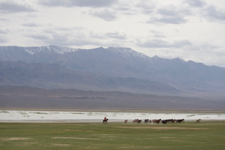
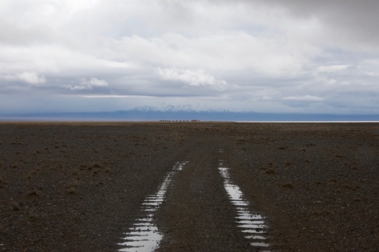
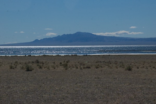
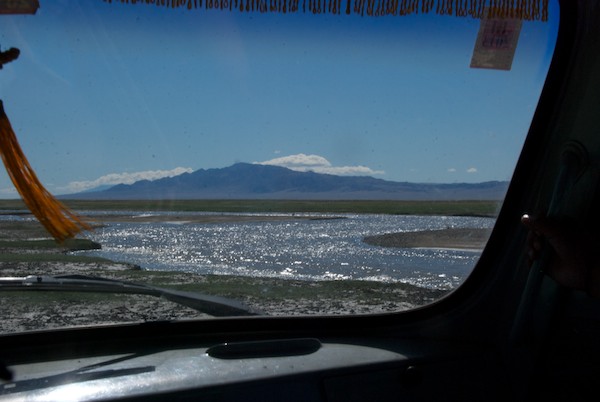
Ikh Bogd Nuruu from the south. Orog Nuur (Lake) is on the other sideWe now drove towards Ikh Bogd Nuruu and worked our way around the south end of the mountain, passing this ovoo on the wayA road sign!We drove back along the north side of the mountain, passing large herds of animals. The hope had been to camp in the area or by the lake but the presence of many herders and their dogs made that unsafe, so we had to settle for stopping a few times for photosAnd what a photo opp!After working our way through some extremely rough ground, we arrived at an overlook for Orog Nuur. It was a big deal for me to see the lake again since I had camped there on the south shore in 2010 on my very first tent camping trip in Mongolia. It was also the first time I’d traveled with Soyoloo. So it was special for both of us since it’s pretty remote
We continued on and found a sheltered spot not far from a soum center. It was quite windy, as it had been for a lot of the Expedition. The drivers and guide went into town to get gas and buy snacks.
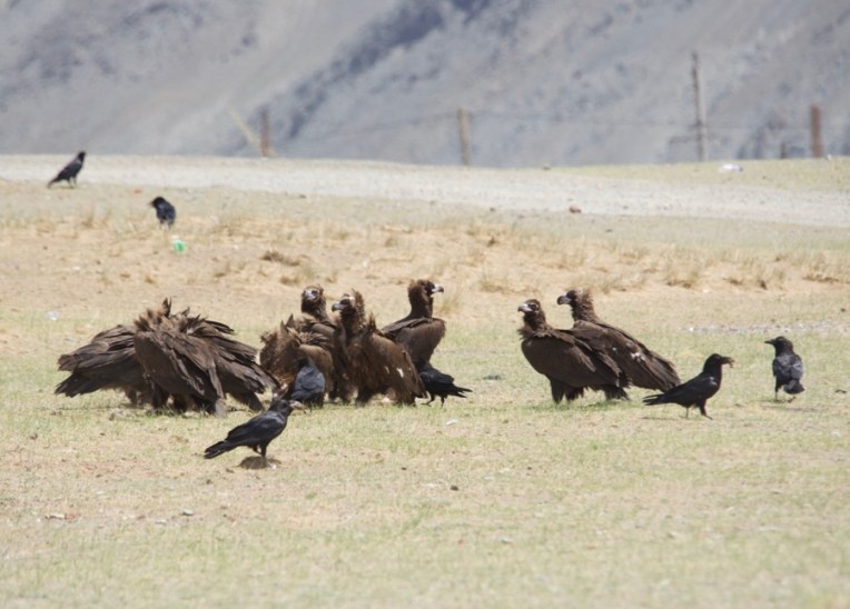
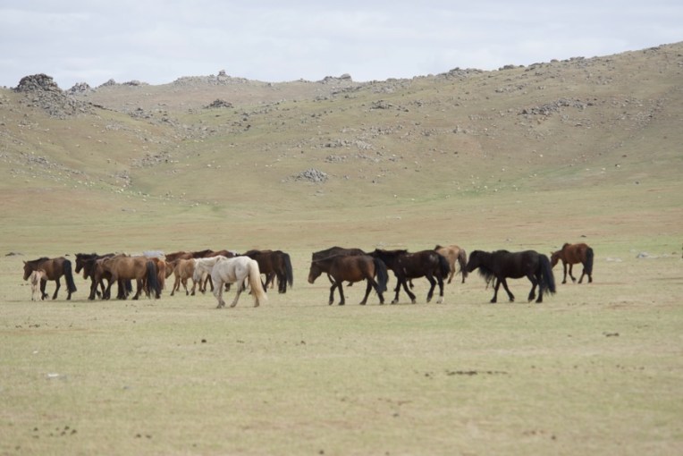
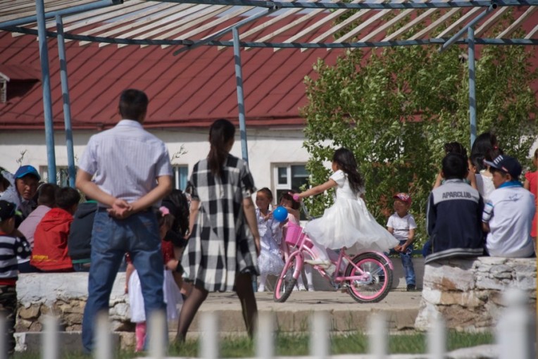
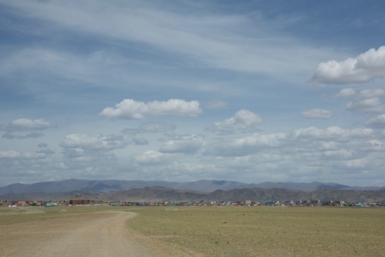
The next morning, not far from the soum center we came upon this flock of eurasian black vultures and I got a lot of really good reference photosAnd it’s always nice to see a herd of horses on the wayOne mare and her foal had other ideas, though, and the owner was still trying to catch up and turn them back when we went out of sightTurned out that it was International Children’s Day, which is a very big deal in Mongolia, with celebrations in every town. Lots of the children are all dressed up and as cute as can beThere was a fenced area that was obviously for community gatherings and this day it was all for the childrenIn the far distance were the mountains we were heading for. And, look, a second road sign!Closing the loop, we arrived back in Bayahongor, which had been our jumping off point for the journey south. We stopped in town and did some final grocery shoppingThen we did what I had originally planned to do when we were there before…travel north up the river valley into the Hangai Mountains to Erdenesogt, which is in the far background
We drove up to a high point with an ovoo and wonderful view of the river valley, then backtracked a short way to a special spot where we set up camp for a few days. And that will be next week’s story.
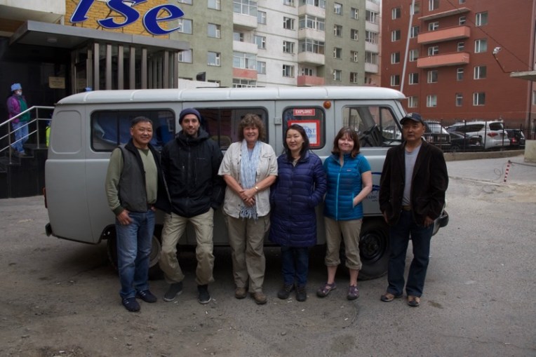
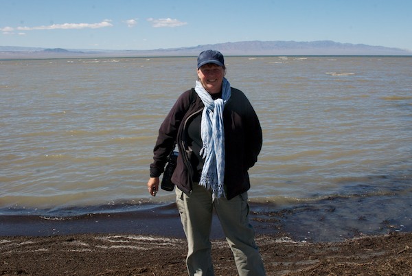
2016 WildArt Mongolia participants and staff, from left to right: Erdenebat (driver), Oliver Hartman (Explorers Club Fellow, filmmaker), Susan Fox (Expedition leader, Explorers Club Fellow), Soyoloo (cook), Kim Campbell Thornton (journalist and author), Puugii (driver). Photo by Batana, our guide. Behind us is our Russian fergon van support vehicle
We left Ulaanbaatar on Sunday, May 15. heading far south to the Great Gobi A Strictly Protected Area, a five day drive. Our main goal was to try to see Gobi bear, a subspecies of brown bear/Ursus arctus gobiensis, which is critically endangered (IUCN Red List). Population estimates range from a low of 28 (the number researchers have counted) to as high as 60 (an estimate based on extrapolation of captured and counted bears. It was highly unlikely that we would succeed, but it was still more than worth the trip to see their habitat and learn about what is being done to conserve them. Wild bactrian camels (Critically endangered, IUCN Red List) also live in that part of Mongolia, along with a variety of other wildlife.
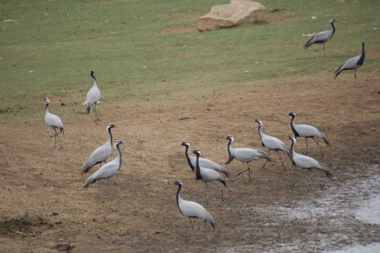
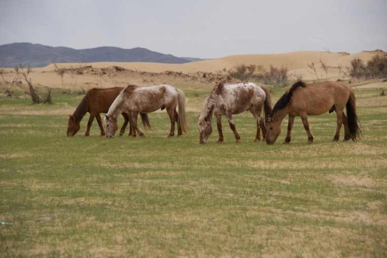
Demoiselle cranesWe stopped at an area with sand dunes for lunch, enjoying watching some of the local horses wander by
Our route took us west and then south. Along the way we saw a large flock of demoiselle cranes, which are quite common in Mongolia and always a delight. Once we were on the road our guide Batana asked if we could stop at his aunt and uncle’s ger to deliver a new ger cover to them. This was great because I knew it would, right away, give Kim and Oliver a chance to visit a herder’s ger and experience Mongolian hospitality.
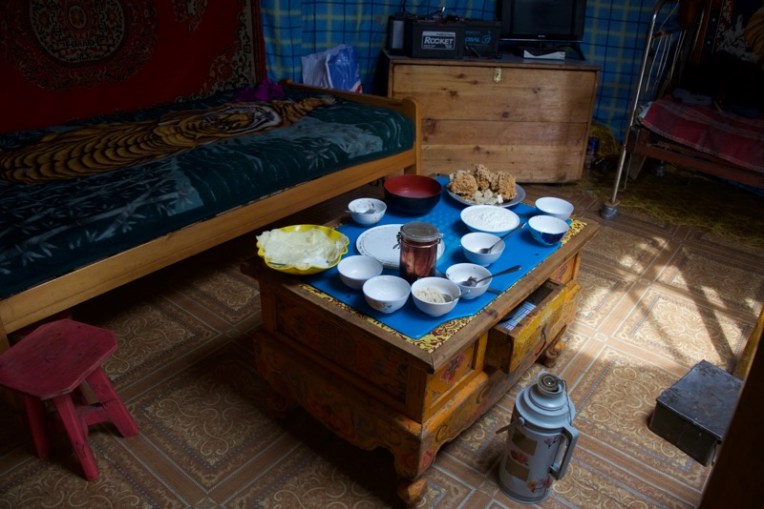
The home of Batana’s aunt and uncle, which was quite near the main roadThey have a lot of sheep and cashmere goatsWe were treated to classic Mongolian dairy foods (tsagaan idee/white food)
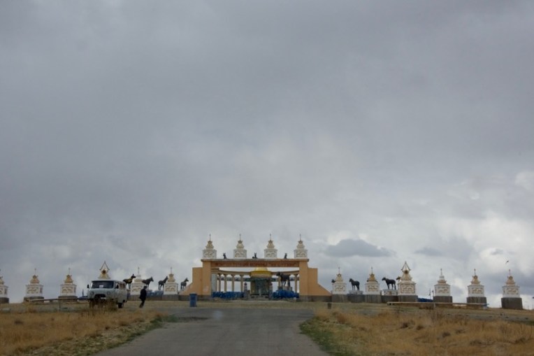
Continuing on we came to the race horse memorial south of Arvaykheer. I’d been to it before, but was more than happy to stop there again. It was late afternoon and was pretty windy.
A must-see if you’re heading south towards Bayanhongor. A quintessential bit of Mongolian culture. Last time I was there, a wedding party showed up to have their photos taken and apparently just relax and visit with friends and family.Bronze portrait statues of famous race horses.
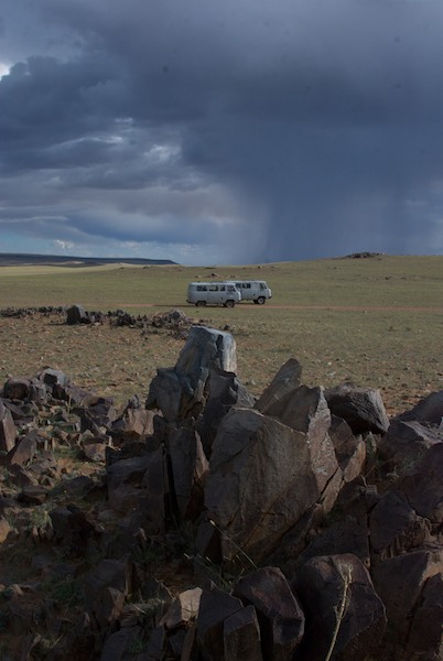
The original plan had been to camp near by, but the location was an open plain and the wind was really starting to pick up. We drove on looking for a more sheltered spot, which took awhile. The idea was to get out of the worst of the wind, but not be so close to a slope that if it rained we’d have to worry about run-off. The problem was finally solved, camp was set up, we had dinner and it was off to bed. On what was one of the coldest nights I’ve experienced in eleven years of travel in Mongolia. Ah, spring in Mongolia….
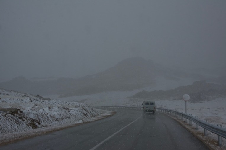
Kim bundled up the next morning, as were we all.Heading right into this storm front, driving southwest. Rain on the windshield.
First it was rain, then kilometer by kilometer it turned to snow. And then blowing snow.
Horses walking through a dusting of snow.As we went up in elevation, visibility went down.As we drove on I grabbed this shot of a ger. Believe it nor not, the owners were toasty warm inside. Felt is a good insulator and once the stove is really going it absorbs the heat and releases it back into the space.Finally we came through the other side of the front and it stopped snowing.By the time we could see Bayanhongor, there was no snow on the ground, but the Hangai Mountains behind the city were covered.
We went into the city for gas and groceries. Plan A had been to go north up the river valley to Erdenesogt and spend a night there, visiting Gachen Lama Khiid (monastery) in the morning, but there was no way we would be able to get there in current conditions. We’d go there on our return instead and so turned south towards the Gobi.
For me, my trips in Mongolia have always begun once we leave the paved roads and are on the earth roads. Here we are, heading south towards Boon Tsagaan Nuur.We got the feeling that it had been raining heavily in this area…Ah, Mongolia.
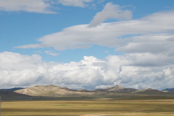
We drove on through the day, bearing southwest. Snow-covered Dund Argalant Nuruu appeared in the distance and then we got our first glimpse of the lake Boon Tsagaan Nuur.
Boon Tsagaan Nuur in the distance with small guest cabins near the shore.The ground was too wet to set up near the lakeshore, but we found a pleasant grassy area farther back. The weather, though overcast, wasn’t cold and there wasn’t much wind, a change from the previous day much appreciated.As the clouds rolled through we were treated to this beautiful shifting light on the mountain.
Next week we’ll explore a bit of the lakeshore, get in some birdwatching and be entertained by local livestock before heading west to get a required permit for our destination.
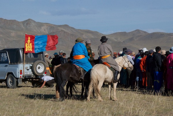
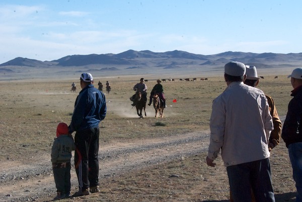
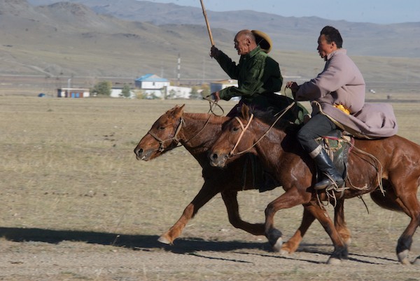
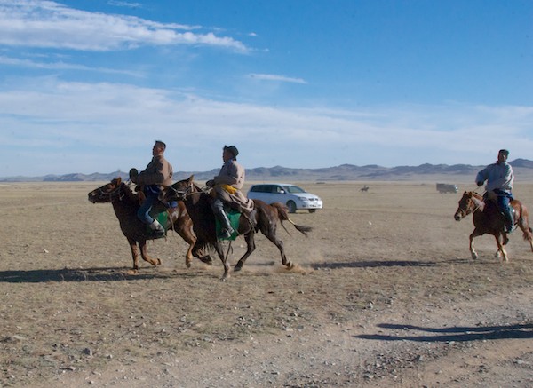
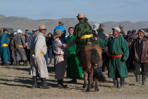
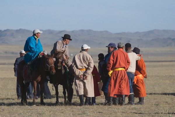
We finally came full circle, in a way, and arrived back to Bayanhongor, from where we had turned south towards the Gobi over two weeks earlier. As we came into town we saw a big crowd and…horses. What was going on? We drove over to the parking area, stopped and jumped out with our cameras. It was a horse race, but not like any I’d seen. For one thing it was on an oval dirt course instead of across the countryside. For another the horses sure didn’t seem to be going very fast. It turned out to be a race for a very special gaited Mongol horse called an ambler. Some horses are born with the ability to pace, which means both legs on one side move together. They are highly prized because they give a smoother ride than the regular Mongol horses who have a shortened gait which is an adaptation to minimize the danger of breaking leg if the horse steps in something like a marmot hole. What a wonderful and unexpected photo opp and experience this was almost at the end of the Expedition!
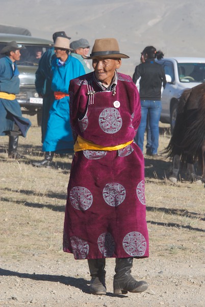
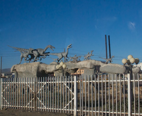
It’s a horse race!This time most of the riders were adult men.I’d never seen Mongol horses move like this before.And I loved how some of the riders were wearing very fancy del.At the finish line.Best. Dressed. Man.One of the winners, apparently.Everyone seemed to having a seriously good time.Smiling for the camera. Love the peace sign.On our way north we passed….a dinosaur park. The light was going and we had a ways to drive to no time to stop. Just grabbed some shots from the van.I want this for our backyard.Back out into the countryside, going north into the Hangai Mountains to a monastery that I visited and fell in love with in 2010, Ganchen Lama Khiid. You can read about that first visit here.It was July and green the first time I went up this road. Now it was September and the land was golden in the setting sun.It truly was a beautiful fall evening.
But it was also going to be cold. We drove on as it became dark and finally arrived at the Monastery….
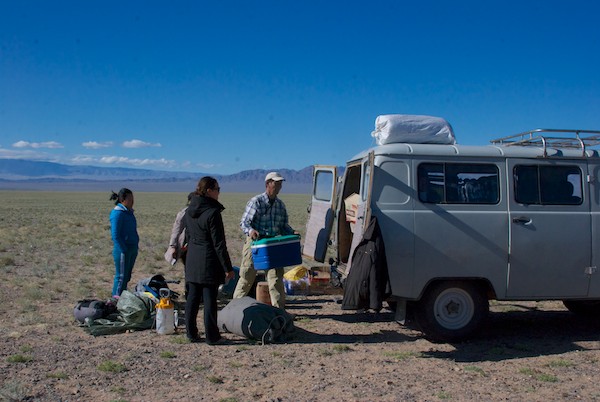
After a wonderful stay at Arburd Sands and Bayan-Onjuul Soum, it was time for the Expedition to start in earnest. Our first destination was Boon Tsagaan Nuur, a lake deep in the Gobi that is known for the excellence of its birdwatching opportunities, both in the number of birds and variety of species.
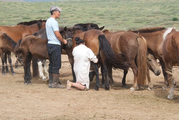
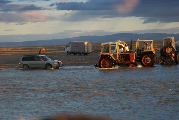
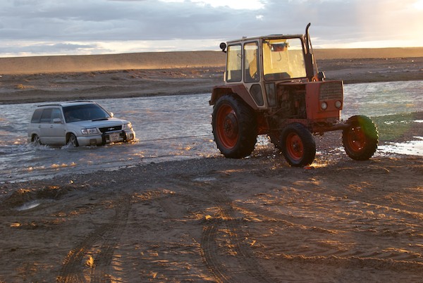
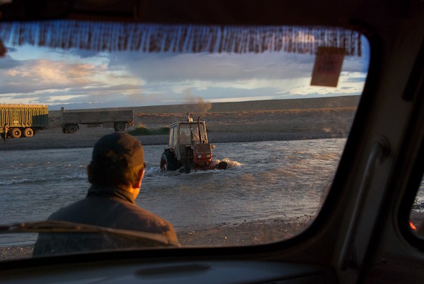
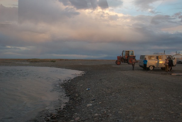
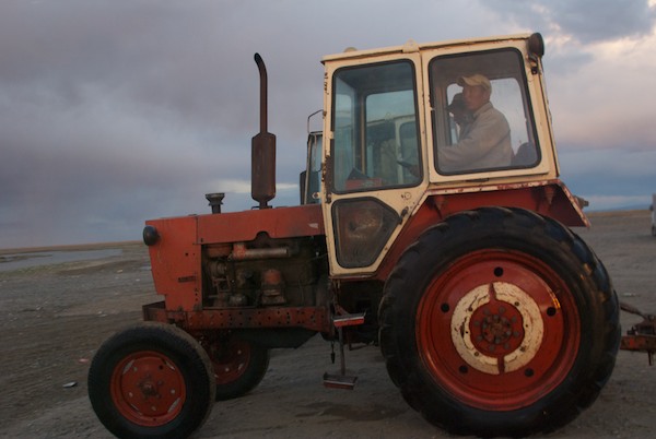
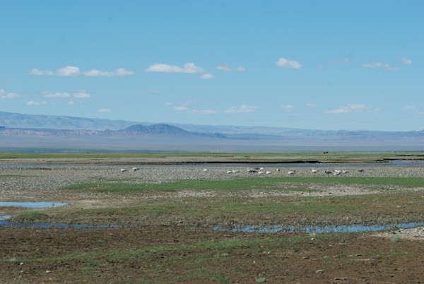
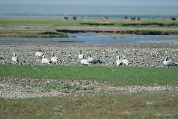
We headed west across country to join up with the main southern east-west road, parts of which are now tarmac. We hadn’t traveled for long when we came upon a herder’s ger just in time to see them milking their mares.
Milking the mares. The foals are tied to a picket line so that their mothers won’t go far and held near the mare so that she will release her milk. Enough is left for the foal to get a good meal. This process is repeated every two hours, 24 hours a day for weeks or months. One result is the famous fermented mare’s milk “airag”, which to me tastes like fizzy yogurt. I like it a lot.Sharon takes a photo of Tugs-Oyun, who is riding in the other van. We all loved her spiffy yellow glasses.Getting water from a local well with the assistance of a young local. An adult had entrusted the keys and the job to him, which he carried off in style.Camping near ArvayheerSharon shows Magvandorj how she photographs flowers close-upEn route to BayanhongorOvoo en route to BayanhongorWhen we arrived at the place to get our water barrel refilled in Bayanhongor, we found that this young boy and his horse-drawn water cart was there ahead of us. A small gift of candy and he was happy to pose for photos. Many of the residential areas of the city are ger districts with no running water. People fetch it themselves, pushing or pulling a wheeled metal frame that holds a water barrel. Or they can have someone with a horse cart deliver it to them.Driving south out of Bayanhongor, which is located at the base of the Hangai Mountains, we traveled through a long stretch of uplands, passing a lot of interesting rock formations, but no gers and relatively few livestock.Reaching the Gobi, we saw the occasional ger. There was rain across a wide swath of the horizon. As you can see, the Gobi is gravel, not sand, although there are isolated dune complexes.We came to the soum center of Baatsagaan, located not far from Boon Tsagaan Nuur. No petrol available and I think at this point the drivers found out what was ahead of us…A lot of rain in the Hangai Mountains had poured down into the Gobi creating temporary rivers and streams. This was between us and the lake. So close, yet so far, since neither of our drivers could find a spot they felt confident taking the vans across. Now what?Batmaa, the driver of the van I was in, grew up in this part of Mongolia and knows it well. He led the way north for quite a distance and then west. We passed really narrow spots like this and I wondered why we didn’t just zip across. But I learned many trips ago that things are often not as they appear to a non-Mongol and that we were going far out of our way for a reason. I had my suspicions though….So benign looking and so tempting….And then we came to this, clearly an established and well-organized operation of some kind.And of course the answer was that Batmaa had brought us to the ford. I would guess the only one for many, many miles around, judging from the number of tractors, gers, and vehicles waiting to cross.We got a preview of what was in store for us.Uh. Oh.Through the deepest part.Piece of cake, right?Now it was our turn. Here’s comes “our” tractor.Last minute directions/instructions. Sharon and I made sure all our gear was up off the floor, just in case.Here we go.Mid-stream.On the other side. Whew.Our hero.On to the south and then east in the setting sun.We drove on and on, hoping to get back to the lake, but finally gave it up and set up camp in the dark with a stiff cold wind blowing. Here we are the next morning. Not too bad for just picking a spot at random. That is part of the Gobi Altai Mountain range to the south of us.Catching up on my journal. Did I say it had been windy?Packing up. The pump sprayer was for both washing our hands and, with an enclosure set up around it, our shower. It worked great and one could get hair and body washed with only a half liter of water, important now that we were going to be traveling through countryside where places to get water were at least a day apart.At last! Boon Tsagaan Nuur!A final stop so that our drivers could consult with local herders. Solar panels and satellite dishes are very common sights now at herder’s gers, along with motorbikes, mobile phones and small flat panel tvs. But this is still a tough environment to live in and only the knowledgeable and smart thrive.We drove along the north side of the lake back to the east end, where the birds would be.The classic landscape of Mongolia….We hadn’t even gotten to the lake yet, having come to a series of interlaced streams we needed to cross, when we spotted bar-headed geese!This species is famous for its ability to migrate from Central Asia to India. Over the Himalayas. At close to 30,000 ft. Which is the height an airliner can fly. Got some great photos from which there will be paintings.One more river to cross. Our van stalled out in the middle, but Batmaa got it started again and we made it across.Our cook, Soyoloo, and guide, Tseegii, walking down to the lake.We had only meant to stop this close to the lake for lunch, but decided to camp overnight. The mosquitos weren’t bad at all, just annoying for a relatively short time.The “I was here” photo. And was I ever glad to be. You’ll find out why in the next installment.